
We’ve had a lot of questions lately from folks wondering where is the El Nino pattern we have been talking about for the past several months. I’m happy to say that we are still very much on track to experience a very strong, possibly historic, El Nino this winter! Sea surface temperatures across the central equatorial Pacific are still running warmer than normal…averaging +1.49 degrees Celsius above normal during August…and the most recently updated El Nino Advisory keeps us at a 95% chance of seeing El Nino conditions this winter, gradually weakening as we get into Spring of 2016. So, for the folks asking “When will it hit?”
First off…El Nino is not a storm system. It’s simply the effect on global weather patterns, specifically the subtropical jet stream, as a result of the increase in sea surface temperatures across the equatorial Pacific. Weather patterns are more sensitive during the winter months to these changes which is why we really haven’t felt much of those “cooler” temps and “wetter” conditions that are considered highly likely with this El Nino. Plus you have to keep in mind that this is just one of many factors that can affect our fall and winter weather. Based on the most recent outlooks, it appears we’ll need to get into October and November before we’ll start seeing anything that we can say is a direct result of El Nino.
For October, it’s likely that we’ll continue to see only minimal temperature impacts, if any, that can be considered a direct or indirect result of the El Nino weather pattern. For Texas, a relatively small portion of southwest Texas in and around the Big Bend region is expected to see somewhat below normal temperatures, but elsewhere we’ll likely see temps right around where they should be for October with an “equal chance” the temps could swing above or below normal as well.
The precipitation outlook for October looks slightly better with much of our state having a 40% chance of seeing wetter than normal conditions during the month. That’s still a 60% chance we won’t see any significant changes in our rain patterns, but it’s better than a zero chance.
As mentioned above, the effects of El Nino really won’t come about until we get further into Fall and early Winter…October, November and December. The chances for seeing below normal temps for the western and southwestern portions of the state expands as the same time the area expected to see an uptick in rain chances expands well into the central plains and southeastern states. The probability increases to 50% across the southwestern area Texas with the 40% expanding further into the central plains and southern US.
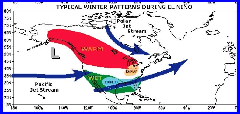
Looking deeper into the Winter Season, we see once again and expansion of the higher probability areas for both increased rain chances and below normal temperatures. Being this far out, take these with a grain of salt. These outlooks are updated mid-month, so we’ll have continued updates throughout the fall and winter season. Also keep in mind that it we will still see our typical rollercoaster temperatures that we see each fall and winter with periods of warmth followed by series of cold snaps like we do every year. It’s just that the rainfall and colder temps tend to hang around a bit longer during El Nino winters because of the more southern orientation of the pacific jetstream bringing increased moisture over our state and allowing cooler air to filter down from the northern plains. Oftentimes, the Pacific jetstream acts like a barrier to the colder air across our northern continent. Having the jetstream oriented further south allows for deeper intrusion of colder continental air; however, we still expect much of it to be moderated by the time it reaches Texas.

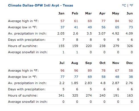
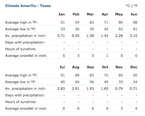
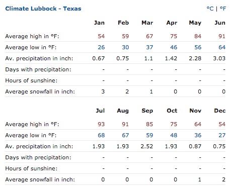
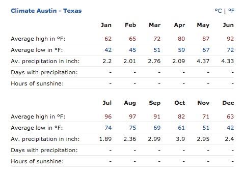
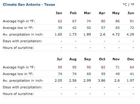
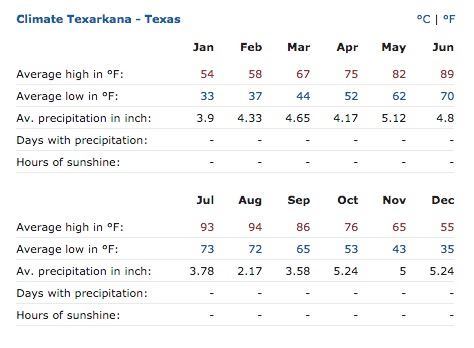
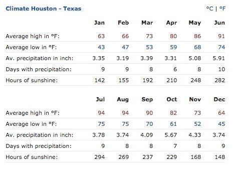
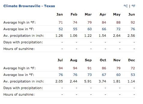
And for those curious as to what typical average temps and rainfall we receive each month, here are some snapshots for various major cities across the state! Click the link to choose other cities.
http://www.usclimatedata.com/climate/texas/united-states/3213


0 Comments