
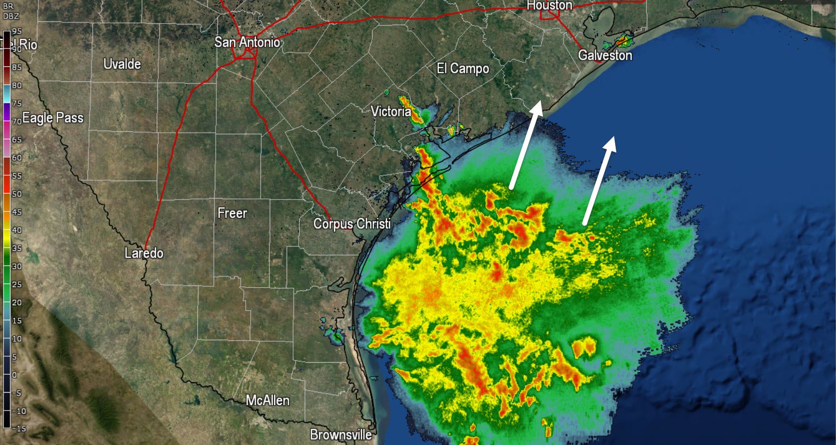
A large cluster of thunderstorms is sitting off the coast this morning. A few storms are impacting the Barrier Islands off Port O’Connor. All the activity is moving north/northeast and may move onshore a bit later this morning. We are not expecting a severe weather threat but as always lightning is a dangerous hazard.
Taking a look up at 500 millibars its easy to see whats causing our offshore rain this morning. A fairly weak upper level low is sitting across Southeast Texas this morning. This same system is what caused the storms yesterday. Our upper level low will continue to slowly move east/northeast today. You can see a trough starting to dig into the Northwest US but otherwise we remain locked with a ridge.
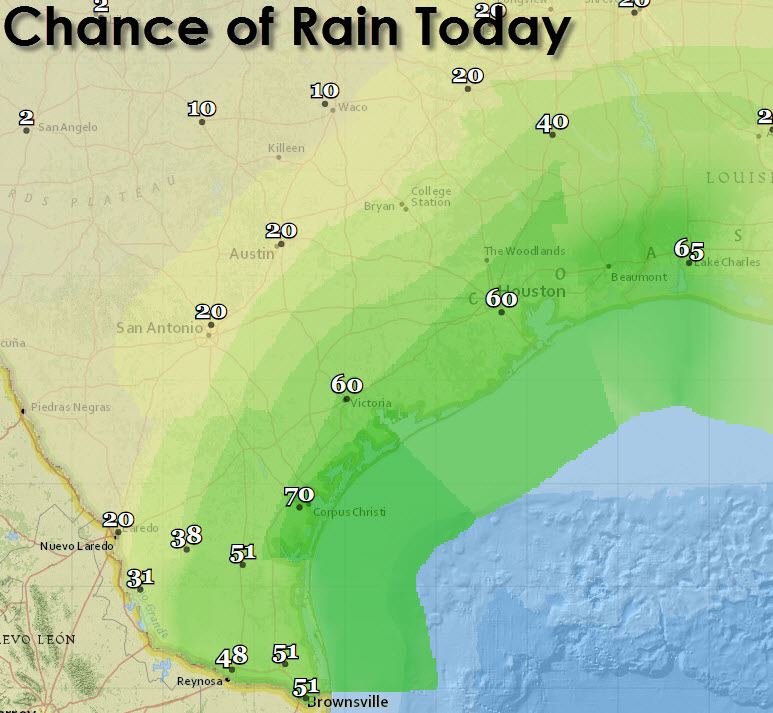
With the upper-level low in place providing lift in a moisture-rich region the chance for showers and thunderstorms is high today across Southeast Texas, South Texas, and the Rio Grande Valley. Isolated to widely scattered activity is possible north to Interstate 20 across North and East Texas this afternoon. Severe weather is not expected but frequent cloud to ground lightning and locally heavy rain is probable with the stronger storms.
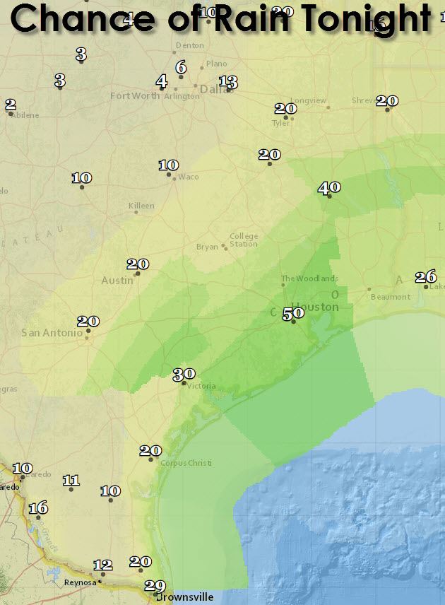
By tonight we’ll see rain chances continue across Southeast Texas north into the Piney Woods of East Texas. Coverage of activity will be less than the daylight hours but we’ll probably have at least some activity continue into the overnight hours.
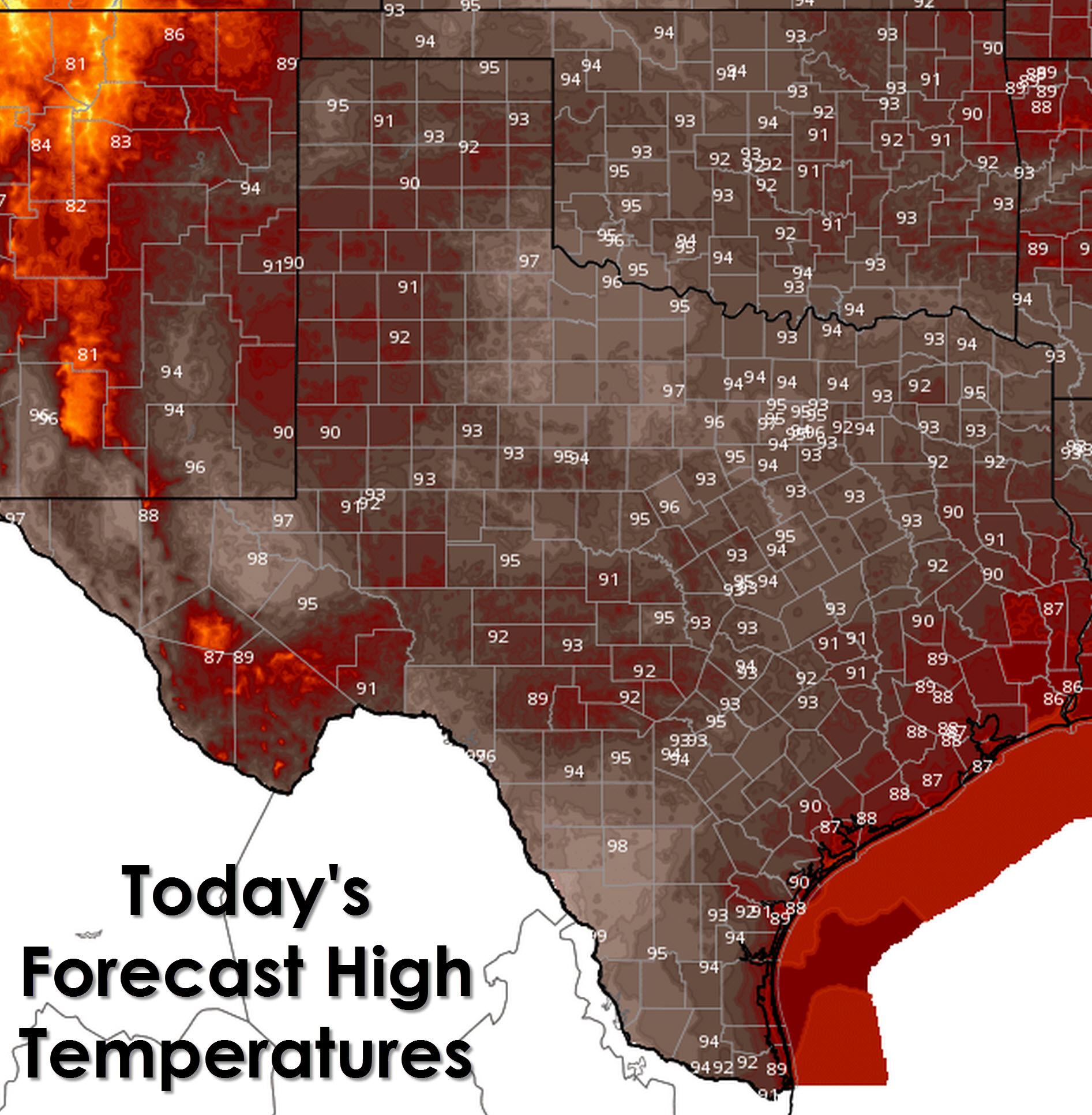
With the good chance for storms today Southeast Texas should remain in the upper 80s with heat index values in the 90s. Everyone else in Texas should see temperatures climb up into the 90s but we may be able to get by without a 100 degree reading today. Those lucky enough to get a shower/storm near them will get a bit of a cool off with temperatures in the 80s.
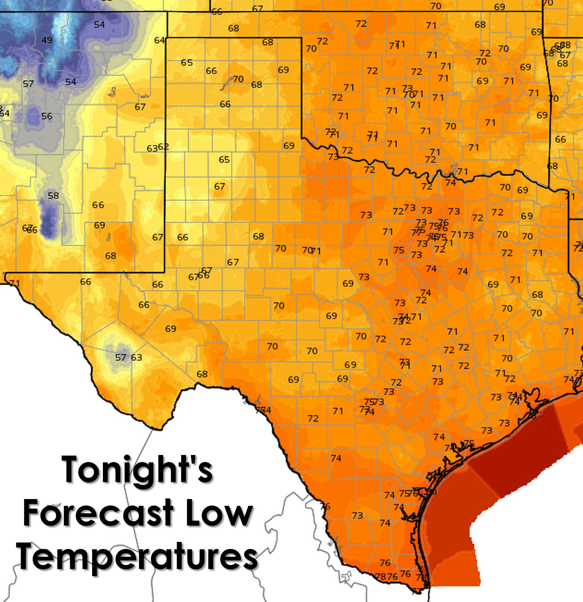
Alpine, Texas will be the winner tonight with a forecast low temperature of 57 degrees. 60s are expected across the Permian Basin, West Texas, and the Texas Panhandle. Finally the remainder of Texas will drop into the low to mid 70s for tonight. Nothing unusual for the first day of September.
Speaking of September today marks the beginning of Meteorological Fall and will continue through the end of November. Meteorological Fall is when we see the weather across North America transition from a summer pattern into a more active fall one. The jetstream will dip back south into the United States and we’ll start seeing cold fronts bring drier air further south. Today and the next few weeks will not feel like Fall in Texas with the ridge remaining in place.


0 Comments