
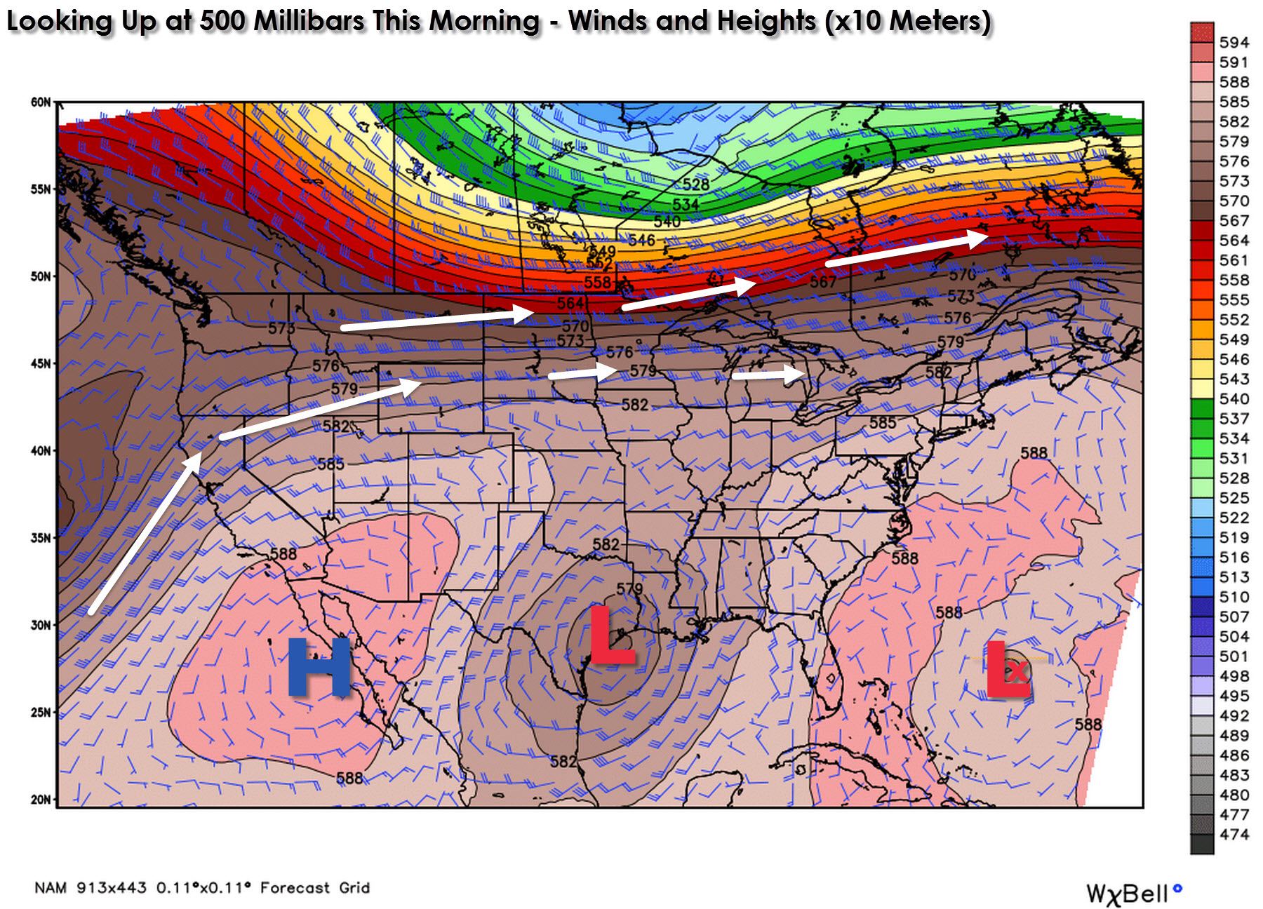
The low pressure responsible for precipitation across the coast and in Southeast Texas is easily identifiable on this morning’s upper level chart. Tropical Depression #11 is out over the open Atlantic and our friendly upper level high pressure is located across Baja California. The primary jetstream is blazing across southern sections of Canada and the Northern United States. A fairly zonal pattern which means no cold air intrusions or upper level troughs impacting the United States today.
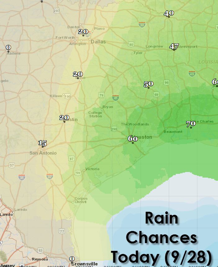
Scattered to numerous showers and thunderstorms will continue today across the coast from Corpus Christi northeast through Beaumont into Louisiana. Southeast Texas, East Texas, and Northeast Texas all have a 40 to 60 percent chance of rain today. An isolated shower or storm may make it to Interstate 35 today from San Antonio north to the D/FW Metroplex. The best rain chances will be along and east of Interstate 45 across East Texas and across the Brazos Valley plus Southeast Texas. Severe weather is not expected today but a few waterspouts are certainly possible offshore.

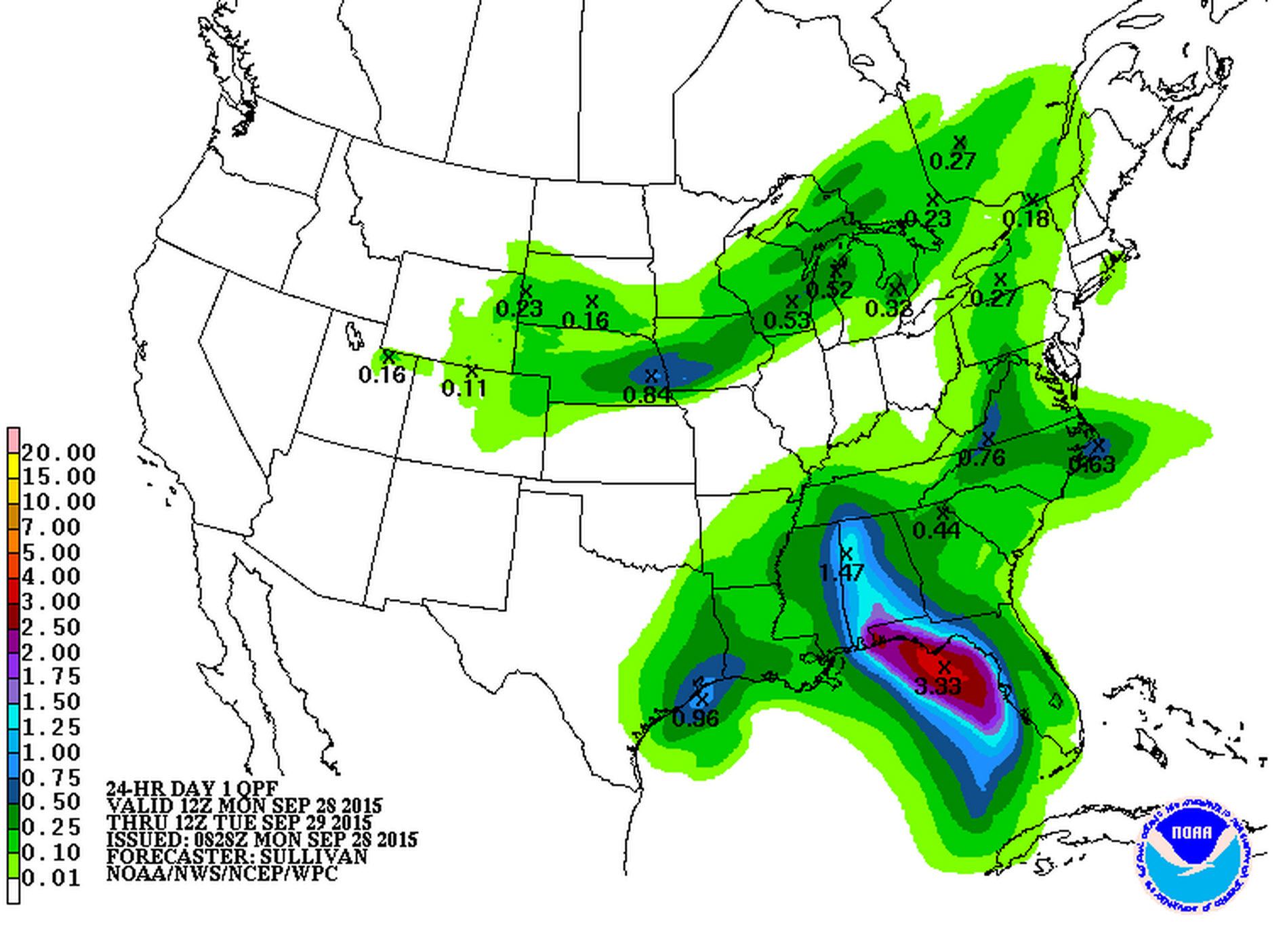
Rain coverage will decrease tonight with a 20 to 30 percent chance of rain continuing across Southeast Texas, East Texas, and Northeast Texas. Up to an inch of rain is possible across Southeast Texas and the coast through tonight with lesser amounts inland.
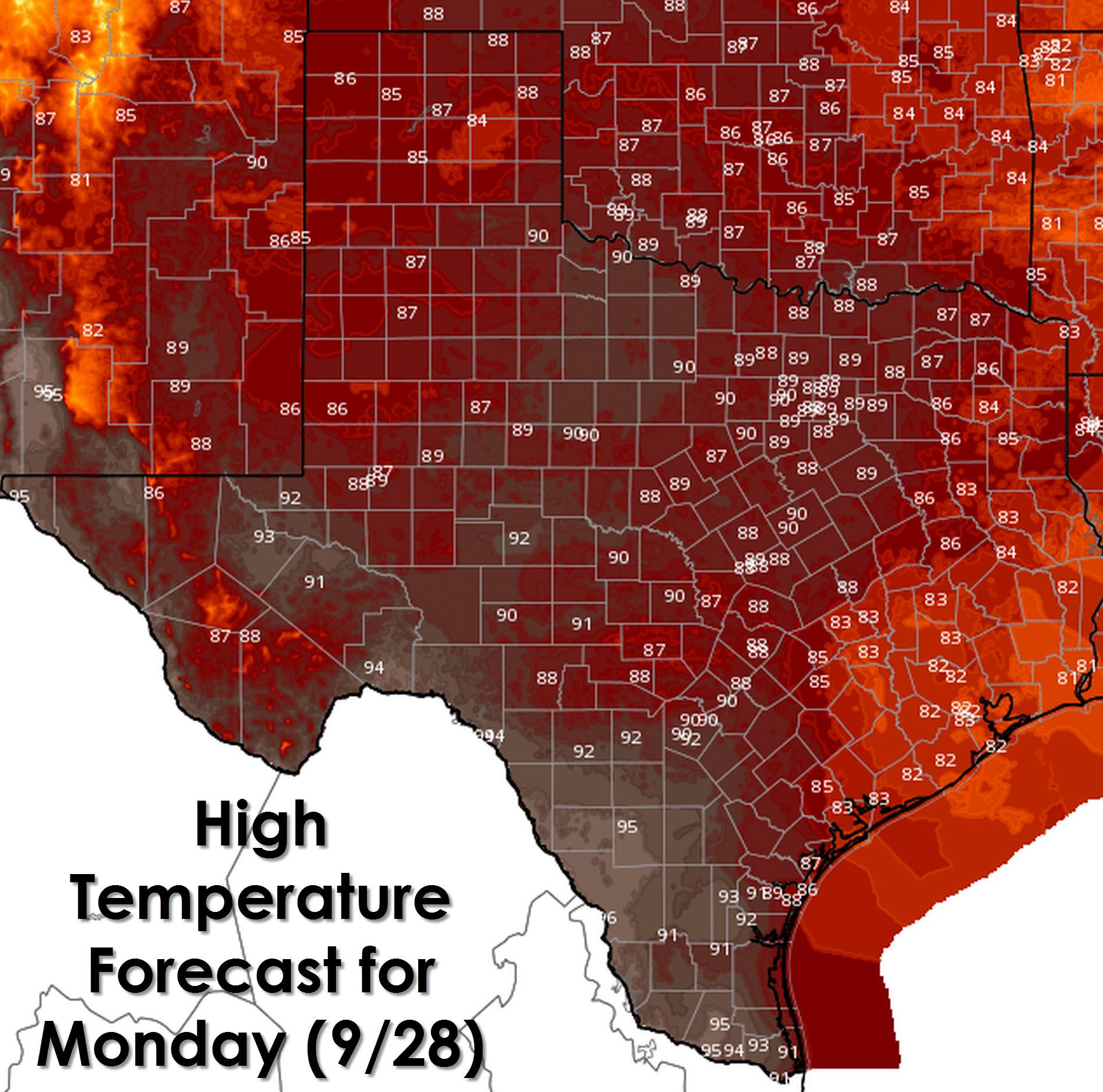
Temperatures will be kept down by clouds across Southeast Texas, East Texas, and Northeast Texas today with high temperatures only climbing into the low and mid 80s. Upper 80s to around 90 degrees are in the forecast for the Interstate 35 corridor with mid 90s in South Texas. Upper 80s to lower 90s are expected across Northeast Texas, the Hill Country, the Permian Basin, and West Texas plus the Panhandle.
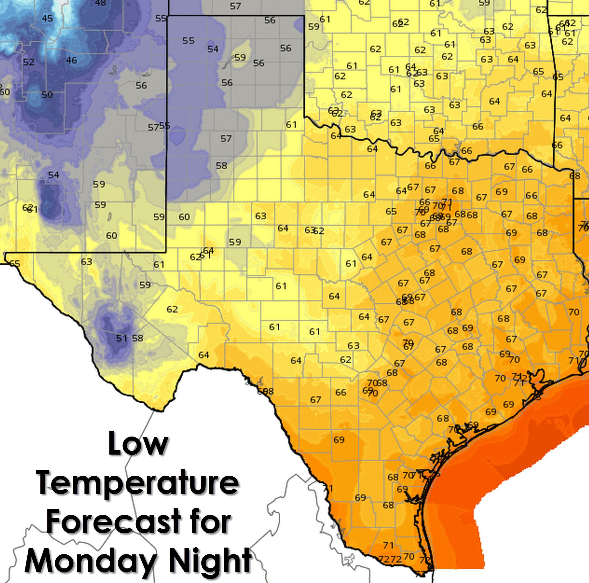
Finally temperatures will fall back into the 50s tonight across the Texas Panhandle and West Texas. Parts of the Permian Basin may even get to enjoy the upper 50s tonight as well. Low to mid 60s will be expected across Northwest Texas, the Big Country, the Concho Valley, and Southwest Texas. Mid to upper 60s across North Texas, Northeast Texas, East Texas, Southeast Texas, Central Texas, and South Texas with low 70s in the urban areas.

Invest 99L is now located in the Central Gulf of Mexico. Conditions are not favorable for development as it moves towards the Mississippi and ALabama coasts. Those folks will see heavy rain but otherwise no tropical-related impacts are anticipated.


0 Comments