Welcome once again to another Monday and the start to the work week. I know many of you are sooooooo happy that its Monday. Look on the bright side, at least this past weekend featured lower humidity and cooler temperatures. The trough across the eastern United States responsible for our northerly flow is being replaced by a high pressure ridge across the southern United States. More commonly known as the ‘heat ridge’ it shouldn’t be a big surprise that our weather is heating back up. Another cold front could be rolling into Texas by Friday with slightly cooler temperatures. With a ridge in place our weather pattern will remain dry for the next 5 to 7 days.
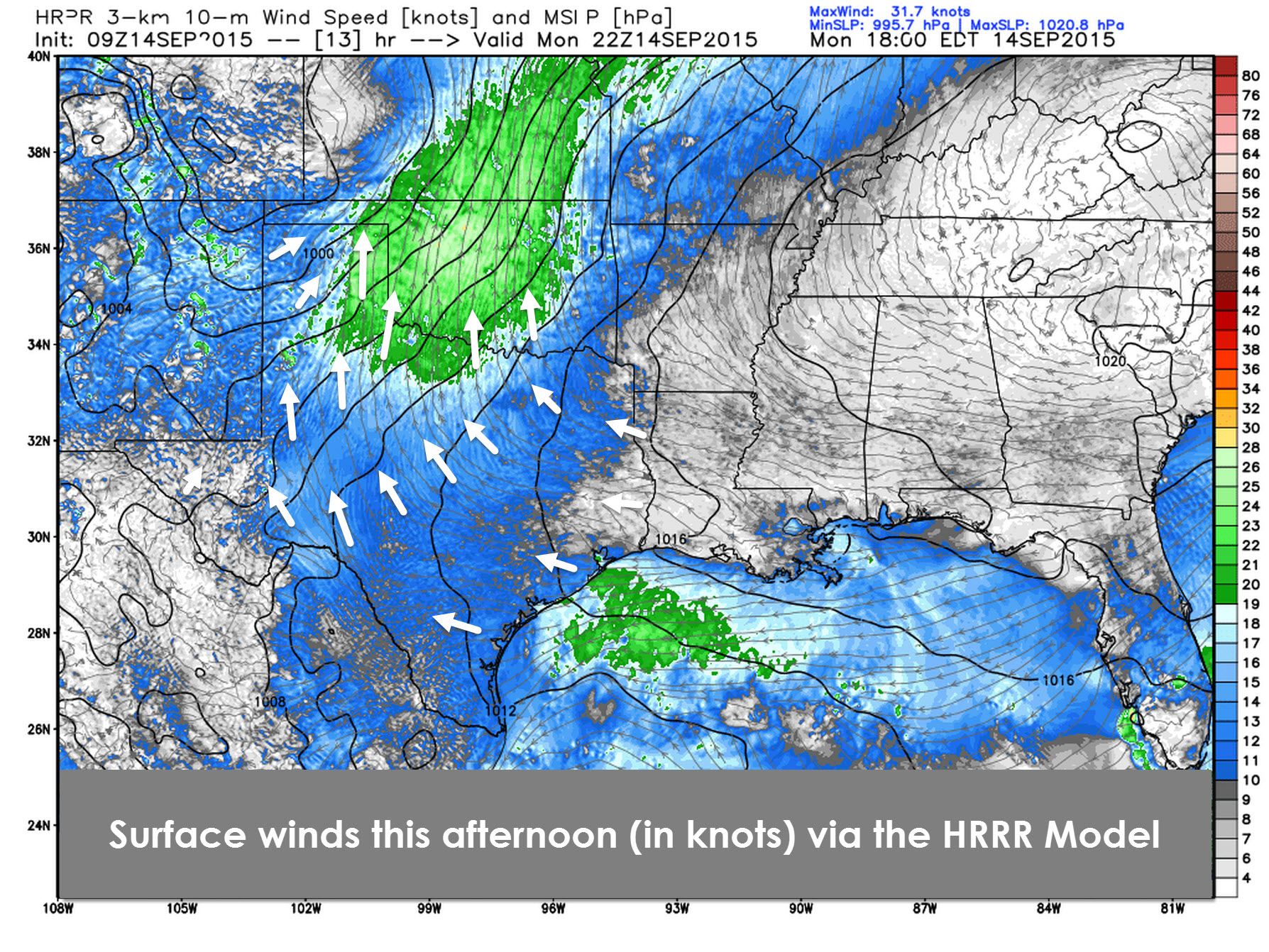
Our upper air pattern will result in benign weather for the coming days. With a storm system taking shape north of Texas a decent pressure gradient will set up shop across Oklahoma into parts of Texas. That means winds could become gusty this afternoon out of the south. With winds pumping out of the south we’ll see the tropical airmass spread back north tonight. The lower humidity values will be gone by Tuesday.
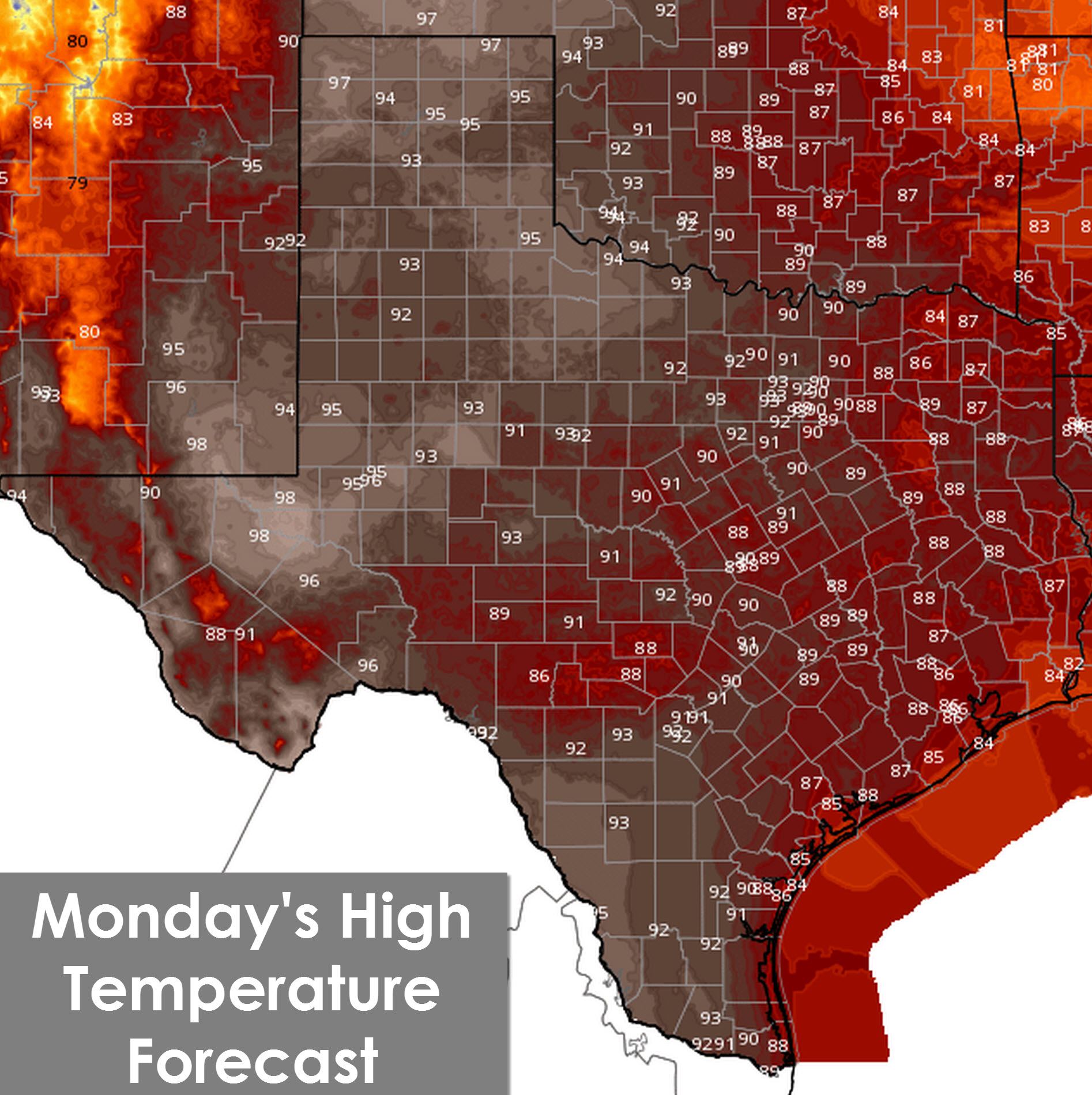
With gusty south winds this afternoon the Texas Panhandle, Northwest Texas, and Permian Basin will see temperatures soar into the mid and upper 90s. Low humidity values combined with the gusty winds and hot temperatures will result in elevated grass fire danger today. The Hill Country northeast into Northeast Texas south to the Gulf Coast will see temperatures climb into the upper 80s to lower 90s this afternoon. A few afternoon storms are possible along the coast.
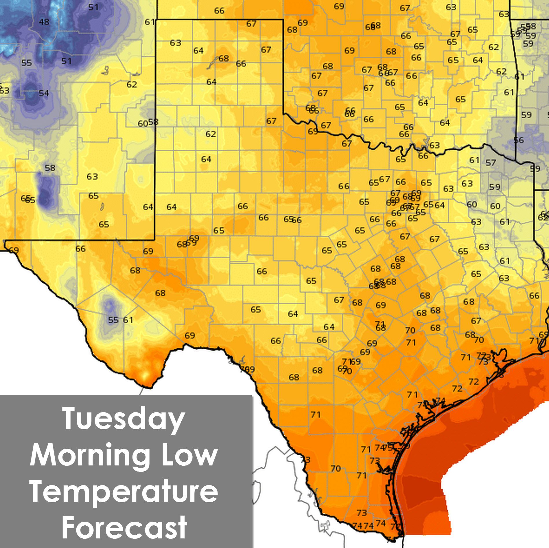
With southerly winds pumping tropical moisture north tonight temperatures will still end up falling into the 60s to low 70s. Some folks in Northeast Texas may see upper 50s tonight. Tuesday night and the remainder of the week will be warmer.


0 Comments