
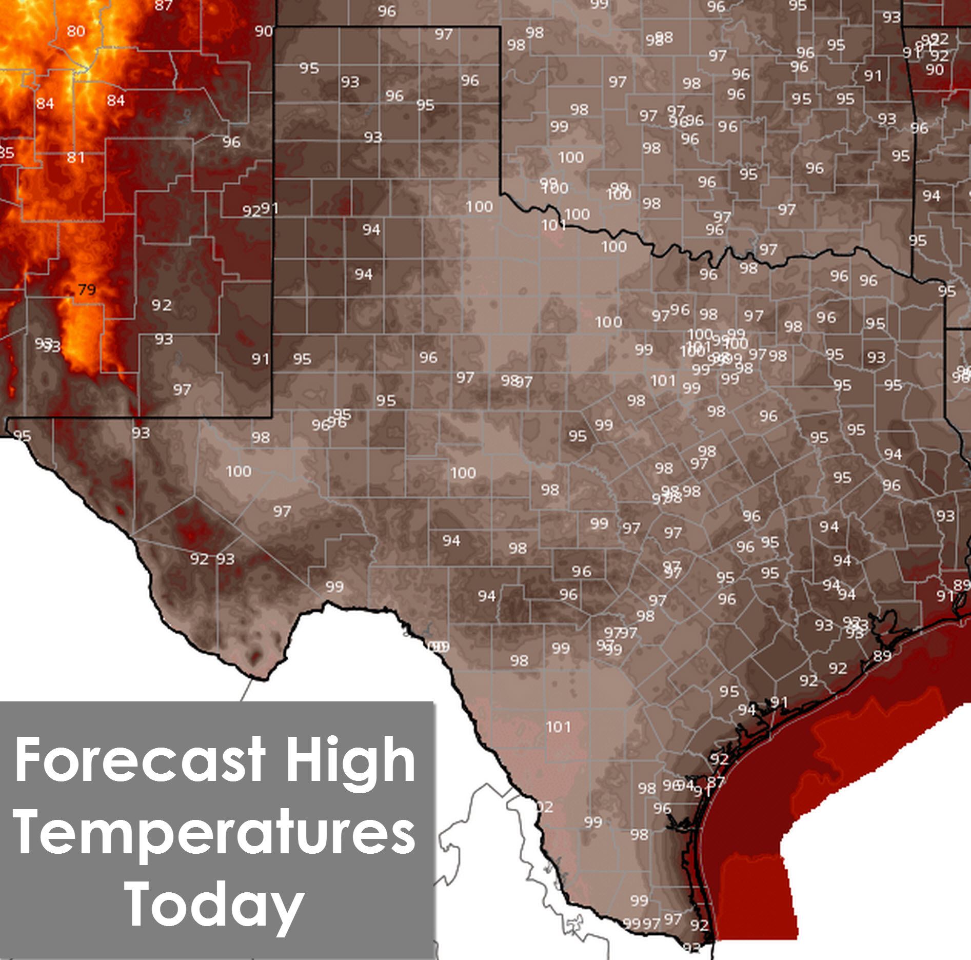
Good Monday morning happy Labor Day. We are going to be headed into an active weather pattern beginning on Wednesday which we’ll talk about in a moment. Nearly all of Texas has another two days or so of summertime weather before a cold front arrives. Temperatures will be above average today with highs in the mid and upper 90s. Parts of Northwest Texas, North Texas, and South Texas will make it up to 101-102 degrees today. Heat index values will be about five degrees above the actual air temperature in the more humid locations today. Pretty much a repeat of Sunday’s weather again today and on Tuesday.
Isolated to widely scattered pop up storms are expected along and east of Interstate 35 today into Northeast Texas, East Texas, and Southeast Texas. The northwestern Texas Panhandle and Far West Texas also have a shot at a few afternoon storms. Severe weather is not expected but the stronger pulse storms may produce damaging microbursts and frequent cloud to ground lightning. Most activity will diminish by sunset with only a rouge shower expected today.
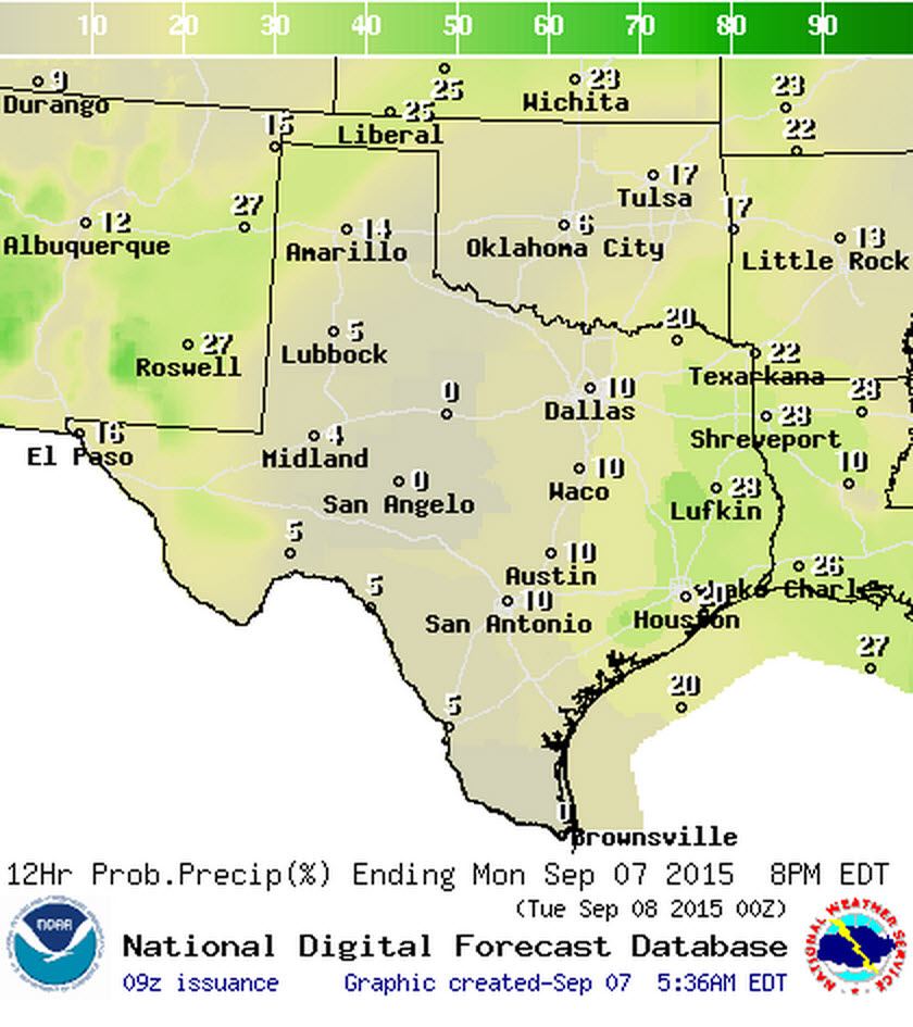
Chance of Rain/Storms (%) This Afternoon
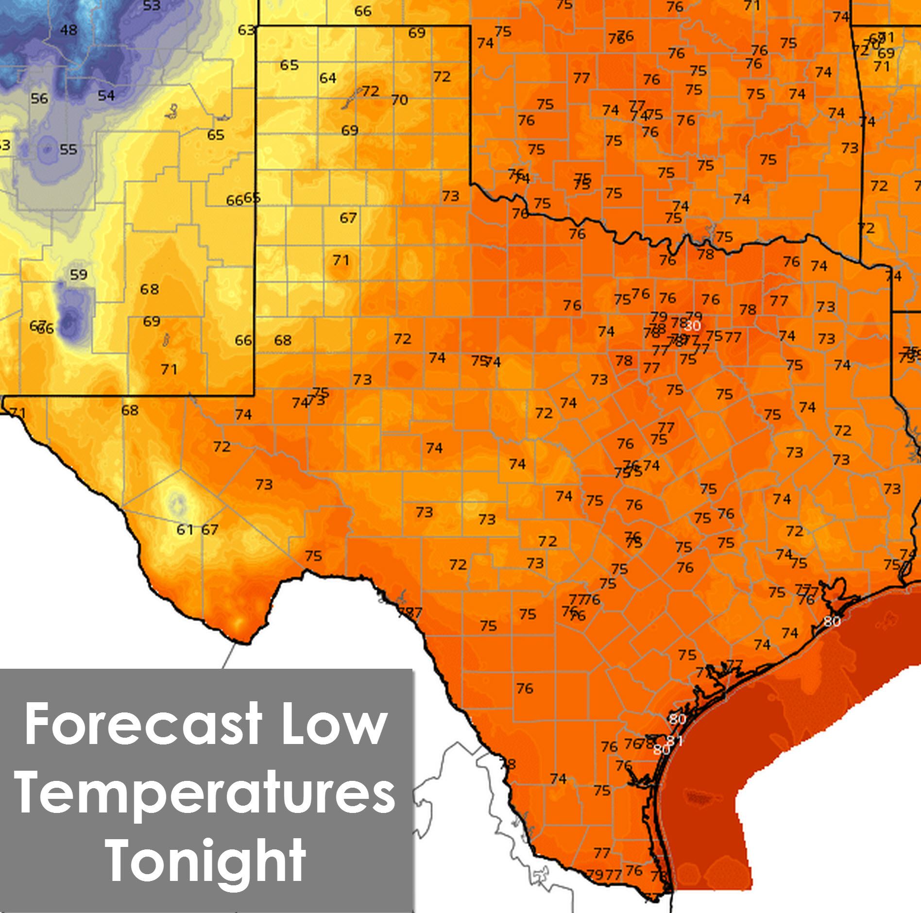
Temperatures will be warm tonight across Texas with mid 70s expected tonight across the eastern two-thirds of the state with humid conditions. The cooler spots will drop off into the 60s by Tuesday morning.
Our ridge aloft is going to be broken down and pushed to the southwest beginning tomorrow. A trough to our north will put us in a weak northwest flow aloft allowing a cold front to push south across the plains and eventually into Texas. By the time it gets to Texas it won’t have too much in the way of cool air behind it. Still we do expect it will push temperatures back down to average or slightly below average for the week. Its still going to be humid though.
Here are several meteograms showing GFS weather model data for the next week. Just ignore everything past this weekend since thats out in weather model voodoo land. Also keep in mind this data is straight from one weather model and should not be taken as a literal forecast.
The most noticeable change in our weather will be the first widespread precipitation event since June. Nearly all of Texas should see some rain over the coming days. Some folks will pick up only a trace to a few hundredths of an inch of rain. Others will get over an inch of rain by Friday. It all depends on who ends up under a heavier storm. Flash Flooding is not expected as we shouldn’t see anywhere close to enough rain to make issues.
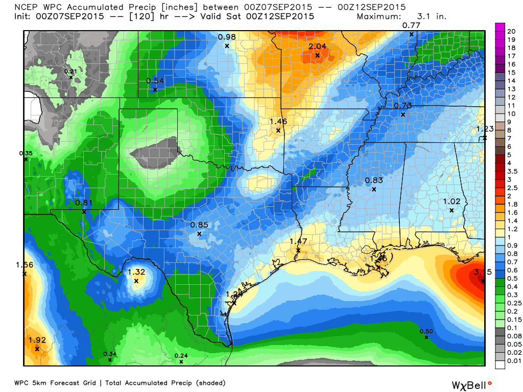
Generalized rain total forecast through Friday from the Weather Prediction Center
Here is a day-by-day rain forecast for the state. Rain chances will really begin ramping up Tuesday Night as a line of thunderstorms moves south across the Red River from Oklahoma. Chances for rain will spread south on Wednesday and generally continue across most of Texas through Thursday Night and Friday Morning.
Weather models are in poor agreement about our weather by the weekend. There are indications another cold front may try and push into the state by Saturday with noticeably cooler temperatures. Another possibility is that the mid-week cold front stalls out in the Gulf of Mexico and opens up the chance for a low pressure system to develop. When you get a boundary over the Gulf of Mexico you have to watch it closely since sometimes it can help develop a low pressure area. In the summer months those lows can become tropical in nature and open up a big can of worms. Just throwing that thought out there but nothing like that is in the forecast at this time.


0 Comments