
Surface analysis this morning shows a stationary front across western Kansas with an area of low pressure moving near Hays. This low pressure will move east today. Meanwhile a northwest flow aloft will start pushing the front south tonight as a cold front. By late afternoon the front will likely light up with a line of thunderstorms from the Texas Panhandle east into Oklahoma. There is a marginal risk for severe thunderstorms mainly involving the threat for damaging wind gusts.
Isolated afternoon storms are possible again today along the coast and in Southeast Texas where the humidity will be oppressive.
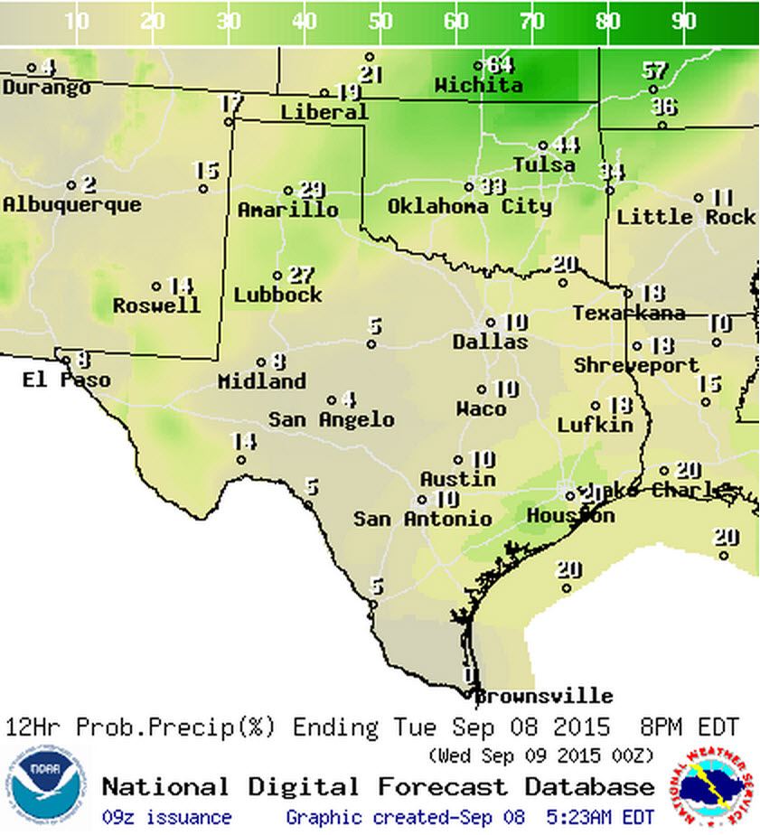
Chance of thunderstorms this afternoon.
The cold front and associated thunderstorms will move south of the Red River late tonight with a 30 to 70 percent coverage of thunderstorms. The highest concentration of storms will likely be across North Texas as the cluster of storms moves south out of Oklahoma. Some of the storms may be strong with strong wind gusts. Thunderstorm coverage will be a bit lower across West Texas, Big Country, and Northwest Texas but we’ll have to see how things develop today.

Chance of thunderstorms tonight.
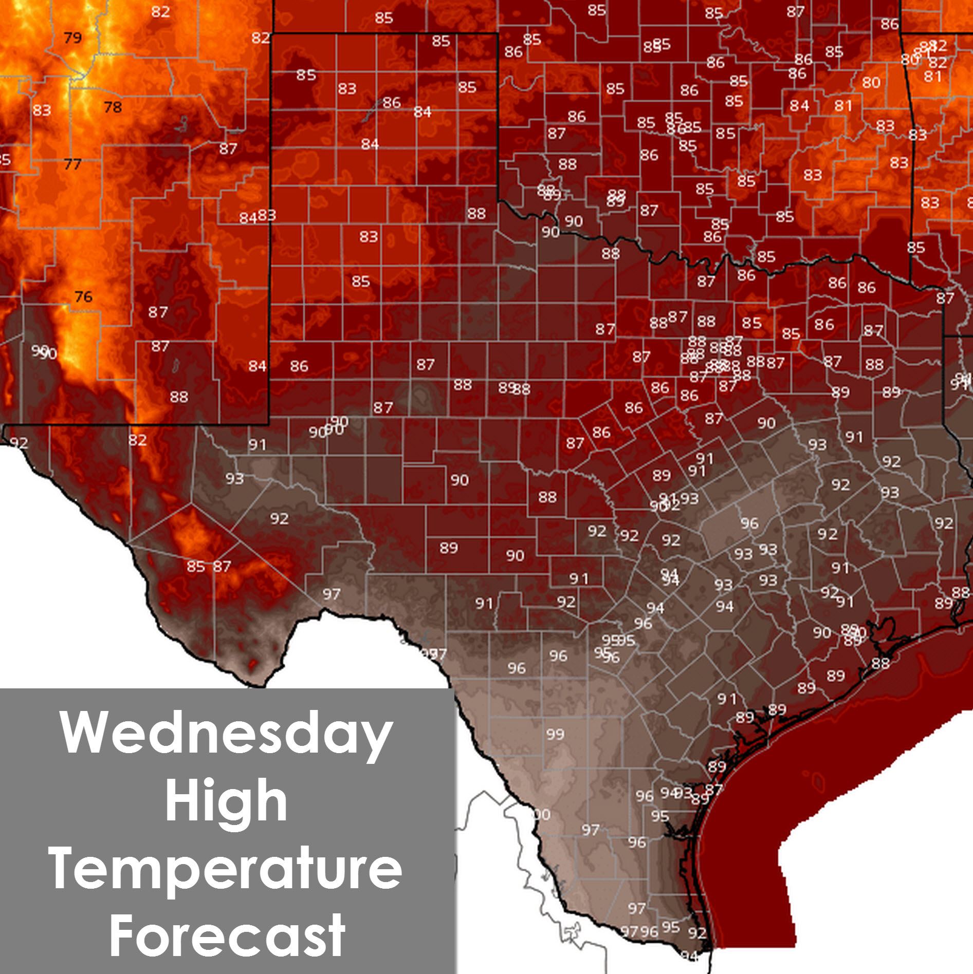
Another day of hot temperatures before things drop back to normal for September. High temperatures will range from the upper 80s in the Texas Panhandle into the low 100s across Northwest Texas, the Concho Valley, and South Texas. Heat index values will be in the 100 to 105 degree range across the southeastern half of Texas.
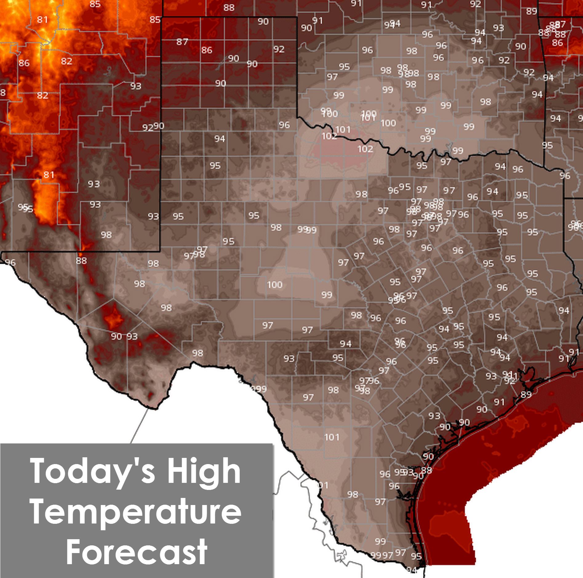
Temperatures tonight will drop down into the 60s across the Texas Panhandle and West Texas. The remainder of Texas will be in the 70s tonight.

Wednesday will be a wet one across most of Texas with a 30 to 70 percent chance of precipitation. Severe weather is not expected with the activity. Overall tomorrow should be our best rain event since Bill back in June. At most a few locations should receive up to 1.25 inches of rain. The unlucky folks will get next to nothing. Flooding is also not expected to be an issue.
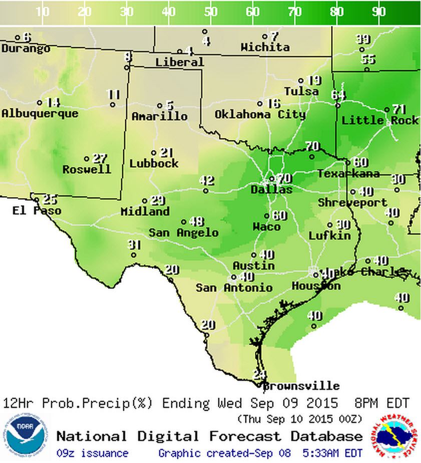
Chance of rain and storms on Wednesday.
Chance of rain and storms on Wednesday Night.
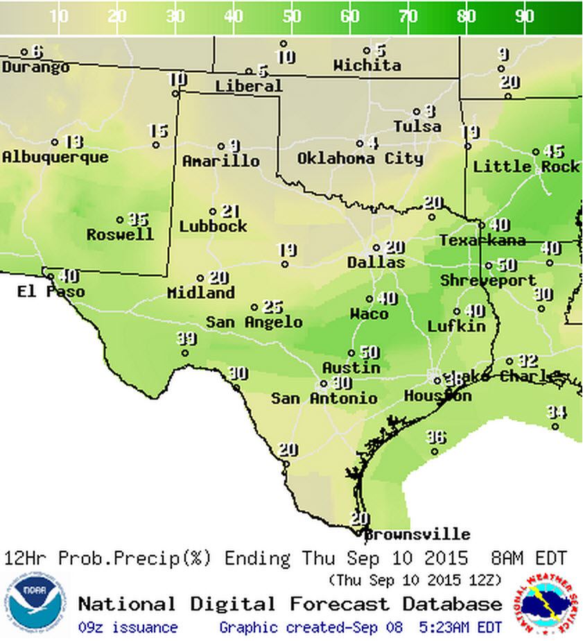
Rain chances will be high on Thursday across South-Central Texas, Southeast Texas, and East Texas with scattered activity across Southwest Texas, South Texas, the Rio Grande Valley, and Far West Texas. Again severe weather is not expected and we don’t expect much in the way of flooding. At most a few locations should receive up to 1.25 inches of rain. The unlucky folks will get next to nothing. In addition we could see another round of scattered storms move into the Texas Panhandle on Thursday Night.

Chance of rain and storms on Thursday.

Chance of rain and storms on Thursday Night.
You’ll be able to find where the cold front will be tomorrow afternoon based on the temperature forecast. In addition fairly widespread rain chances will keep things cloudy north of the cold front. South of the front temperatures will be hot on Wednesday with 90s and humid conditions. It’ll still be humid north of the cold front but temperatures will be in the 80s.
I’ll leave you with the projected rain total forecast through Saturday Night. We may have another system move in towards Sunday. The extended range forecast continues to feature uncertainty with weather models still in disagreement. We may or may not have another cold front and storm system move in towards the early part of next week.
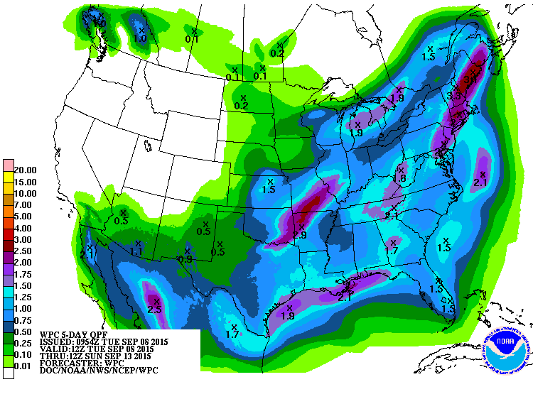
Rain total forecast from the Weather Prediction Center through Saturday Night


0 Comments