

Chance of rain today
Chance of rain tonight
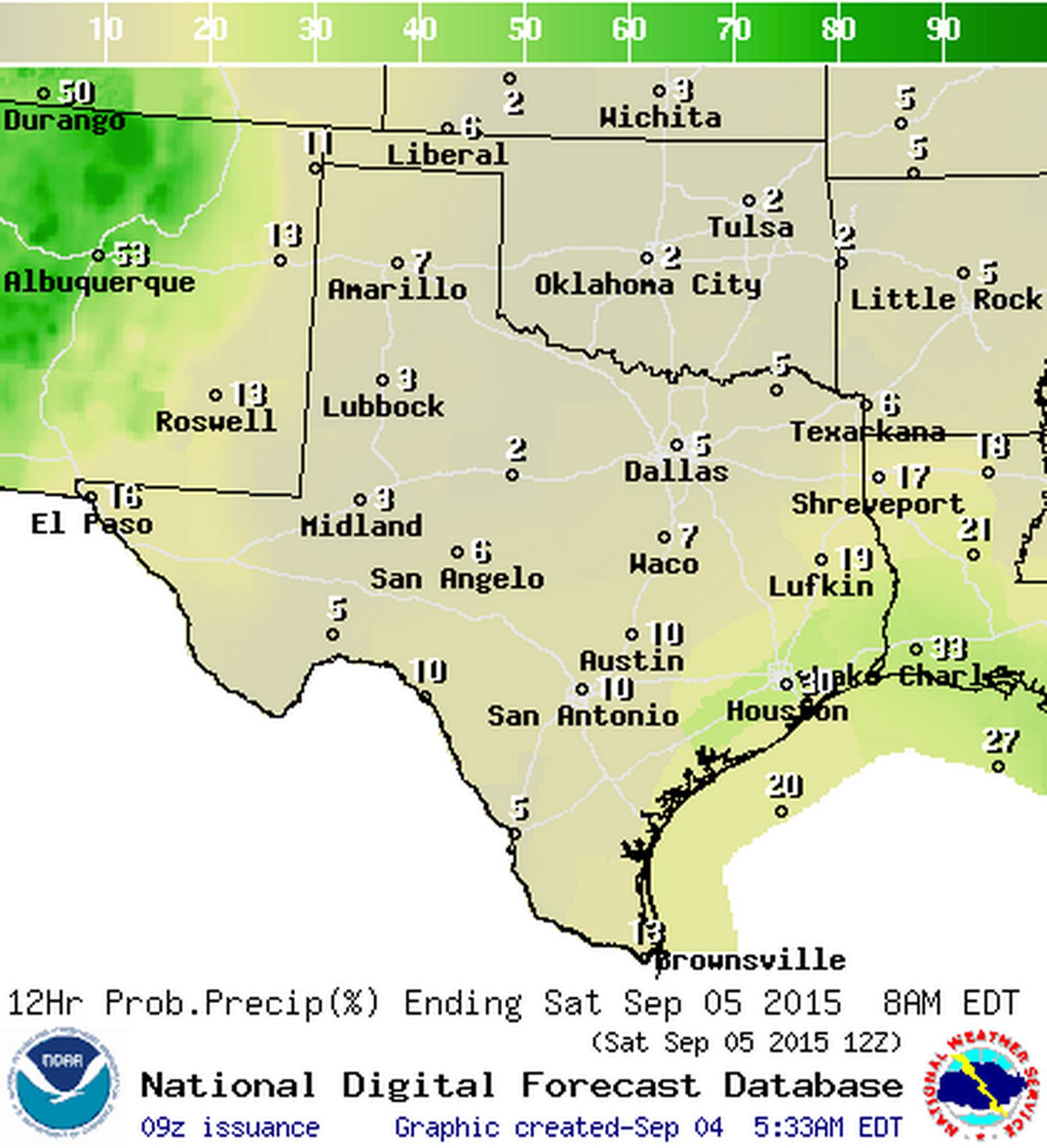
Yet again the weekend is upon us along with the first of many local and regional football games. Fall activities may be starting up but it will certainly continue to feel like summer for the next several days across Texas. As is customary for summer we’ll have a 20 to 30 percent chance of afternoon popcorn storms along the coast and immediate regions inland. Severe weather is not anticipated but the stronger storms may end up producing gusty winds and frequent cloud to ground lightning. Most activity should be dying down by sunset which will allow outdoor events to proceed as scheduled. Still a storm or two will remain possible until about midnight across the coast. Except for the El Paso area we are not forecasting any precipitation today.

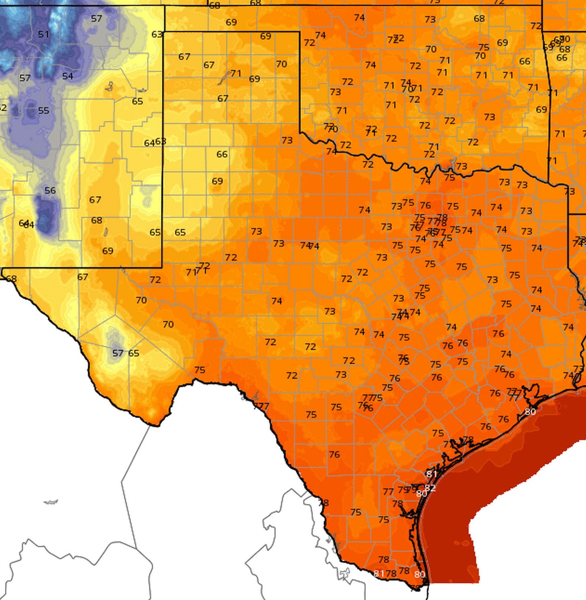
High temperature forecast for today (9/4)
Low temperature forecast for Saturday morning (9/5)
Temperatures will climb into the mid and upper 90s for high temperatures today with parts of Deep South Texas and Northwest Texas hitting 100-101 degrees. Heat index values will be about five degrees warmer in the more humid areas. Temperatures will drop off into the 80s to around 90 degrees by 8 PM. By Saturday Night temperatures will be in the 70s across the state with 80s on the coast and 60s across West Texas and the higher elevations around Alpine.

Chance of rain on Saturday (9/5)
Another toasty day is in the cards for Saturday and those attending the football games will want to dress appropriately. A 20 to 30 percent chance of afternoon storms will be in place across East and Southeast Texas along with El Paso in Far West Texas. Temperatures will be in the upper 90s to low 100s across Texas with heat index values in the 100-105 degree range. It may be meterlogical fall but that doesn’t mean much for Texas.
We’re still anticipating a patter change by Wednesday-Thursday of next week. A cold front along with increased rain chances will be the result. Temperatures won’t get too cool but we should see highs drop back into the 80s to around 90 degrees (so a 10 degree drop compared to now). We’ll continue to refine the cold front’s timing and overall rain chances as we get closer to next week.


0 Comments