
It’s been an interesting day along the coast with a waterspout reported near Surfside Beach, a possible funnel cloud reported near Brenham (most certainly trying to get some Blue Bell ice cream!) and numerous strong showers dumping inches of rain all up and down the coast from Houston all the way to Brownsville where flash flooding has been an issue this afternoon. And there’s more to come as an upper level low sits nearly stationary across south central Texas tonight and into tomorrow creating chances for showers along and just offshore overnight and into tomorrow. Not everyone will see rain along the coast tonight or into tomorrow, but if you’re lucky enough to get under one, your yard could pick up a quick 2 to 4 inches in a very short amount of time.
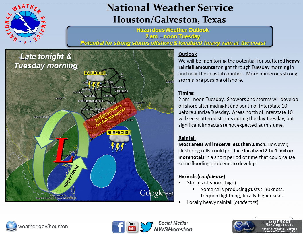
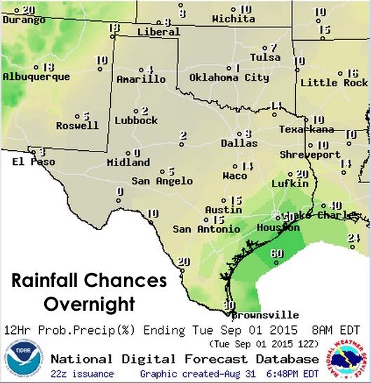
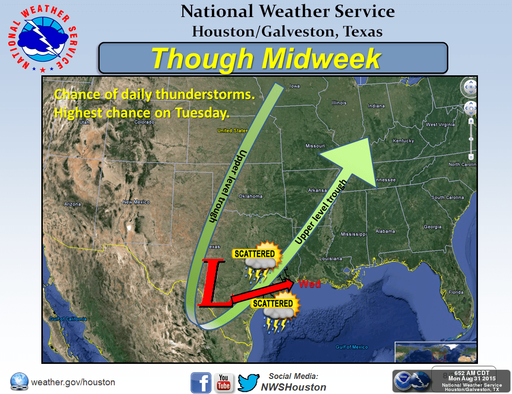
Tomorrow, we expect rain chances along the coast to continue as the upper level low continues to sit over the region. We expect they’ll behave much like today with widespread development impacting the coastal counties and isolated development possible across the inland counties of south central Texas and over into the Hill Country region near the I-35 corridor. How much rainfall coastal and inland counties will receive through the middle of the week is difficult to determine right now. Our best short-range model has the upper level low sitting over the region a little bit longer with slightly more precipitation possible. Our best mid to long-range model has it shifting east by the middle of the week taking most of the rain chances with it.

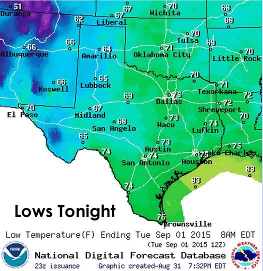
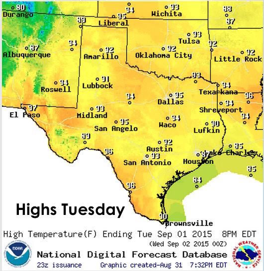
Lows tonight, once again seasonal and muggy across much of the state…cooler and drier across the panhandle and far western Texas. Highs tomorrow, seasonal and in the 90s across much of the state, with a few cooler spots for those who receive rain tomorrow. Not seeing many chances for 100 degree readings, which is certainly nice!
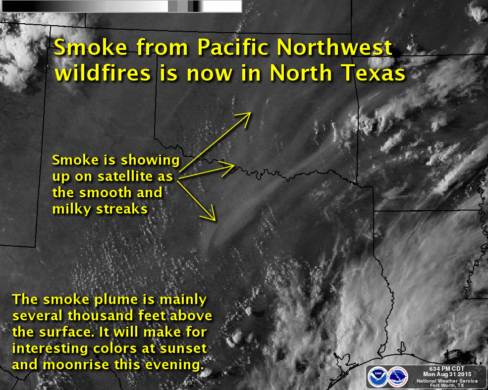
We’ve had a bunch of questions recently on why the haze over parts of northern Texas and the panhandle the past couple of days. The answer is smoke…from wildfires in Canada and the Pacific Northwest! High pressure sitting over the desert southwest has resulted in upper level winds over Texas being primarily from the north/northeast as they flow clockwise around the high. As these upper level winds flow from north to south, they’re carrying the lofted smoke with them and right over our state. This smoke is quite high up in the atmosphere, which is why both the sun and the moon have taken on an orange appearance while still many degrees above the horizon. Is this a health hazard? Not particularly, since the smoke particulates are several thousand feet above the earth’s surface. The only airborne health hazards at the moment are just typical metroplex pollution, pollen, dust from any agricultural harvesting in your area…or those stinkers your dog lets loose every now and then.


0 Comments