
Scattered to numerous showers and thunderstorms are expected today across Southeast Texas. Houston received more rain yesterday (0.75″) than all of July combined. In all likelihood they’ll add on to that total today. A few strong wind gusts are possible but severe weather isn’t expected. Storm coverage will greatly diminish after sunset. Isolated to widely scattered storms are possible this afternoon across the Texas Panhandle and South Plains. A complex of thunderstorms may move in from the northwest and impact the Texas Panhandle tonight. A marginal severe weather risk does exist mainly for 60 MPH wind gusts and pocket-change size hail wth the storms this evening.
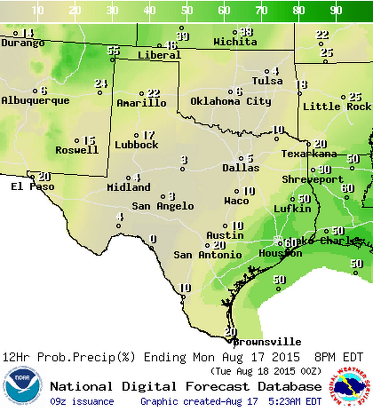
Chance of rain/storms today
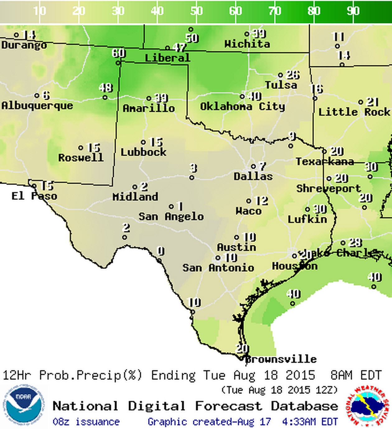
Chance of rain/storms tonight
Temperatures will top out in the 90s across all of Texas today – very usual for August. For most of the state these temperatures will be about ten degrees cooler than the 100-109 experienced over a week ago. Those temperatures will fall tonight into the mid 60s to mid 70s across the state. The cooler temperatures will be in the Texas Panhandle with the remainder of Texas having lows in the mid 70s.


An unseasonably potent summer cold front will start rolling into the state Tuesday Night. The front will bring thunderstorm chances Tuesday Night to the Texas Panhandle, West Texas, and the Red River Valley. Storm chances will increase across the Big Country, Concho Valley, Permian Basin, North Texas, Northeast Texas, East Texas, Southeast Texas, and Central Texas on Wednesday into Wednesday Night. Rain chances will continue into Thursday for folks along and east of Interstate 35 before finally tapering off Thursday night. Heavy rain isn’t expected but folks along and east of Interstate 35 may pick up an inch of rain or so.
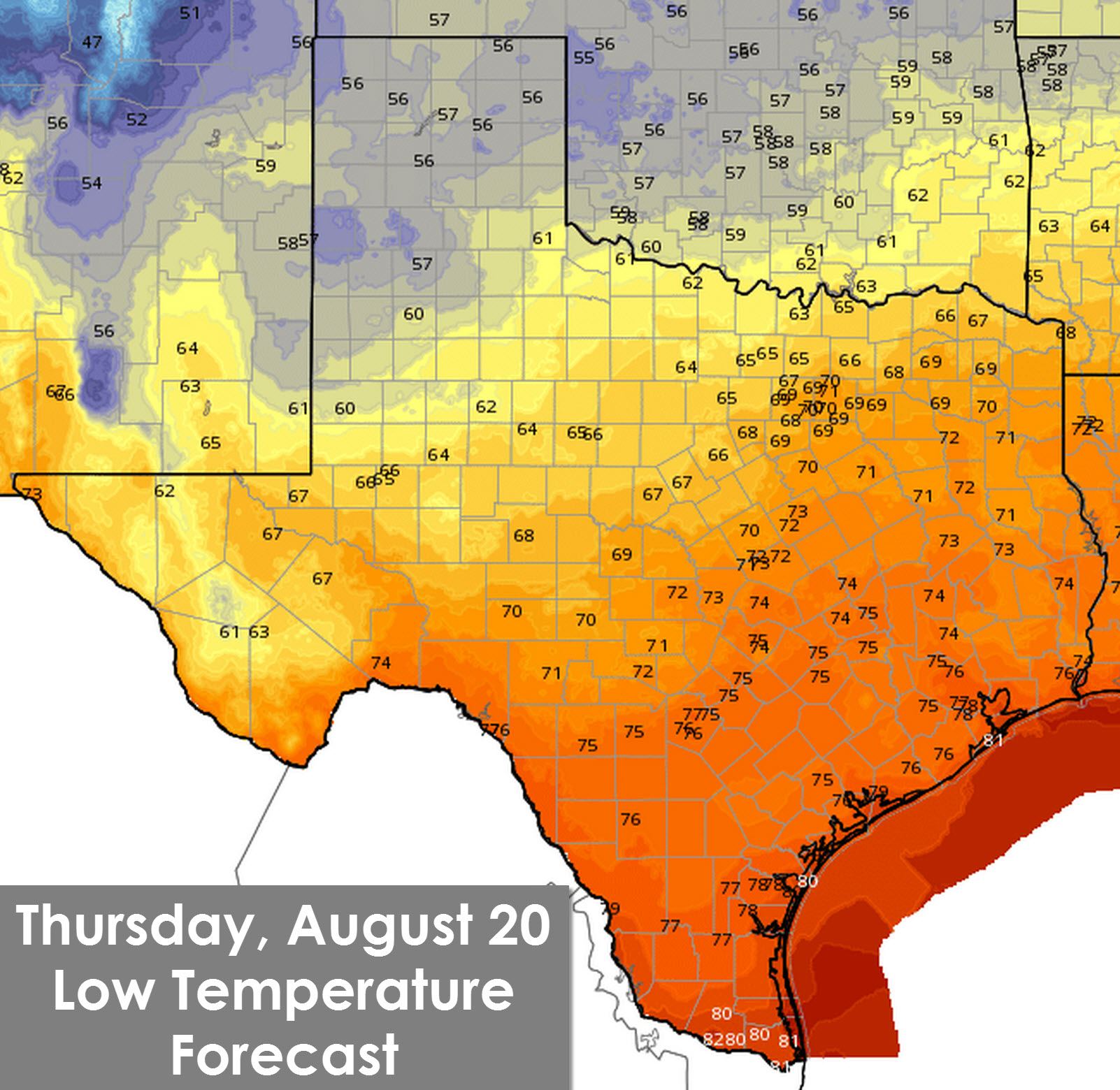
While rain is good news I think folks in the northern half of Texas are going to like this bit just as much. Temperatures by Thursday Morning will fall into the 50s to around 60 degrees across the Texas Panhandle, West Texas, and Northwest TExas. Upper 60s can be expected across the Concho Valley, Big Country, Permian Basin, North, and Northeast Texas. Noticeably lower humidity values will accompany this fall preview. Folks across South-Central Texas, Southeast Texas, Deep South Texas, and the Rio Grande Valley won’t really see much in the way of cooler weather with this cold front unfortunately. The cooler weather will only last a day or two before we rebound back to normal summer weather by the weekend.


0 Comments