
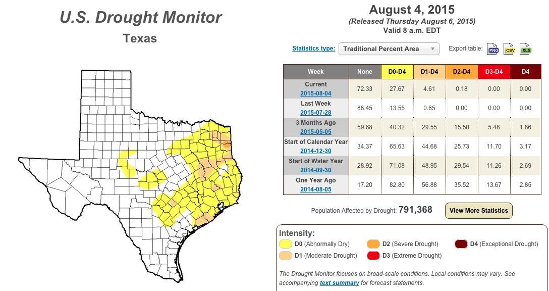
The latest Drought Monitor was released today and it shows we’re beginning to lose what we gained with all the rain we had earlier this year. East and southeast Texas are seeing the greatest return in drought conditions since earlier this summer. Not surprising since a large portion of the state has received little to no rain since May. I’d like to say that our forecast models are showing chances for widespread rain soon across the region, but they aren’t. Other than a few chances across the panhandle/western Texas over the next day or so, there’s not much hope for at least the next 7 to 10 days as a dome of high pressure sits on top of us. We are seeing what we HOPE is a pattern change by the end of next week which may bring some chances back, but we’re not even close to betting on that just yet. Best we can do for now is just hang in there and look forward to a cooler and wetter than normal fall and winter as we begin to feel the effects of a strengthening El Nino.
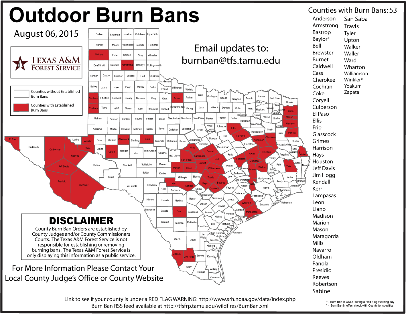
Along with the lack of rain and increasing heat here recently, we’re starting to see an uptick in conditions favorable for wildfires. According to the latest data from the National Interagency Coordination Center, a large (10,000 acre) wildfire of human origins is currently being worked near Fort McKavett in Sutton County. Thankfully, it’s now 70% contained, but it’s a reminder that when we begin to dry out, we need to be extra cautious with anything that could cause a spark or flame.


0 Comments