
An unseasonably strong cold front will give parts of Texas a early fall preview beginning tonight. The cold front will usher in drier air and comparatively cooler temperatures. In addition to the cooler weather the front will also be a focal point for shower and thunderstorm development. A couple storms are possible today along the coast and in West Texas. Scattered storms are likely tonight across the Texas Panhandle, Northwest Texas, Red River Valley, and West Texas as the front pushes south. Scattered to widespread precipitation is a good bet across Southeast Texas, East Texas, Northeast Texas, North Texas, and the Concho Valley on Wednesday and Wednesday Night. A few stronger storms with hail to the size of quarters and 50-60 MPH winds will be possible with this activity.
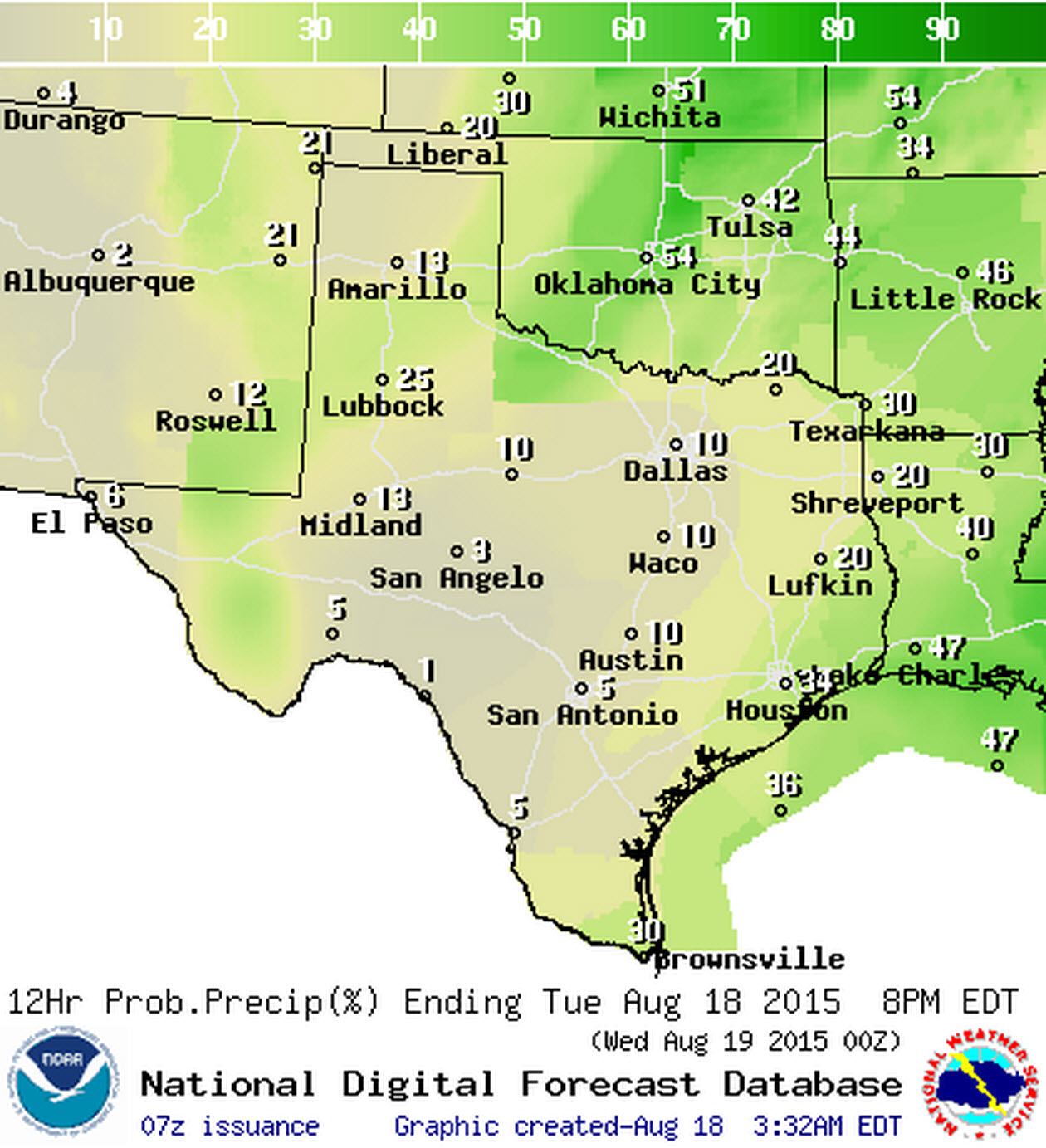
Chance of rain Today
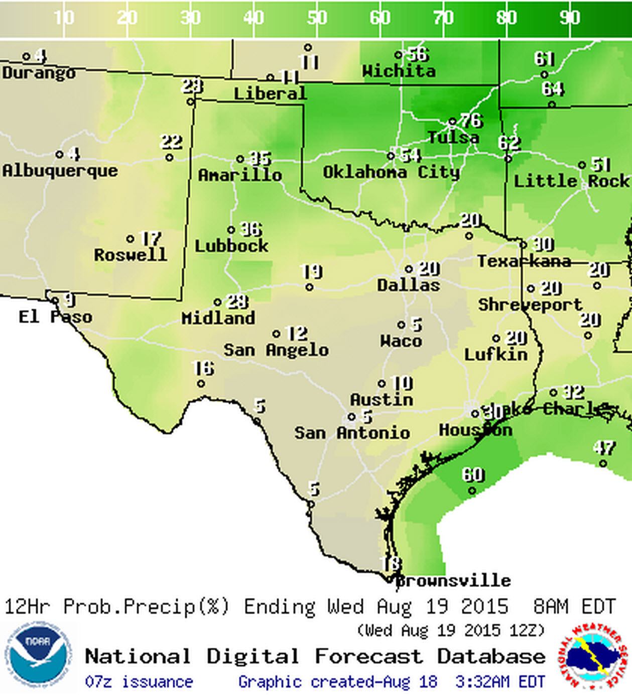
Chance of rain Tongiht
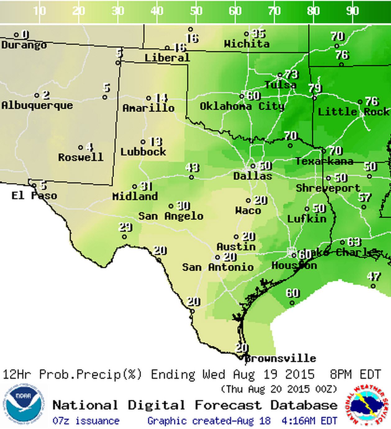
Chance of rain on Wednesday
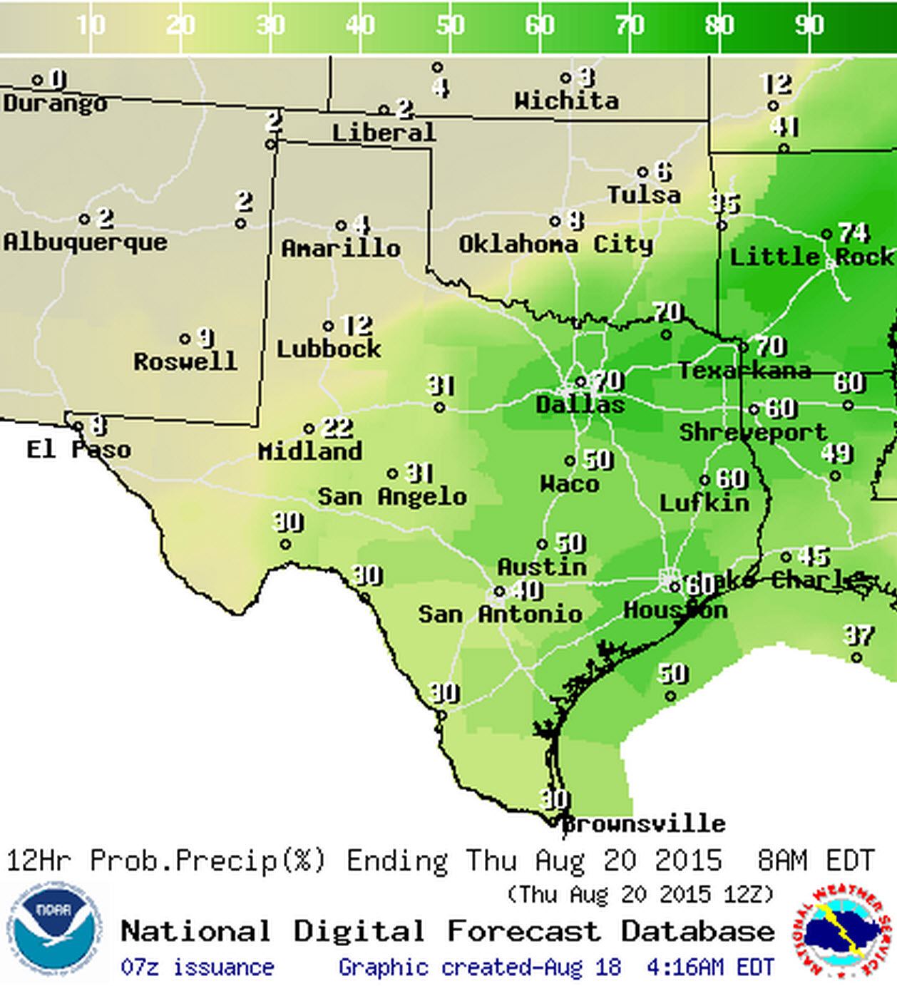
Chance of rain Wednesday Night
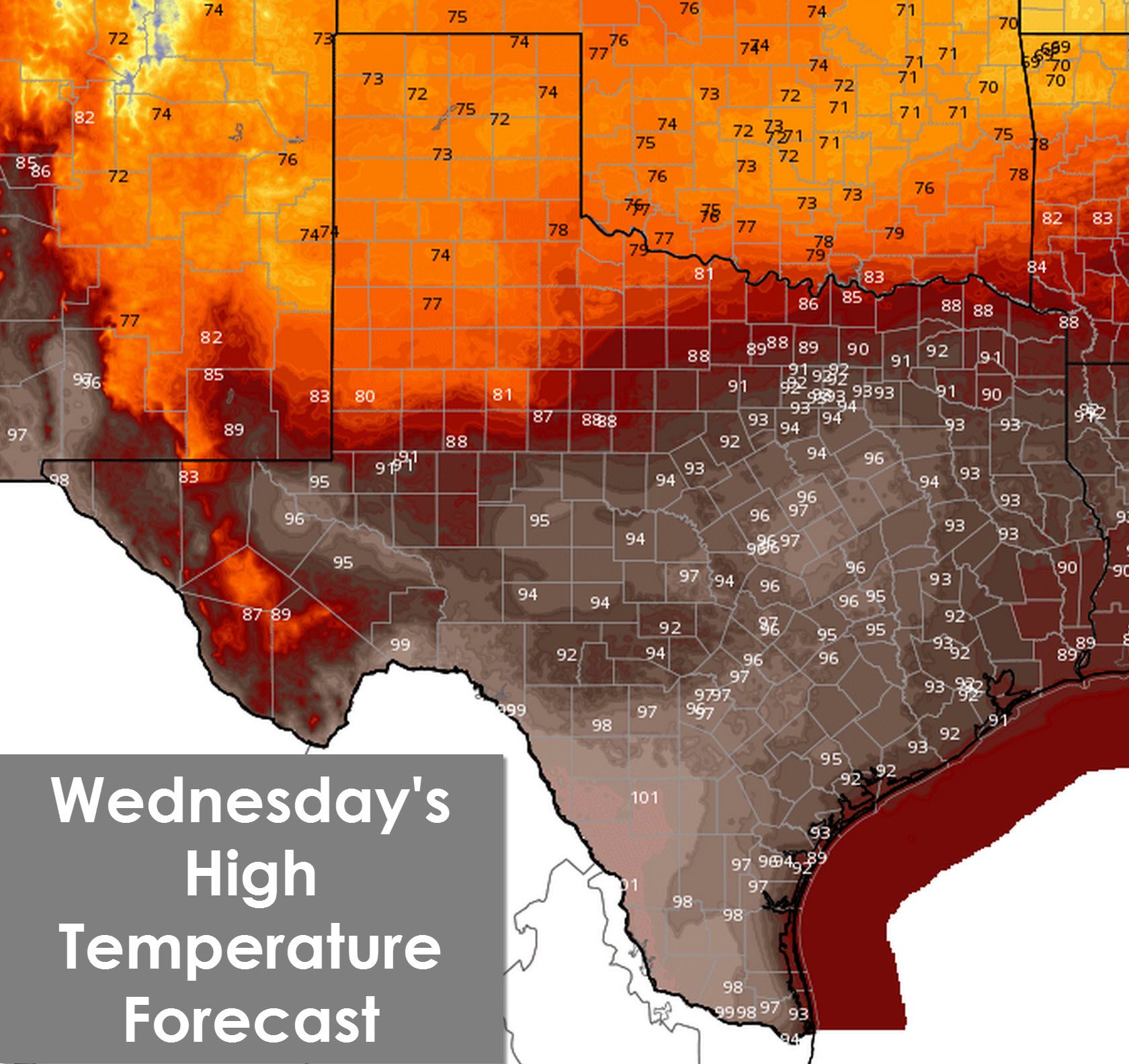
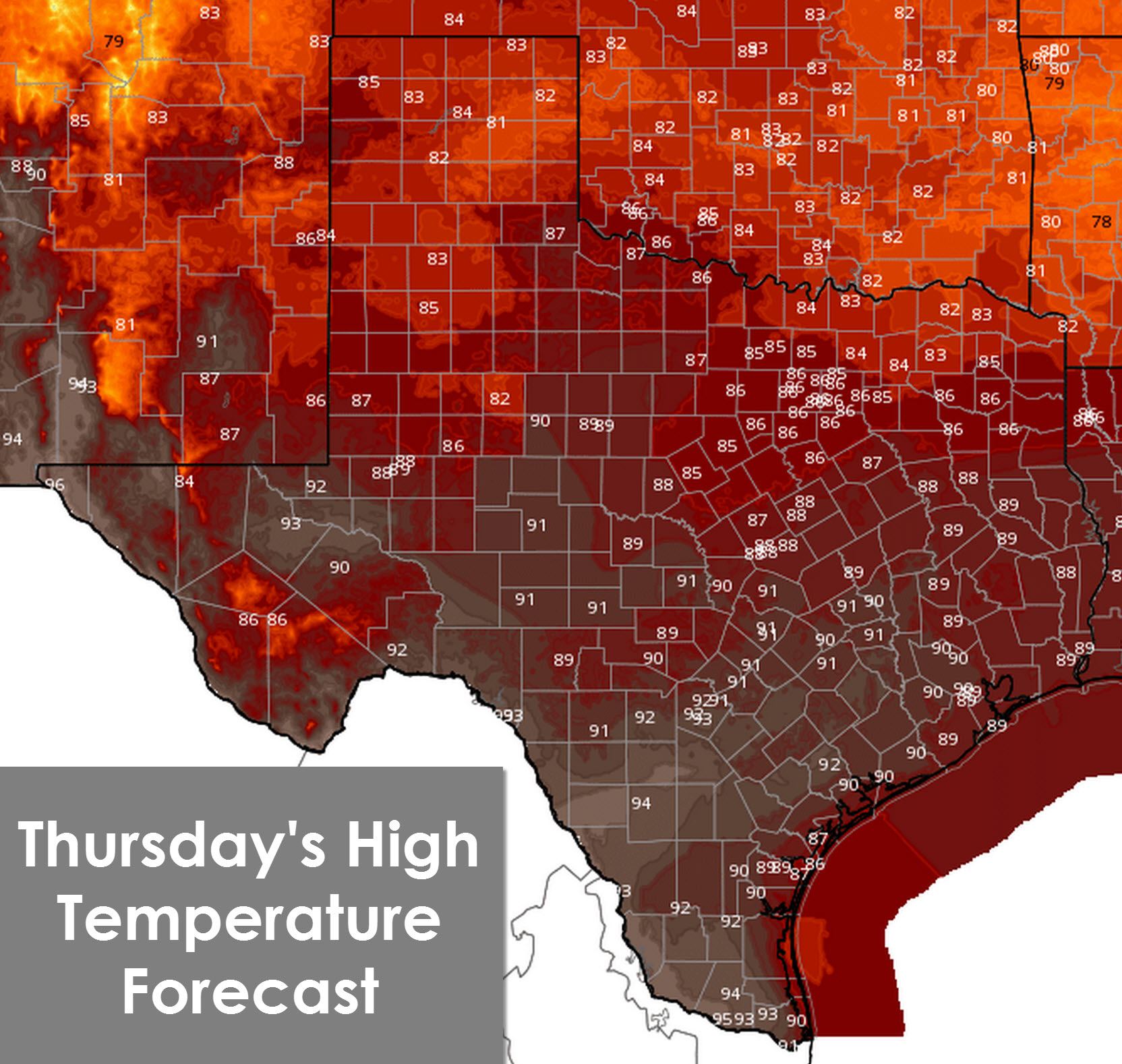
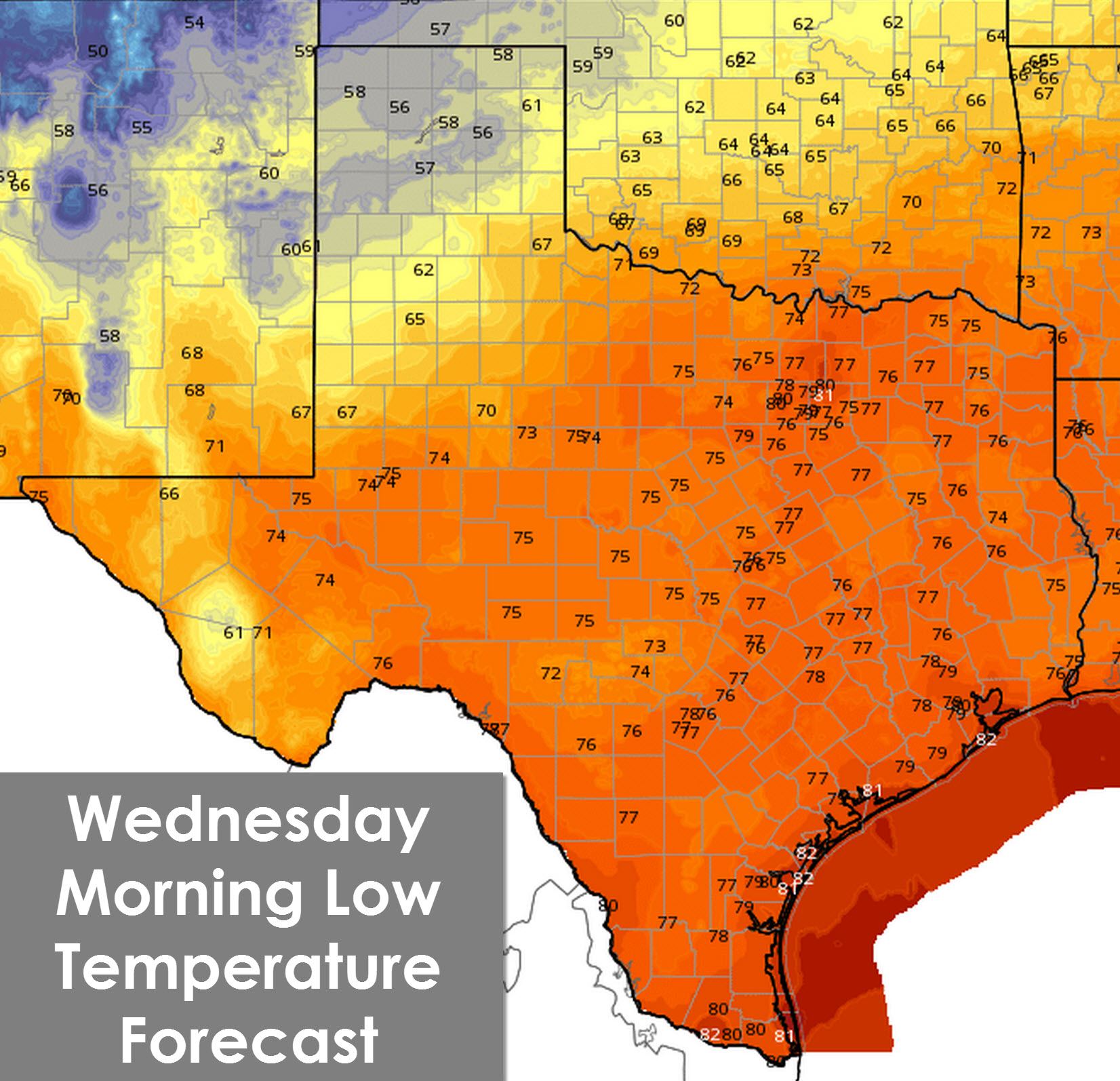
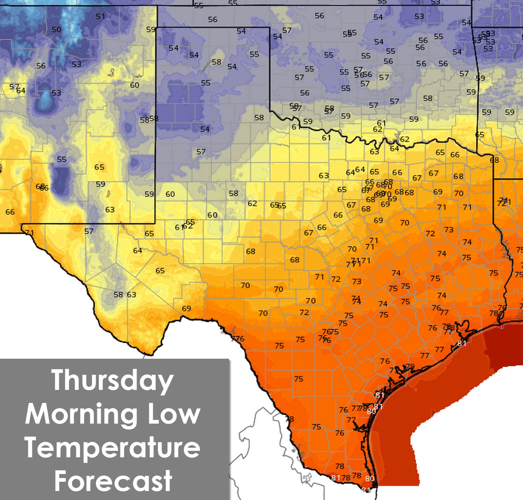
High temperatures today will climb into the 90s across the state as is typical for a summer afternoon. Chances become more apparent tonight as the Texas Panhandle drops into the 50s with 60s across West Texas behind the cold front. On Wednesday temperatures will remain in the 70s across the Texas Panhandle, West Texas, and Northwest Texas. Folks south of the front will see another hot day – but as the front continues to push south into North Texas and the Concho Valley temperatures should drop. Low temperatures in the 50s will be widespread Thursday Morning across hte Texas Panhandle, West Texas, and parts of Northwest Texas. 60s are likely across the Concho Vlley, Big Country, North, and Northeast Texas with lower 70s across Central and East Texas. Thursday will feature below-average temperatures along and north of Interstate 10. Even across Southeast and South Texas temperatures will only climb into the low 90s. 80s to around 90 degrees is expected north of Interstate 10 with a drier airmass in place. By the weekend we’ll see temperatures rise back up towards our typical summer values. Another cold front may intrude next week but that’s a tale for another day.


0 Comments