
Our weather is going to take an interesting turn this week. Quite unusual for August a pattern shift will bring a cold front and thunderstorm chances to Texas this week. With the jetstream dipping south even severe thunderstorms will be possible. All of this is fairly atypical for August but is something seen with El Ninos in place. Enough about all that for now lets get on with today’s weather forecast. Scattered thunderstorms will develop this afternoon across Southeast Texas, South Texas, and the Rio Grande Valley. Two-fifths of y’all should get wet today while three-fifths stay dry. When Thunder Roars Go Indoors since lightning is close enough to strike. Activity will diminish by sunset. Another area that will see widely scattered thunderstorms late this afternoon into tonight is Far West Texas and the western half of the Texas Panhandle + South Plains. I can’t rule out a rouge shower or two across East and Southeast Texas tonight either.
Temperatures today will climb into the 90s across all of Texas. A few 100-102 degree readings are expected across the Permian Basin and Southwest Texas. Those lucky enough to get a storm near them today will have a chance of rain-cooled outflow dropping temperatures down into the 80s for a time. Upper 60s to mid 70s will be commonplace for tonight’s temperatures which is a few degrees cooler than what we saw with the heatwave earlier this month.
An unusually potent trough for August will dig across the eastern two-thirds of the United States this week. The result will be a cold front along with a shortwave (upper-level energy) that will bring relatively high rain chances this week. The exact forecast will continue to evolve as we get closer but the highest rain chances should begin on Tuesday and continue through Thursday depending on your location in Texas. A Category 2 Severe Weather Risk has been issued for Tuesday in the Texas Panhandle. That means we’ll be watching out for stronger to severe storms capable of producing large hail and damaging wind gusts. We’ll need to keep an eye out for an isolated tornado as well. A few strong storms will be possible on Wednesday and Thursday further into Texas but weather model variability means low-confidence in that solution.
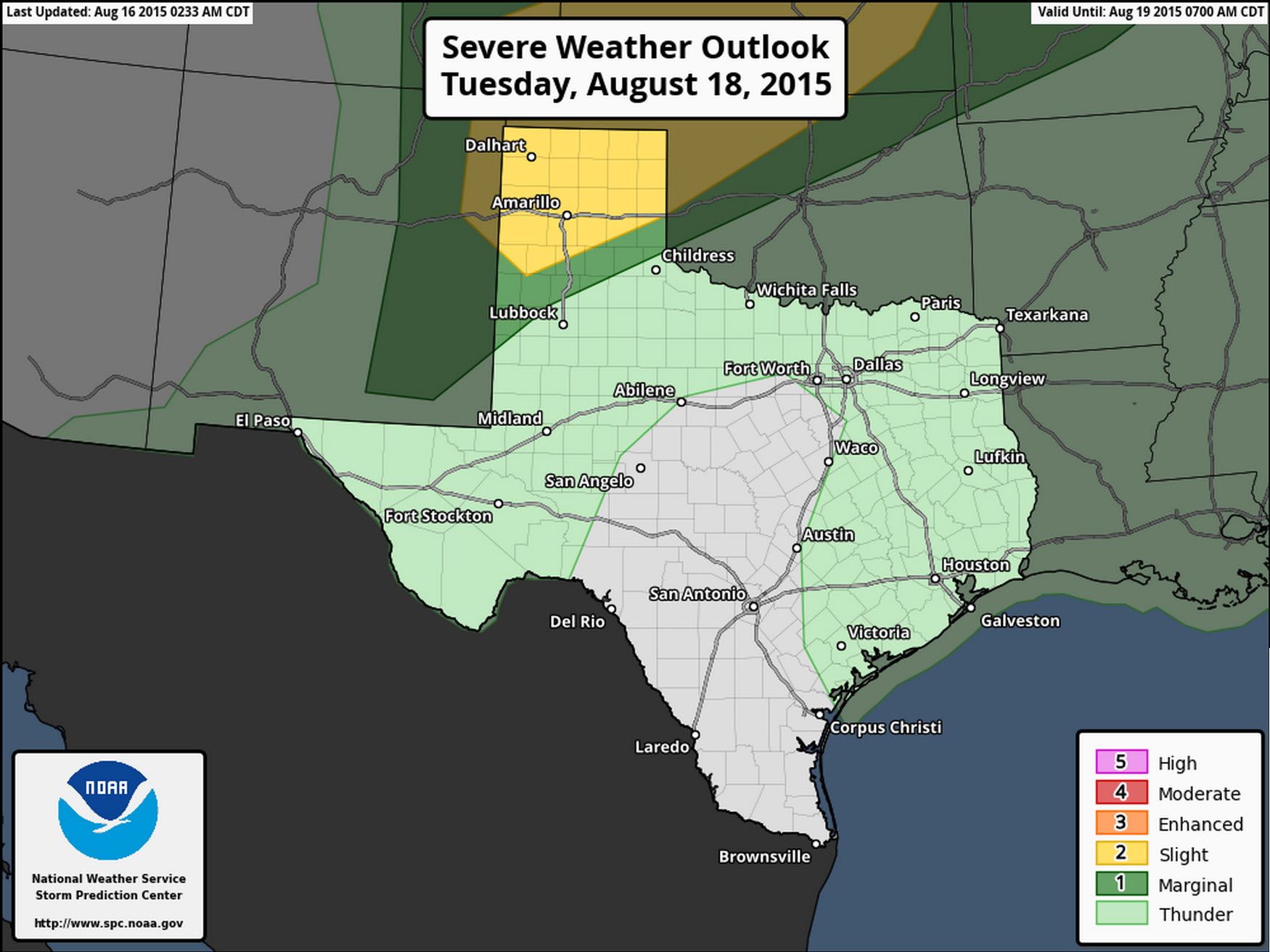
Severe Weather Outlook for Tuesday
The cold front that will arrive this week won’t bring drastically cooler temperatures to the state – but those in the northern sections will notice a drop in temperatures. Rain chances will play a drastic role in temperatures as well – since any rain/storms will help keep things cooler. We should just be happy rain is in the forecast.
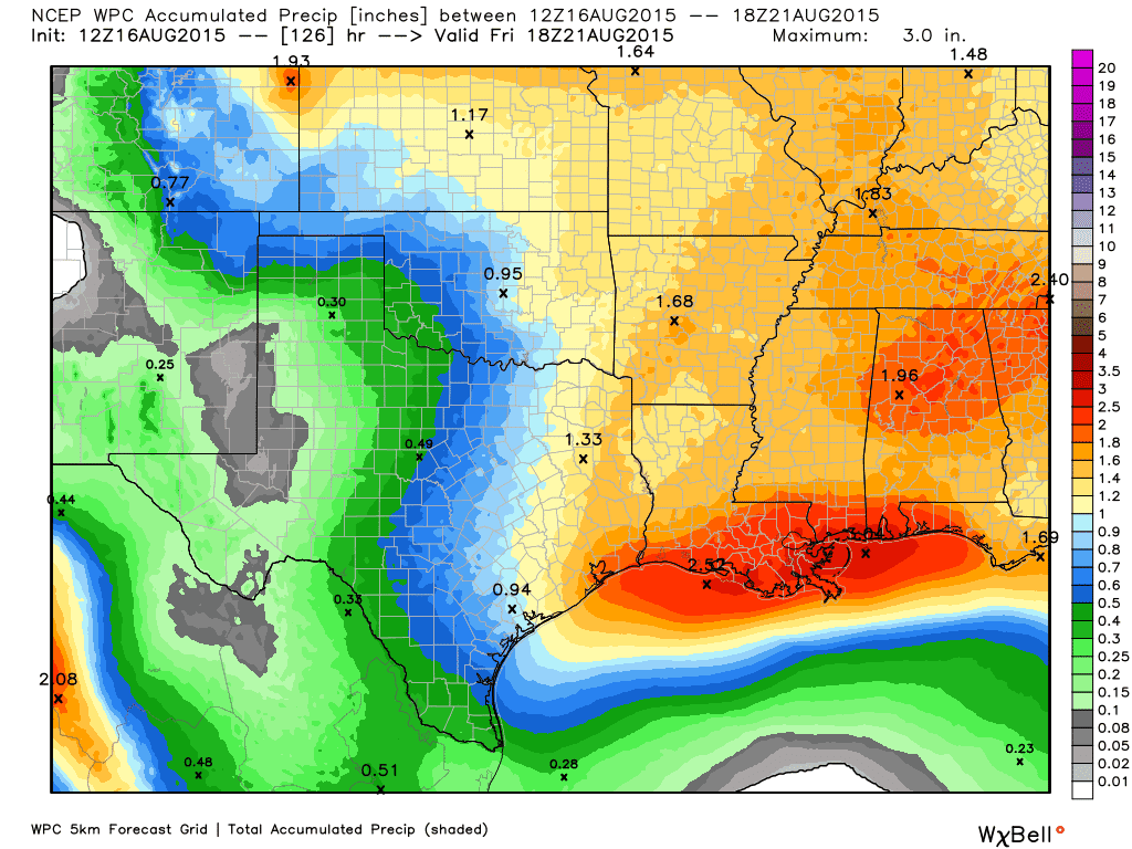
Finally here is the Weather Prediction Center’s rain forecast for the next six days. We’re not expecting flooding nor are we expecting enough rain to end the ‘flash’ drought in the areas who have not seen rain in the past month. Regardless any rain is welcome at this point and will help green things back up a bit until our wetter months arrive this fall/winter.


0 Comments