
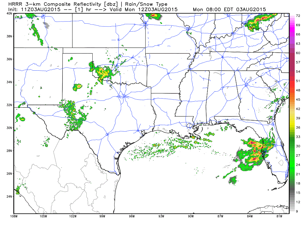
Simulated radar forecast through early Monday evening. 11Z HRRR (High Resolution Rapid Refresh) from WeatherBell.com
We’re starting the work week off with rain across parts of Northwest Texas into the Permian Basin. This activity is slowly moving southeast with moderate rain and a few cloud to ground lightning strikes. A general weakening trend will be noted through late morning before most of the activity dissipates. Light rain may try to make it as far east as the western sections of the D/FW Metroplex – but it shouldn’t amount to much. Additional showers and thunderstorms are expected to develop this afternoon across the Texas Panhandle, West Texas, and Permian Basin as we see the atmosphere become a bit more unstable.
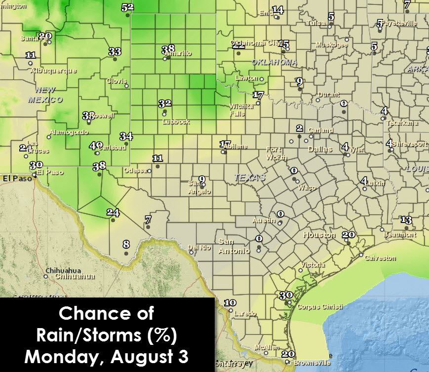
Forecast chance of rain/storms through 7 PM Monday

Forecast chance of rain/storms from 7 PM Monday through 7 AM Tuesday
Coverage of thunderstorms should approach a 35 to 60 percent mark (a 6 in 10 chance of getting wet). A marginal severe weather risk is possible in the form of gusty winds and hail this afternoon and early evening up in the Texas Panhandle. Widespread severe weather is not in the picture today. Storms later today will move in a southeasterly direction with locally heavy rainfall possible across West Texas, Permian Basin, and the Texas Panhandle.
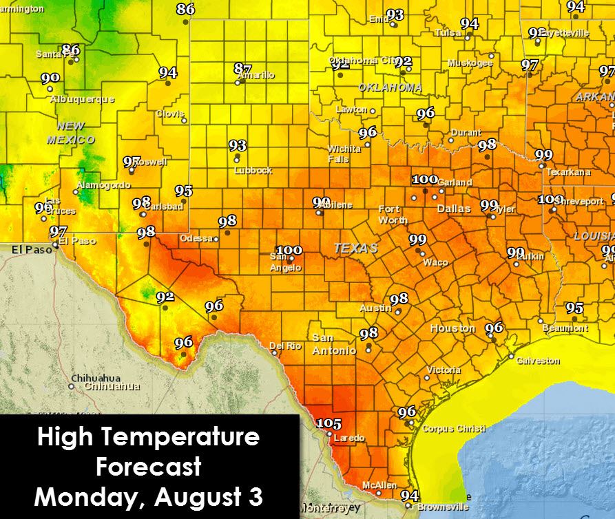
High temperature forecast for Monday, August 3
Folks in the Texas Panhandle are going to have another cool day compared to the rest of Texas with high temperatures in the 80s. The remainder of Texas will climb into the 90s with the hottest locations breaking 100 degrees. Laredo’s high temperature this afternoon is expected to top 105 degrees. San Angelo and parts of the D/FW Metroplex should hit triple digits along with some unlucky folks in East Texas. Humidity values are on the rise after a reprieve this past weekend. Heat index values will become elevated this week.
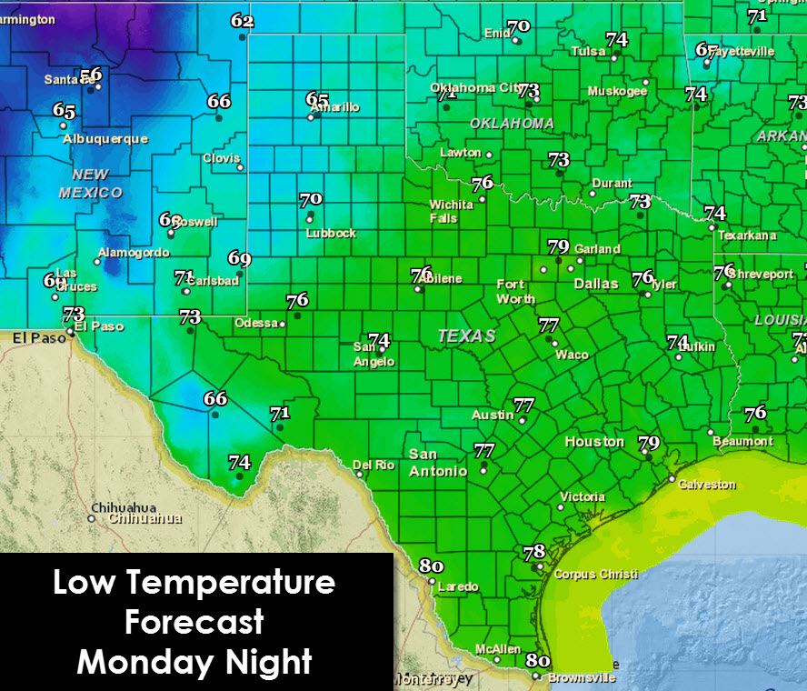
Low temperature forecast for tonight into Tuesday morning
It’ll be another seasonably cool night in the Texas Panhandle and West Texas with lows in the 60s along with the Alpine Mountains. Mid to upper 70s are in the forecast across the Hill Country and the rest of Texas. Deep South Texas will stay in the 80s most of tonight. I hope you enjoyed the little cool front this past weekend. After temporarily weakening late last week the heat dome is coming back with avengence. The hottest temperatures so far this summer should arrive in Texas for the latter half of the work week. Get ready for several days of toasty hot conditions.


0 Comments