
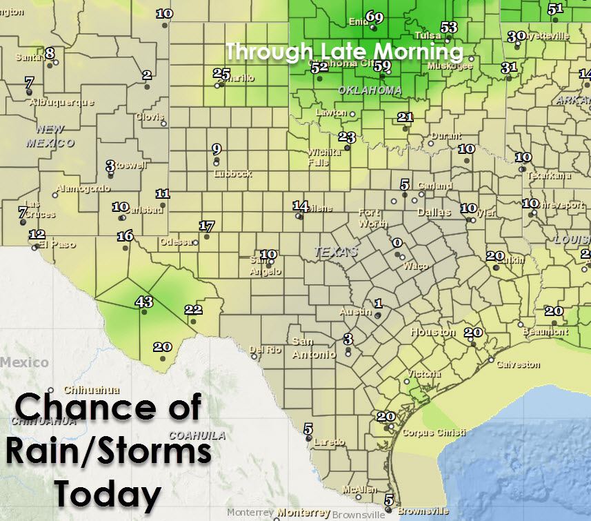
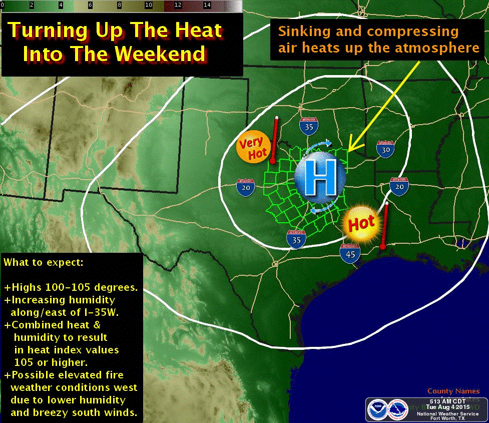
We’re starting out another day with rain across parts of Northwest and West Texas. Another cluster of storms moved across the Texas Panhandle late last night before moving into Oklahoma early this morning. There is no severe activity this morning in Texas. In fact we’re only observing a few lightning strikes with the convection across Northwest Texas. Most of this activity is weakening while making slow progress to the southeast. Current trends indicate that the rain will dissipate by lunchtime. Look on the bright side – temperatures will stay a bit cooler this morning before the sun comes out. Isolated thunderstorms are possible this afternoon across the higher elevation of extreme Southwest Texas and the Alpine Mountains. Otherwise the heat dome of doom is building back in and we’re looking at some big-time heat by the weekend. Get ready because the hottest weather we’ve seen in a year is on the way and it is not going to be pleasant.
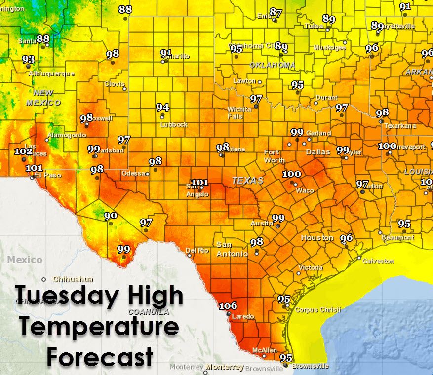
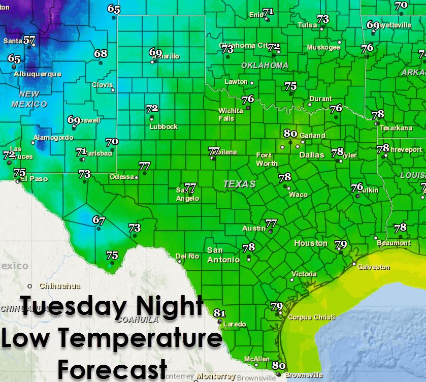
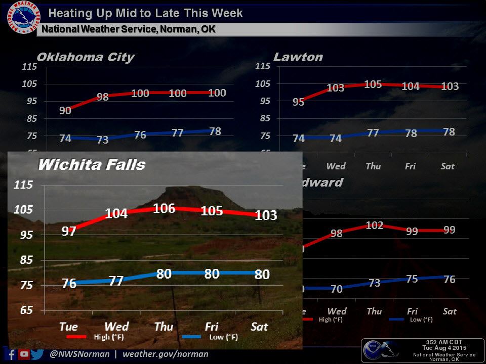
Widespread triple digit temperatures are likely for the end of the work week. Heat advisories will probably be issued as the heat dome really ramps up on Thursday and Friday. Low temperatures will struggle to get below 76-81 degrees as well.


0 Comments