
Good Morning and welcome to an abnormally interesting August weather day in Texas. We’re starting out cool along and north of Interstate 20 this morning. The Texas Panhandle and Northwest Texas are in the 50s which does put some locations quite close to setting new record low temperatures. We’ll have a comprehensive low temperature summary later this morning once the data has arrived. Folks north of the cold front are also being treated to drier air with lower dewpoints. Honestly this kind of weather is more typical of early October versus August.
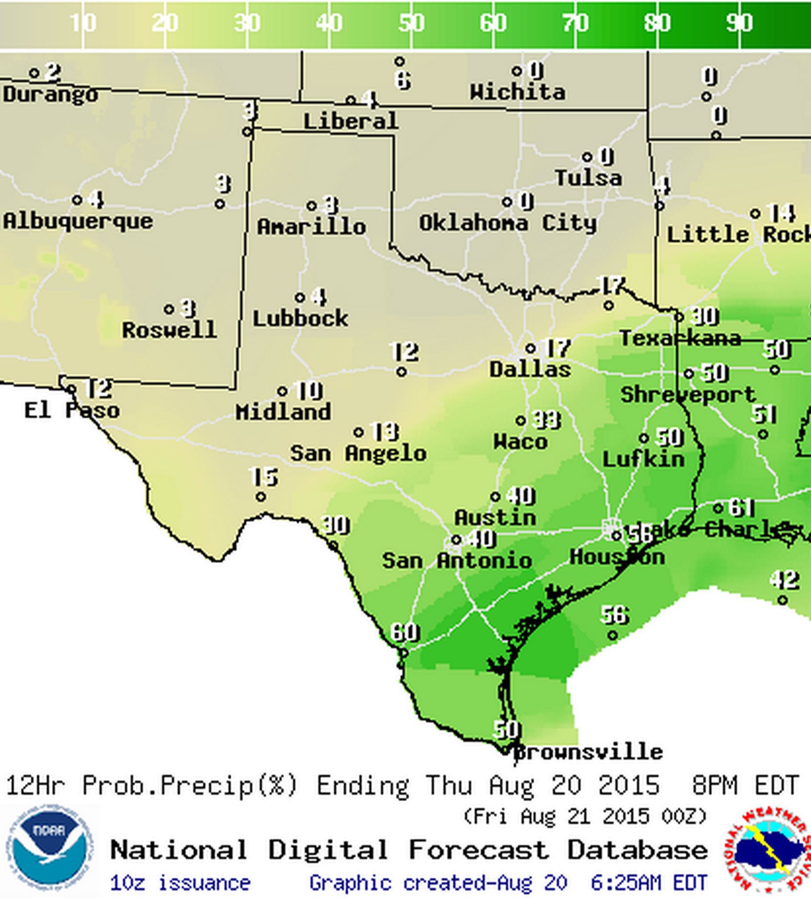
Chance of rain Today

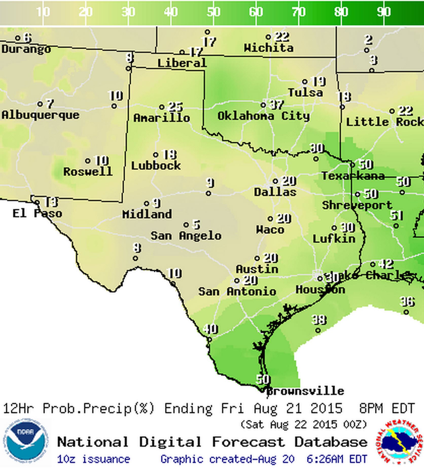
Chance of rain Tongiht
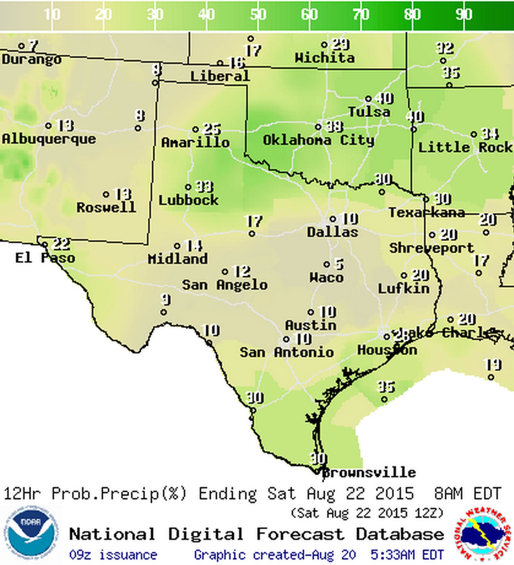
Chance of rain on Friday
Chance of rain Friday Night
Our welcome cold front will continue to slowly sag south today with scattered showers and thunderstorms expected across East Texas, Southeast Texas, South Texas, and the Rio Grande Valley. Rain chances will be relegated to the Rio Grande Valley tonight although a few showers can’t be ruled out along and east of Interstate 35. Isolated to scattered thunderstorms are expected on Friday across South Texas, Southeast Texas, East Texas, and Northeast Texas as our winds switch back around to the south and moisture gets pumped back inland.
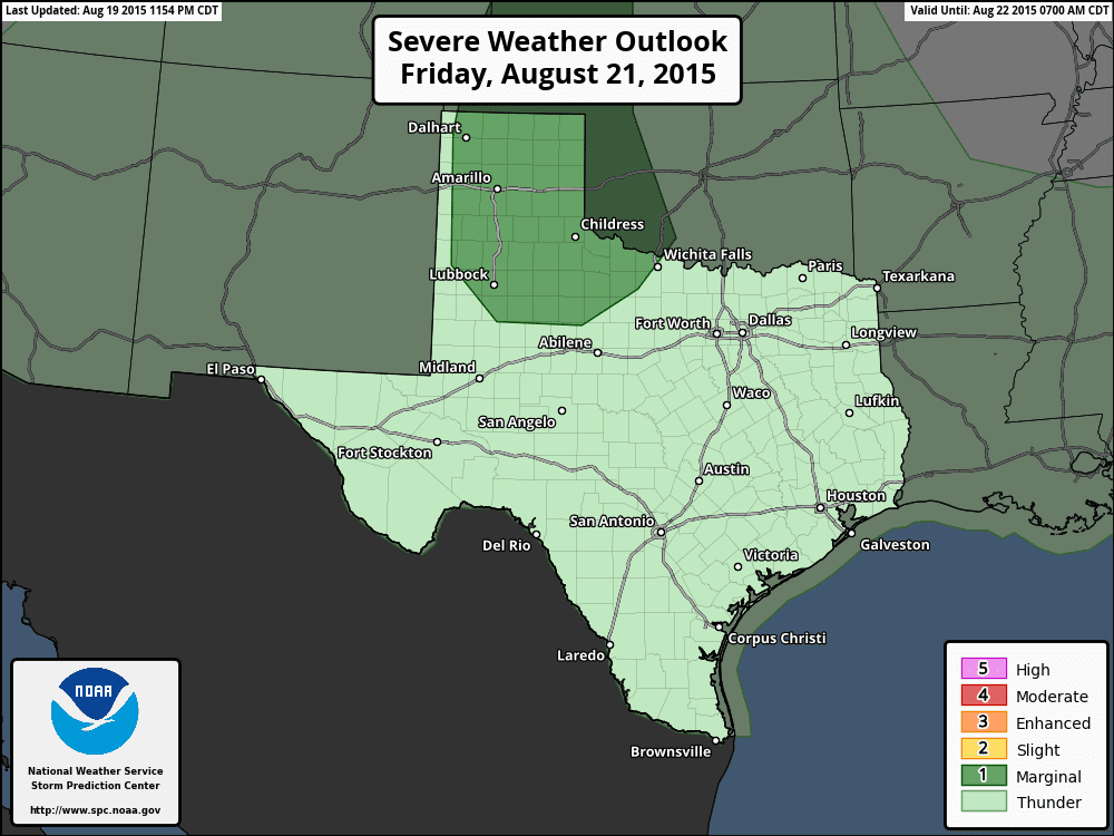
A weak upper level disturbance will move across the Texas Panhandle into Northwest Texas on Friday and Friday Night. Its not too common to see such a system in August but considering this morning’s weather we’ll just go with it. Scattered strong thunderstorms will likely initiate across the Panhandle tomorrow afternoon and move southeast along the Red River Valley Friday Night. Wind profiles will be supportive of an organized convective mode but there are questions about how unstable the atmosphere will become prior to thunderstorm development. At this time the Storm Prediction Center has a category 1 severe weather risk out for the Panhandle on Friday. Should upcoming weather model data indicate a more unstable airmass the severe weather risk will be upgraded in later outlooks. The primary threat would be large hail and damaging straight line winds.
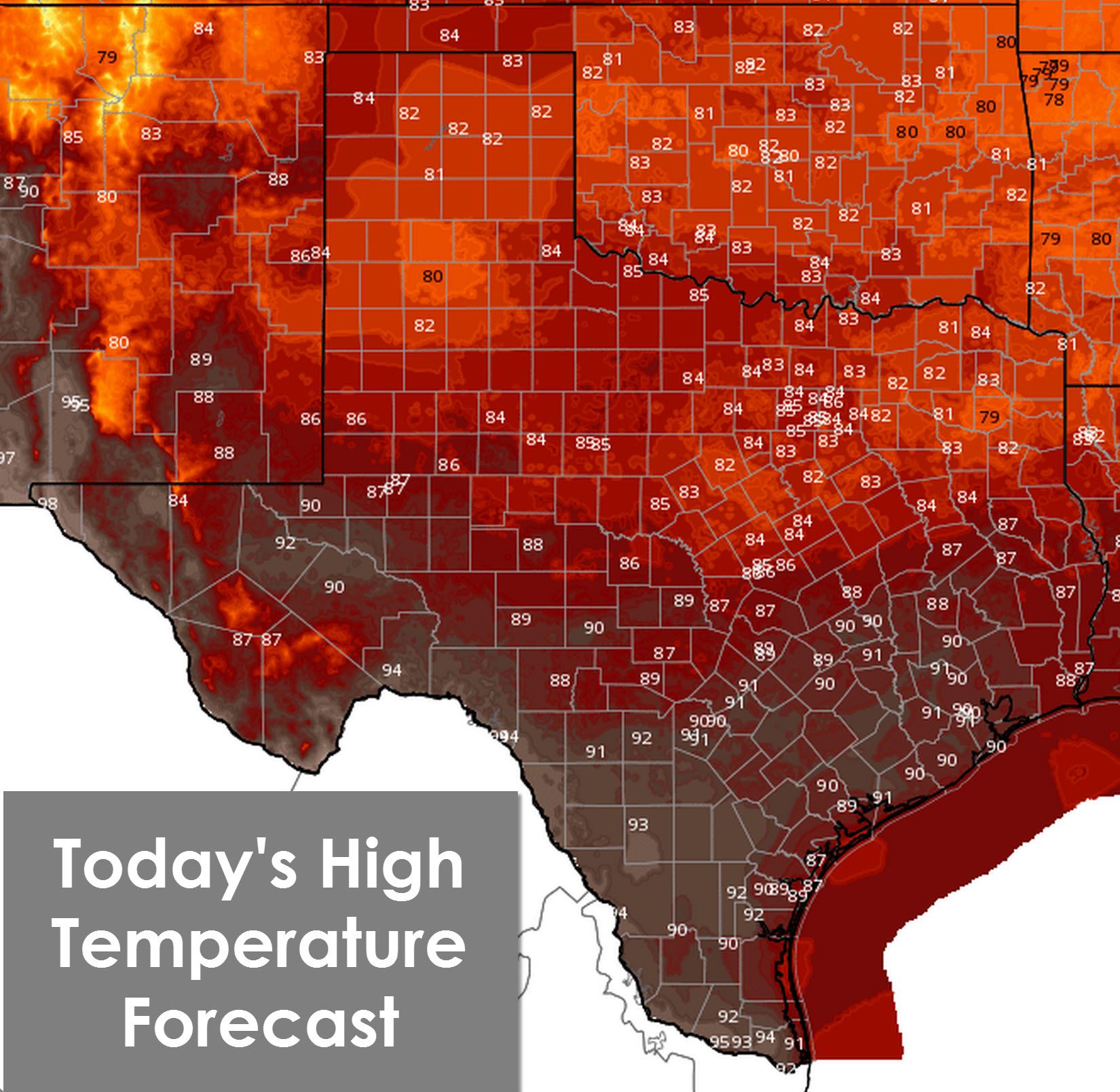
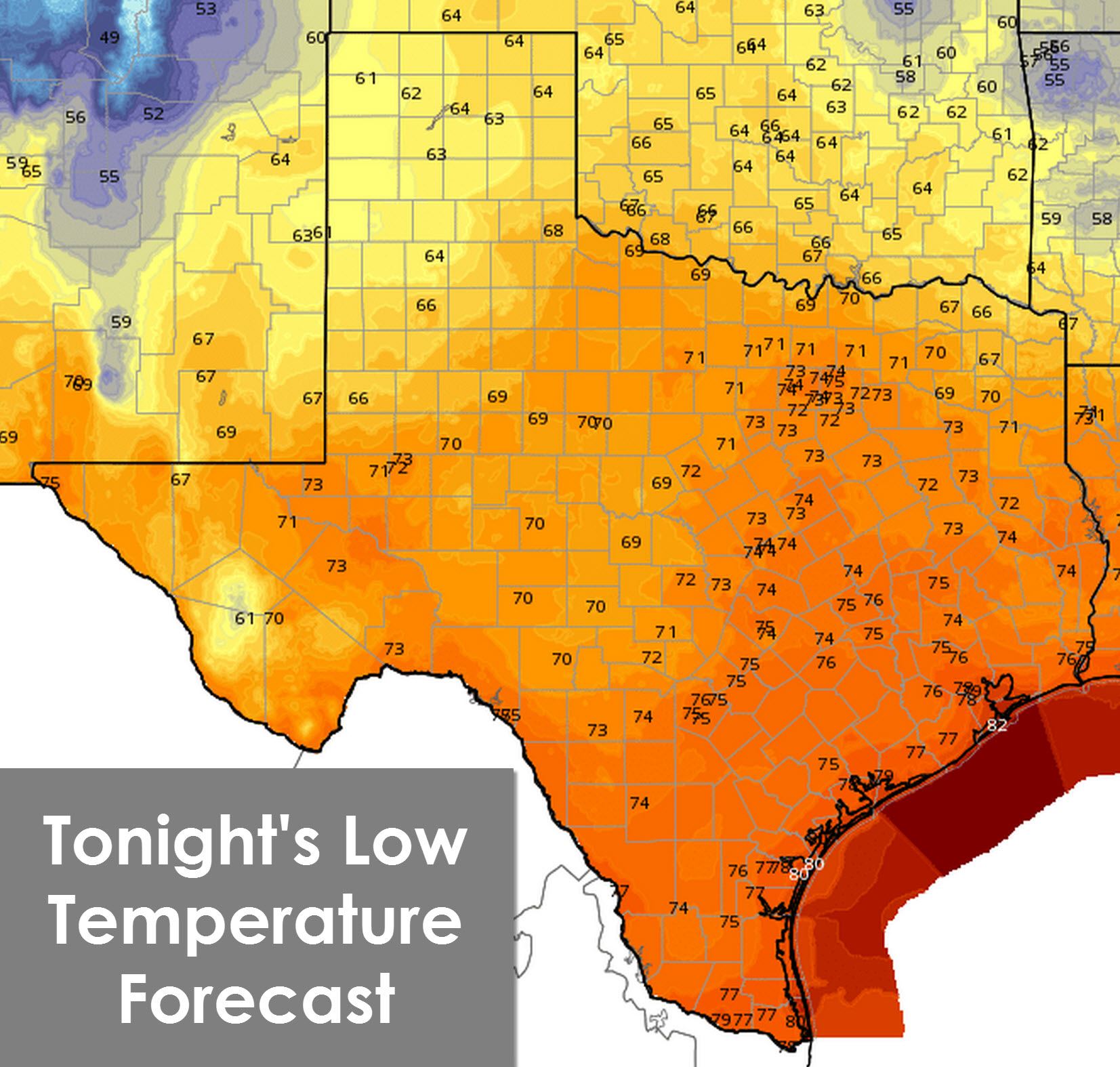
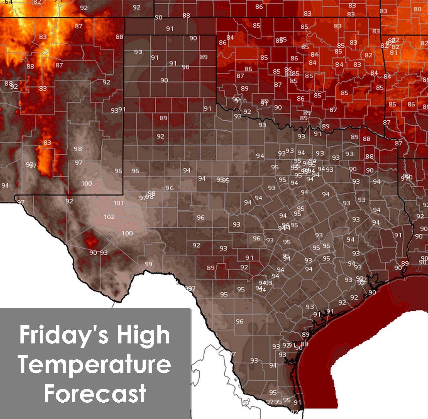
Temperatures will be well below average today across the Texas Panhandle, West Texas, Northwest Texas, North Texas, and Northeast Texas with high temperatures in the low to mid 80s. Drier air will make today feel absolutely wonderful. Folks across the southern half of Texas will top out in the upper 80s to lower 90s – comparatively cooler than the past few days even with more oppressive moisture values. Temperatures will drop towards comfortable values tonight with 60s and 70s across Texas. On Friday we’ll see temperatures rebound back towards seasonal averages for August with low to mid 90s across the state.


0 Comments