
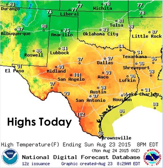
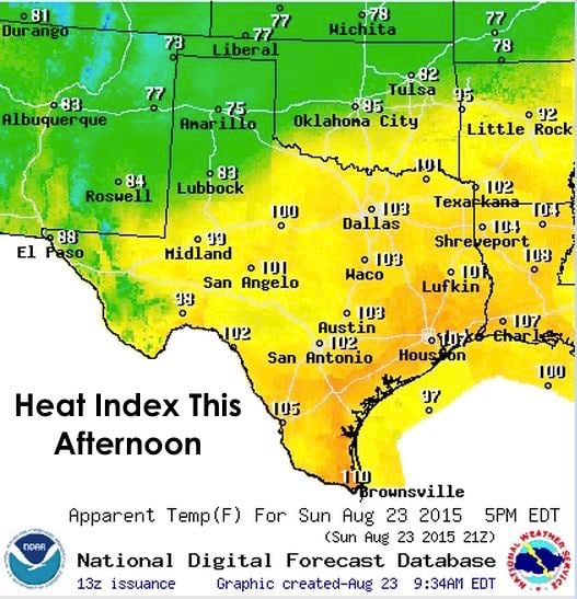
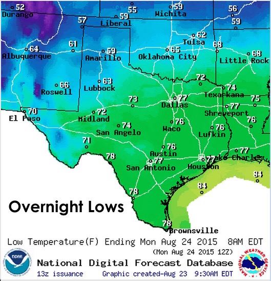
Good morning and happy Sunday! Last day before school begins for many of the public school children across our state…and some of them will be waking up tomorrow and taking jackets with them on their first day, while others will be in tshirts and shorts! A cold front has worked its way through the Texas panhandle and will be approaching the Red River counties of northern Texas later this evening. Highs today in the panhandle will struggle to reach the mid 70s, while elsewhere, we’ll be experiencing our typical summer highs in the 90s and 100s. Heat Index values across coastal and south Texas will be intense with readings topping out between 106 and 110 for a few hours later this afternoon. Lows by tomorrow morning will drop down into the 50s to low 60s across much of the panhandle region. The cold front will slow down today and is not expected to make it across the Red River and into northern Texas until after midnight. That will make it hard to pinpoint how low temps will drop in the counties along the Red River, but low 70s…maybe even a few upper 60s is not out of the question. For the remainder of the state, seasonably warm and humid with lows ranging from the mid to upper 70s by morning.
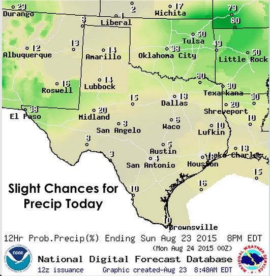
Rain chances today will be hard to come by for most areas. Forcing along the shallow frontal boundary is not all that great with the best chances for shower and storm development occurring out in west Texas today as the front stalls across the Permian Basin/Trans Pecos region. Since this will highly depend on where the frontal boundary stalls later this afternoon, any shift further north or south will alter the location of best rain chances. There are also slight chances for some isolated strong to severe storm development across northern Texas this afternoon as well, although this area will be less likely to experience storm development than further west. With any of the storms that develop today, downburst winds and frequent lightning will be the greatest threats. The forecast models always have a hard time with shallow cold fronts. Ultimately, by early tomorrow morning, the front is expected to drop south of San Angelo and somewhere along or just south of the I-20 corridor across north central Texas.


0 Comments