
Hurricane Katrina. That phrase brings up memories in nearly every person. Most focus on the man-made disaster in New Orleans. Many don’t realize New Orleans actually got a skirting blow from the weaker side of the storm. Mississippi took the brunt of what Katrina had to offer and it was absolutely devastating. We’ll talk more about the impacts to Mississippi and the Gulf Coast tomorrow as we continue to relive Katrina 10 years later.
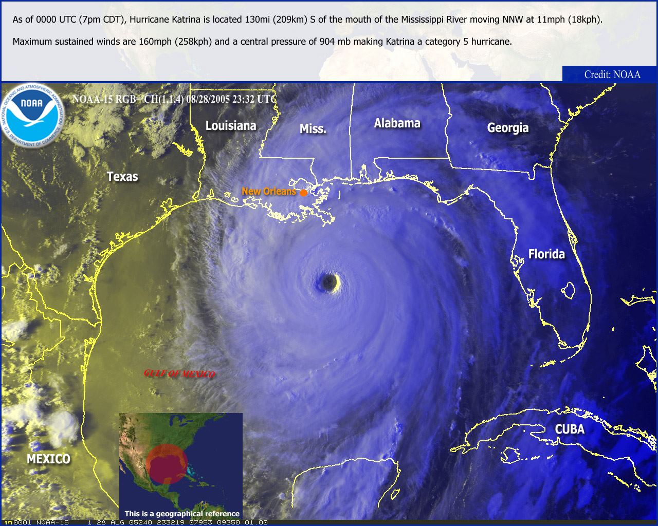
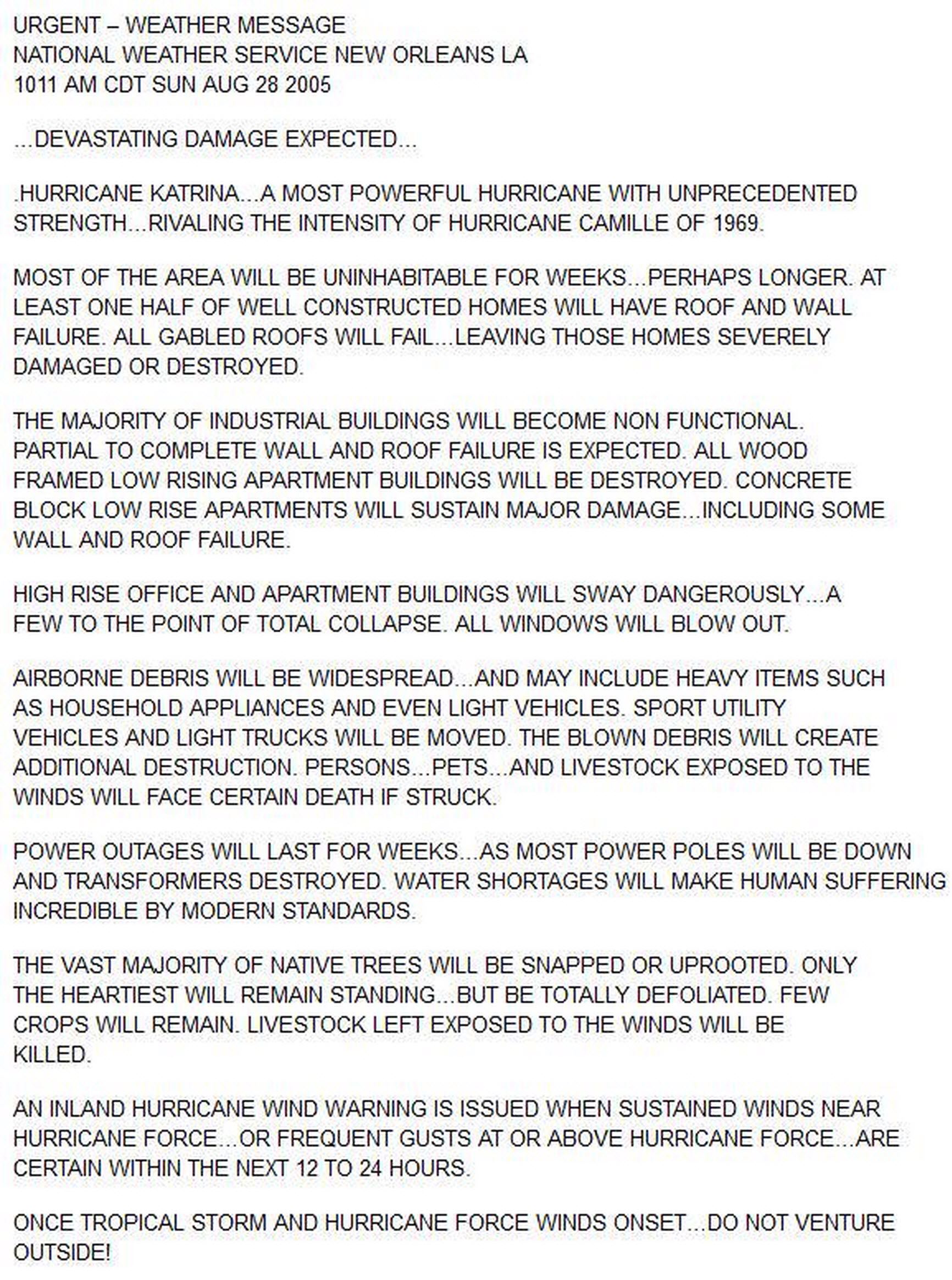
During the morning hours of August 28, 2005 Katrina became a Category 5 hurricane. Maximum sustained winds reached 175 MPH with gusts easily exceeding 200 MPH – the strength of an EF5 tornado. Less than 24 hours remained before the eye of Katrina would make landfall in southeast Louisiana. On Sunday morning The National Weather Service in New Orleans issued a strongly worded statement. This statement went down in the history books and was credited with saving lives.
Katrina was not only powerful – it was large. Sustained tropical storm force winds of 38+ MPH extended over 200 miles out from the eye with 74+ MPH winds emanating 100 miles out in each direction. All that wind helped push water which resulted in a historic, cataclysmic storm surge along with Mississippi Gulf Coast of nearly 30 feet. We’ll talk more about Katrina’s landfall tomorrow along with the impacts she brought not only to the Gulf Coast – but to all of Texas too.


0 Comments