
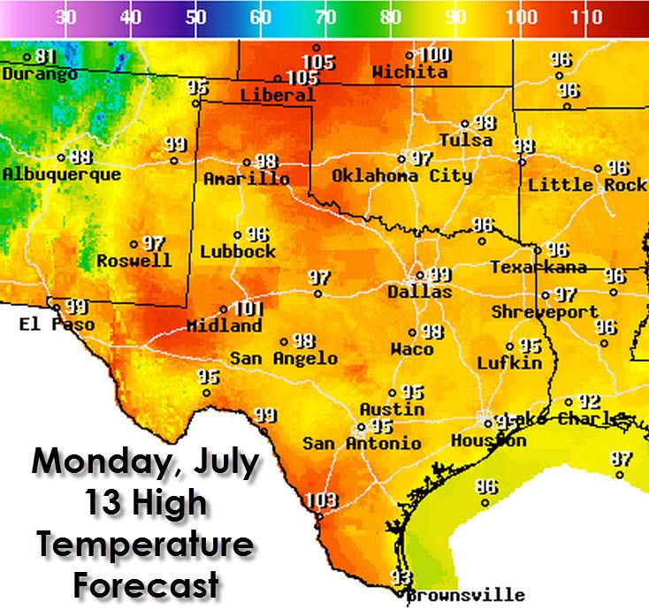
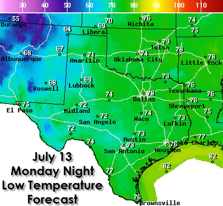
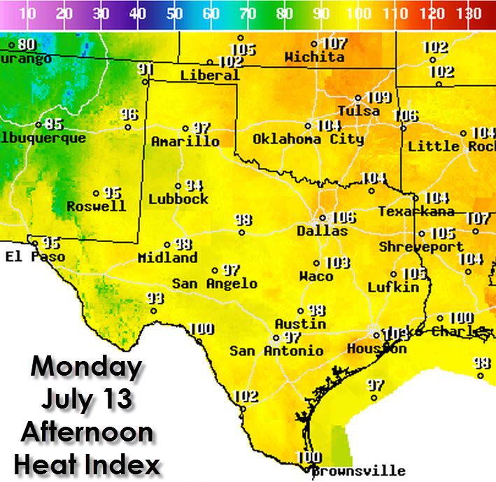
Summer time oh summer time. Gone are the rain showers and here comes the heat. The next few days will likely be the warmest we’ve seen all summer which isn’t saying much considering we’re now just seeing average July temperatures. Rain chances are pretty much zero across all of Texas today. Even the usually dependable seabreeze storms are not expected to occur today. Temperatures will climb into the upper 90s to lower 100s across all of Texas today. South winds will keep things a bit more bearable, but barely. The northeast Texas Panhandle into the Oklahoma Panhandle could see temperatures approach 105 degrees this afternoon. Humidity values will be higher along and east of Interstate 35 today. The projected heat index value in the D/FW Metroplex will range from 103 to 106 degrees this afternoon. The same will be said for Northeast, East, and Southeast Texas into Central Texas. I won’t go giving out heat tips – but do realize this is the type of heat that can cause a few issues if you’re not staying hydrated and cool. Another factor is that temperatures really won’t cool off much tonight. The forecast low temperature for Dallas is 78 with mid to upper 70s across the urban corridors. West Texas will see lower 70s along with the rural areas. Tuesday will feature the same weather.
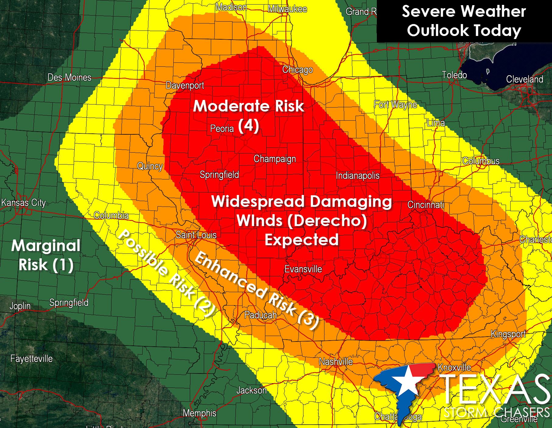
An outbreak of severe weather is expected later today and into tonight across Illinois, Indiana, and parts of Kentucky. Widespread damaging winds are probable with some gusts exceeding hurricane force (75+ MPH). Tornadoes are also a possibility with large hail. When all is said and done this will probably end up being a derecho event which is a long-lived damaging wind bow echo.


0 Comments