
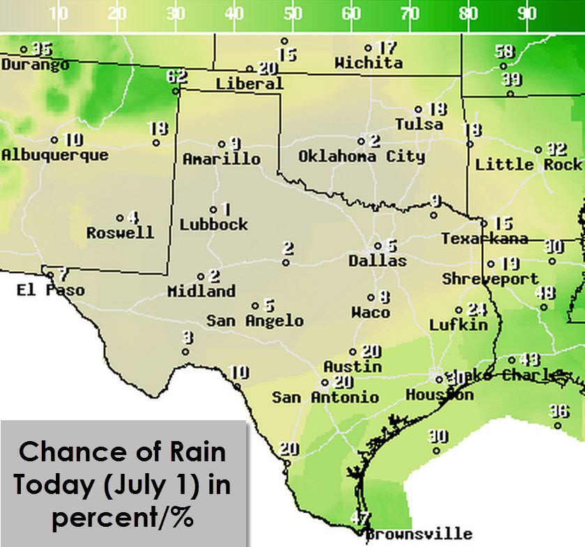
Good Wednesday Morning and welcome to July! Its hard to believe that Independence Day is this upcoming Saturday. Typical summer weather is forecast including the chance for afternoon thunderstorms this weekend. We’ll have more on your July 4th forecast in upcoming blogs. As for today the tune remains the same. Scattered thunderstorms are expected once again by late morning into the afternoon hours. For today the highest storm chances will be along the Gulf Coast from the Rio Grande Valley northeast through the entire Texas coast. As the sea breeze moves inland we’ll see storm chances increase across Deep South Texas, South-Central Texas, Southeast Texas, and East Texas. The stronger storms may produce downburst winds up to 60 MPH and locally heavy rain. All thunderstorms produce dangerous cloud to ground lightning. I do believe storms will remain south of the D/FW Metroplex today so hopefully we can break the ‘string of storm days.
Outside of rain-cooled air by this afternoon temperatures will certainly make you believe its July. Low to mid 90s will be the rule of the day with heat index values closer to the 97-100 degree range. The hottest temperatures today will be in the Texas Panhandle into Northwest Texas where upper 90s to perhaps 100 degrees will occur. Nothing unusual tonight with low temperatures dropping into the 70s combining with humid conditions. Welcome to July folks!


0 Comments