
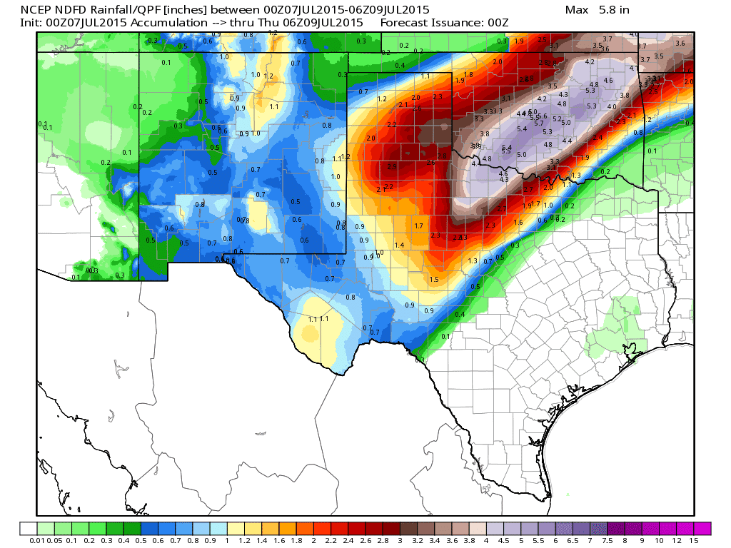
I suppose when I said earlier this evening that the full blog update would be out after 9pm, I should have said closer to 10pm. My bad! At any rate, I wanted to wait on the latest forecast updates and developments since systems like what we’re seeing in the Texas panhandle can sometimes take on a life of their own and blow previous forecasts out of the water. We’ve already seen rainfall reports earlier this afternoon which far exceeded prediction. These have been rather isolated reports, so the overall forecasted rainfall amounts are still on target. Flash Flood Watches remain in effect through 7am tomorrow for much of the panhandle, south plains and northwest Texas. Below is a graphic depicting the current rainfall forecast across the region through early Thursday. Get ready!
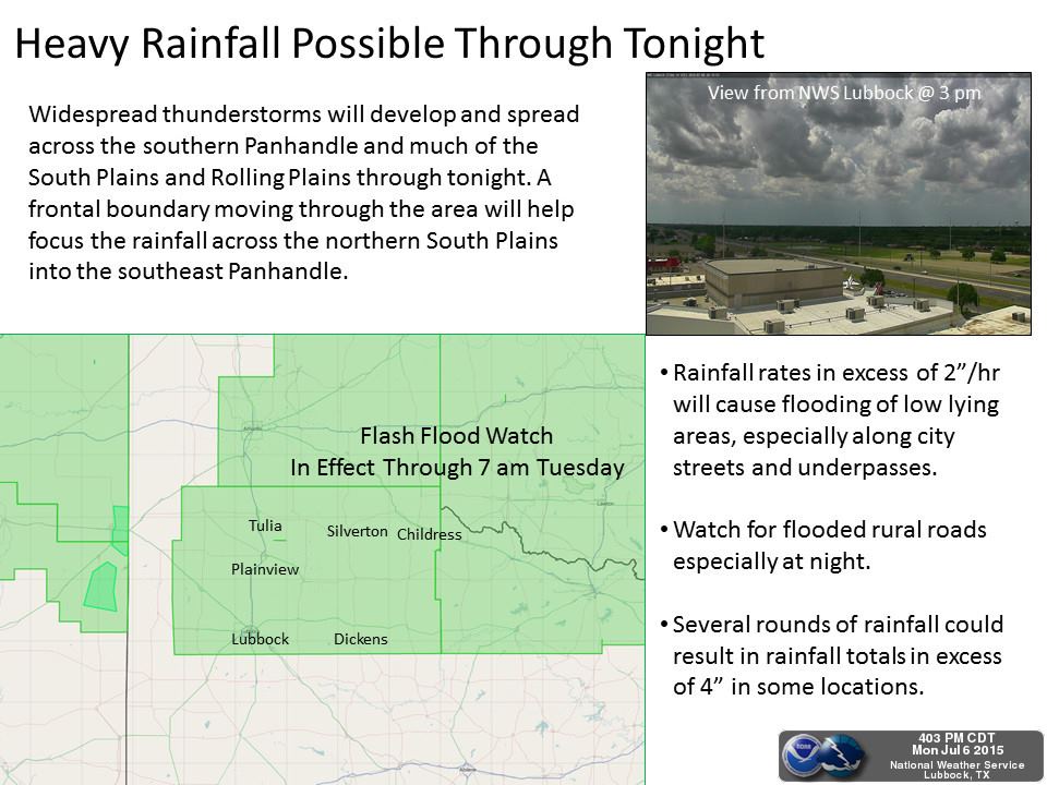
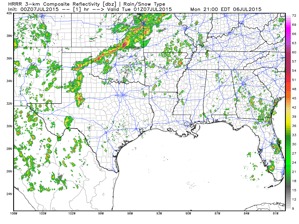
For the remainder of the evening and overnight, continued rainfall….some quite heavy…across west Texas, southwest Texas, southwest Texas panhandle, eastern and southeast Texas panhandle, western and central south plains, and into western north Texas. Frequent lightning and gusty winds up to 50mph along with small hail are also likely. Flash flooding will be a major concern overnight into tomorrow morning…especially across parts of northwest Texas in and around the Wichita Falls area. Precipitable Water Values will range between 2 to 2.6 inches across the area which is a good 2 to 4 Standard Deviation above normal for this time of year. Anyone out and about overnight and early tomorrow will need to be on the lookout for ponding or washed out roadways. Here’s a look at simulated radar overnight into early tomorrow morning. It may take a couple of seconds for the animation to load.
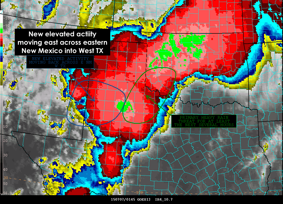
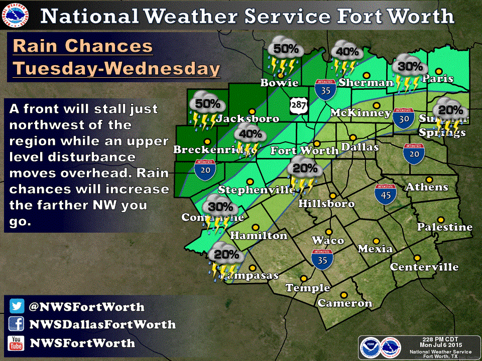
We also have a lot of folks asking about the rain chances for north central Texas and the Dallas/Ft. Worth metro areas. There will be chances, but it will depend on the position of the cold front by tomorrow morning and how far east the outflow from this mesoscale convective system (MCS) pushes. Right now, a tight gradient in rainfall amounts is expected from northwest to southeast across the DFW metro area, with the greatest amounts northwest of the DFW metro area. These types of systems are not easily resolved by the short-range forecast models, so the forecast will be closely watched overnight for any changes in the currently anticipated rainfall amounts for the Dallas/Ft. Worth metro area.


0 Comments