
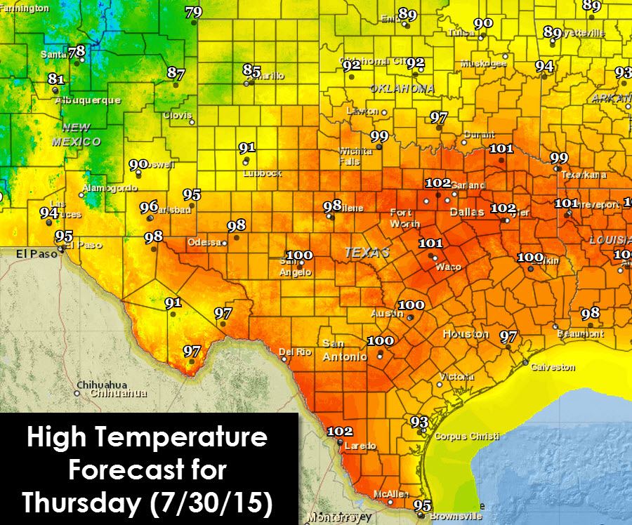
Thursday will be a toasty one across the eastern two-thirds of Texas with high temperatures in the 97-103F degree range. The lucky folks will be where clouds and rain chances keep temperatures cooler today. Those few lucky folks in the Texas Panhandle and South Plains will see high temperatures in the mid/upper 80s to around 90 degrees.
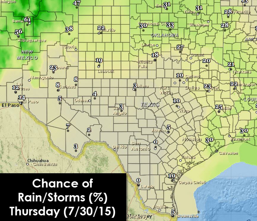
Isolated showers and thunderstorms are possible across the Texas Panhandle, South Plains, Northwest Texas, Northeast, and East Texas. Scattered thunderstorms are in the forecast for Southeast Texas and those along the coast.

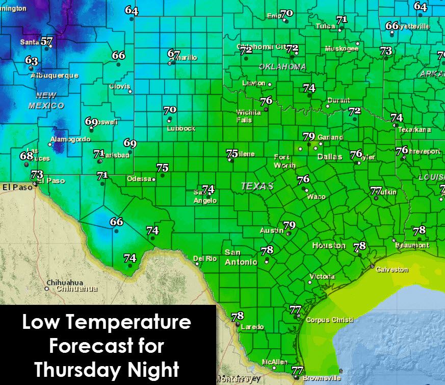
Shower and thunderstorm chances continue tonight across all areas mentioned above. A rouge shower will also be possible across Central and North Texas. Low temperatures tonight will be in relatively same window as we saw this morning, perhaps a degree or two cooler.
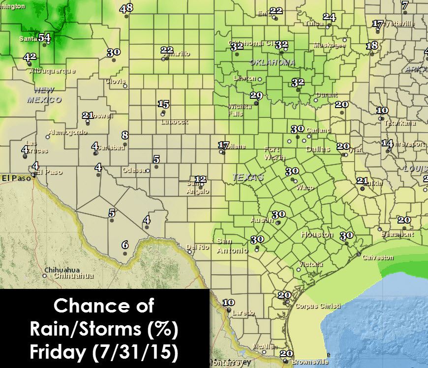
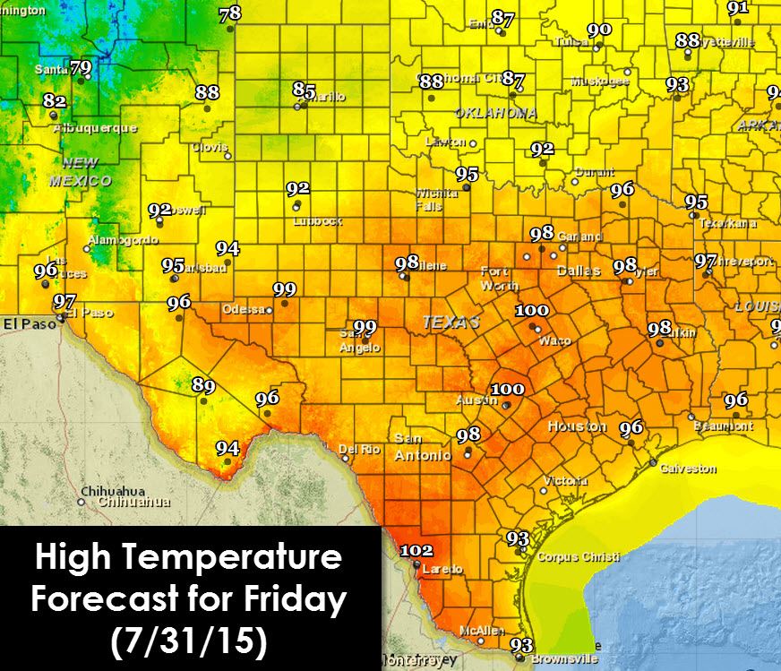
The weather forecast becomes more active on Friday with scattered thunderstorms forecast in the Texas Panhandle, South Plains, Northwest Texas, North Texas, Central Texas, Southeast Texas, and the Hill Country. The strongest storms may produce 40 MPH wind gusts, localized heavy rain, and frequent cloud to ground lightning. A positive note will be nearby storms should help cool things off with rain-cooled outflow boundaries. High temperatures will still be in the 90s to lower 100s – but some folks may be down in the low-mid 80s by late afternoon as popcorn storms help cool things off. Remember that lightning is dangerous and unpredictable – move indoors to a safe shelter if a storm approaches your location.


0 Comments