
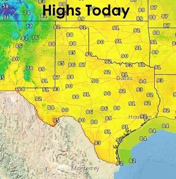
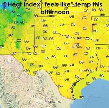
Warm and humid will the the theme for today across much of the state. The ridge of high pressure we’ve been dealing with all week will pretty much max out today. Our next upper level system currently over the west coast will begin to push the ridge to the southwest starting tomorrow and into Monday. This will be the start of our next weather pattern shift which will bring rain and storms back into the forecast for parts of the state next week. But, for today…highs across the state will be in the low 90’s, but for parts of north central, east and southeast Texas, higher humidity levels this afternoon will result in heat index values in the mid to upper 90’s. If you have any outdoor plans this afternoon where the heat index values are expected to be in the mid to upper 90’s…stay hydrated and take it easy. It’s still early in the season and our bodies aren’t acclimated to the heat just yet.
Here’s a look at the overnight lows. Looks like it will be nice and pleasant across parts of the panhandle with temps dropping into the low 60s! As you move east across the state, muggy conditions will yield warmer nighttime temps.

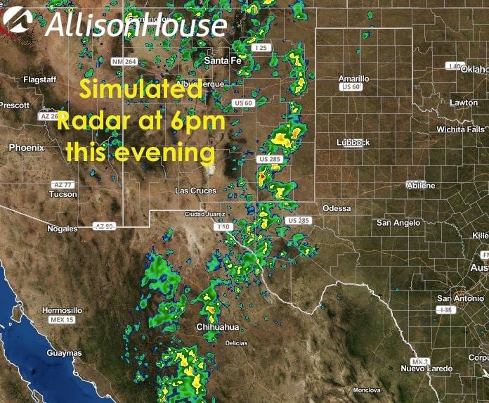
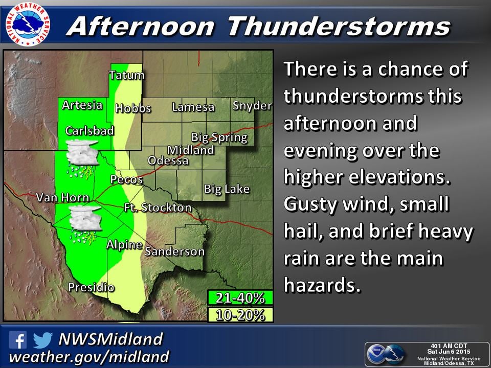
Rain and storm chances today will be greatly inhibited by our ridge of high pressure, but we may see a few sneak in on the western periphery of the ridge by this afternoon. Storms are expected to develop across eastern New Mexico and make a run for the Texas border. We also have a chance at seeing some development this afternoon across the higher elevations of west Texas. A few storms could become strong to severe with a damaging wind, lightning and small hail threat. Localized flash flooding will also be a threat.
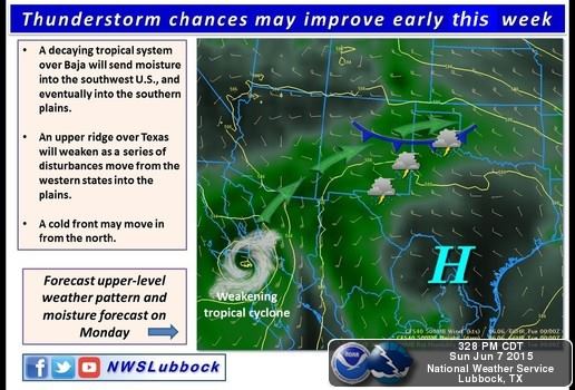
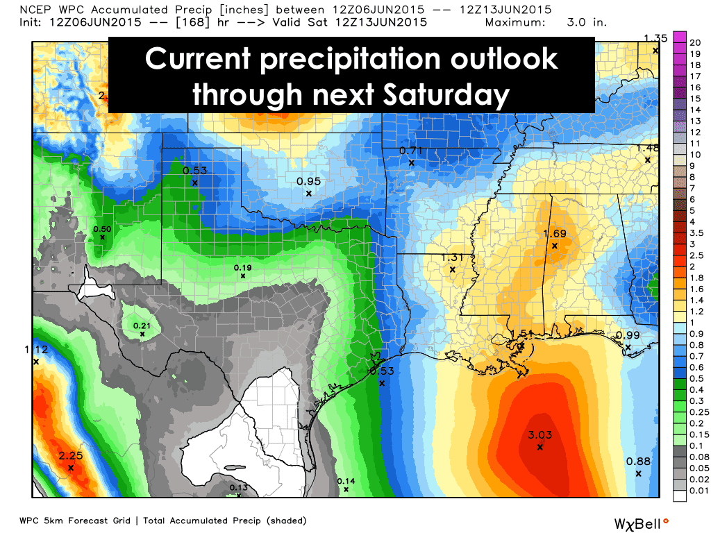
A look ahead into next week. As mentioned above, we will see the return of rain and storm chances to the state beginning early next week. The finer details of our next system have yet to be resolved by the forecast models, but the current outlook has multiple chances for rain across the northern and eastern half of the state into next week. As you can tell by the graphic below, we’re not looking at widespread flooding rain, thankfully, but the potential for a stalled frontal boundary across north Texas, and a daily seabreeze front across coastal to inland areas in south central to southeast Texas, is likely to result in scattered pop-up showers and storms Monday through Wednesday. Beyond that, the forecast models are struggling with either continued scattered rain chances, or the high pressure ridge building back in towards the end of next week. So, it’s a “wait and see” for the remainder of the late week forecast.


0 Comments