
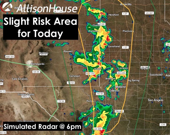
Good morning and happy Saturday!! More chances for pop-up showers and storms this weekend as high pressure continues to loosen its grip on the state. We also are monitoring the chance for a tropical system to move into the gulf early next week which could mean additional rainfall into next week depending on its eventual track…and if it even makes it this far north. More on that at the end of this blog update. For today, storm chances once again across west Texas…specifically along the TX/NM border in the panhandle and down into the trans-Pecos and big bend region as we get into peak heating. We’re looking at a scenario very similar to yesterday with storms beginning to fire along the border by late afternoon and continuing to develop and eventually congeal into a large convective cluster, or mesoscale convective system (MCS) by late evening. The Storm Prediction Center has this area under a Slight Risk for severe thunderstorm development this afternoon. A bit more capping of the atmosphere over western Texas will keep the storms more isolated at first, and there is a small threat of a few tornadoes to develop similar to yesterday, but the main threats today will be high winds, large hail and very heavy downpours. Here’s a look at simulated radar through the afternoon and evening. As always, keep in mind this is simulated radar from a forecast model, so reality could look a little different this afternoon.

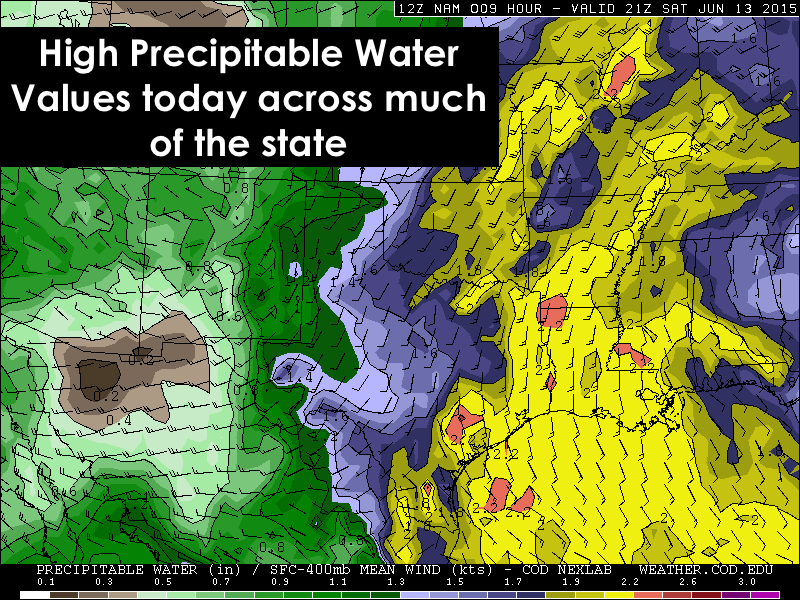
Across north Texas, pop-up showers and storms are also possible this afternoon, and for the next couple of days, with mainly a downburst/microburst wind threat as these storms go up quickly, then collapse shortly thereafter. Isolated heavy rain and lightning will also be possible under some of the stronger cells. Widespread severe weather is not expected. Coastal and southeast Texas will also seen an increase in storm coverage as moisture levels will be quite high for this time of year. This daily rain and shower activity is expected to continue into early next week with anywhere from 1 to 4 inches of rainfall expected between now and Wednesday. Again, widespread severe is not expected…just gusty winds, heavy rain and lightning. Tropical funnels will not be out of the question with the amount of moisture over the area, but we’re not looking at any sort of major tornado threat for the region. With the heavy rain expected at times, localized flash flooding will be a given…especially since we’ve already had well above normal rainfall back in May. Central Texas and southwestern Texas…just isolated pop-up showers expected today and for the next several days.
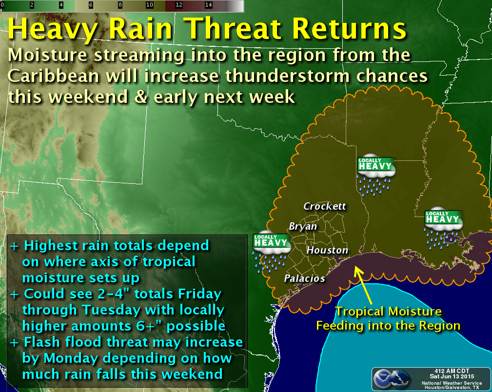
Tropical Mischief….an area of low pressure has developed in northwestern Caribbean and is expected to move across the Yucatan Peninsula later today and into the southwestern Gulf. Additional developing into any sort of tropical system is still questionable, but the mid-range models are picking up on this and bringing two possible scenarios to its evolution early next week. One model brings the system a bit further east and across the eastern half of the state, while another model keeps it further west and takes it across Corpus Christi and across south Texas. I need to emphasize that NONE of these models at this time develop it into a hurricane or anything other than a tropical low with increased heavy rain chances. As always, we will continue to monitor this and keep you updated as the forecast refines over the next several days! 


0 Comments