
Advertisements
In order to keep this short with good information I’ll be using a bullet-point system to share updates.
- Regardless of this system now being a Tropical Storm the threat for heavy rain and flooding remains the top concern. That aspect of the forecast has not changed.
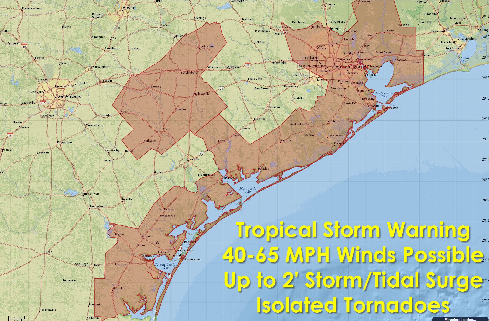
- Tropical Storm Warnings are now in effect from about Corpus Christi northeast through Galveston Island onto the Bolivar Peninsula. Winds of 35-65 MPH will be possible on Tuesday resulting in some power line and tree damage.
- Tropical Storm Warnings extend inland to Interstate 10 from near Luling east through the Houston Metropolitan Area. Winds of 35 to 55 MPH will be possible resulting in isolated power outages and isolated tree damage.
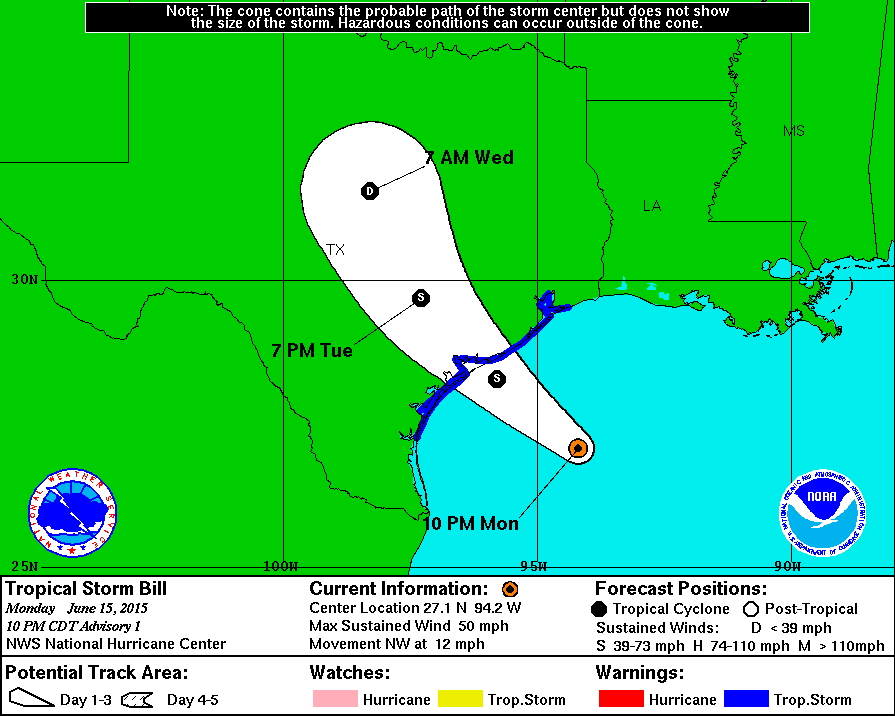
- Landfall of Bill is expected between 7 AM and 10 AM on Tuesday. From there the system will move northwest into Central Texas on Tuesday Night and into North Texas on Wednesday. The system should weaken below tropical storm strength by this point with extremely heavy rain a big concern. As always the track of the system will greatly determine who ends up with the biggest rain totals. Any west/east shift will result in that forecast changing.
- Overall rain accumulations along and east of the center will be 2 to 6 inches. Isolated rain totals of 8 to even 12 inches will be possible. Hourly rain rates under the heaviest storms/rain could approach or even exceed 4 inches per hour as the system moves north through Wednesday. This will result in a dangerous flash flooding threat.
- Isolated tornadoes will be possible in the eastern semicircle of the storm on Tuesday and Wednesday including portions of Southeast Texas, East Texas, Central Texas, and even parts of North Texas.
- Remember not to focus on the centerline of where the storm will pass. Impacts will extend out at least hundred miles to the east and perhaps even to the west. Wobbles in the track will result in forecast adjustments.
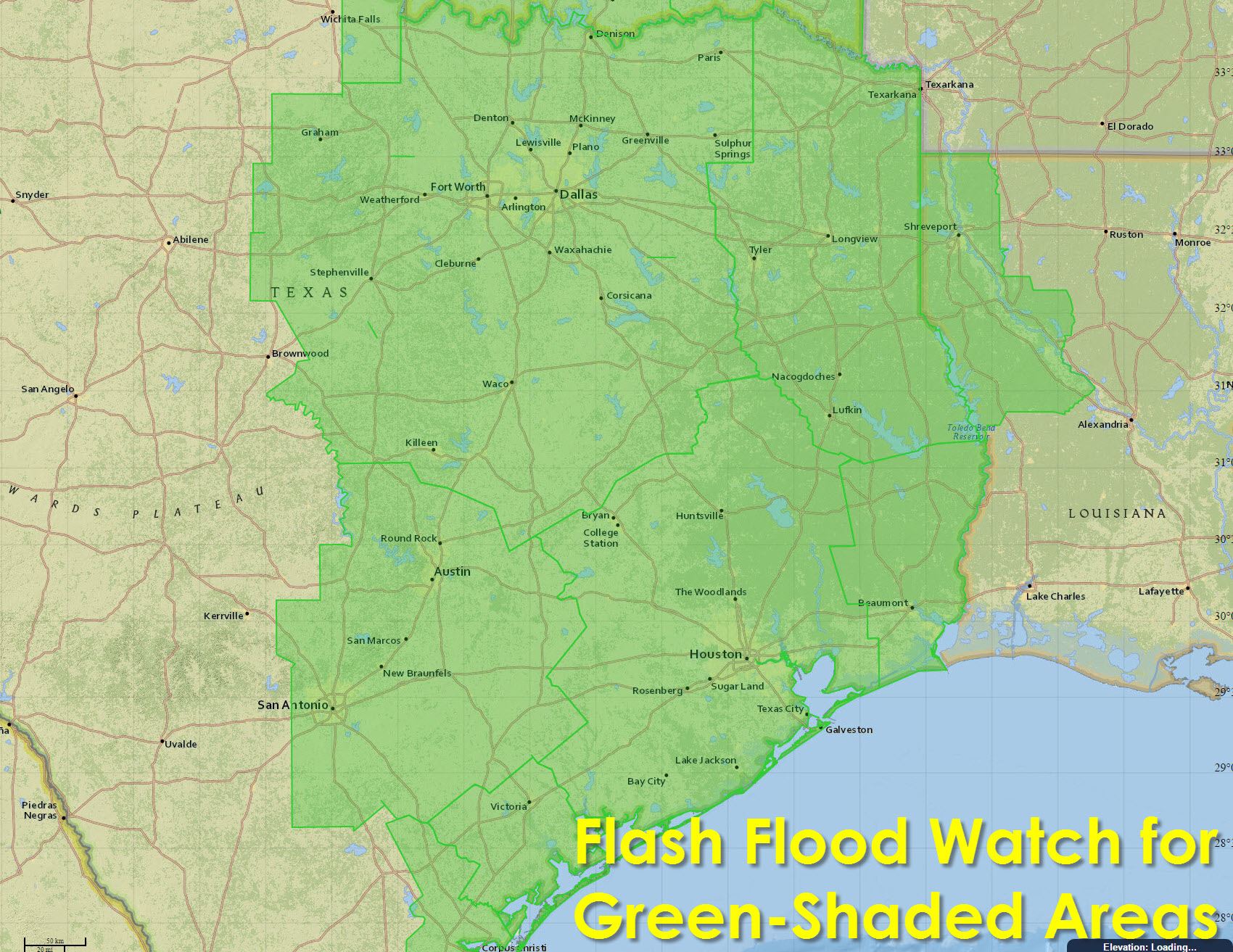
- Flash Flood Watches are in effect for South-Central Texas, Southeast Texas, East Texas, Northeast Texas, North Texas, and Central Texas and into the eastern half of Oklahoma.


0 Comments