
An outflow boundary generated by storms in Oklahoma on Monday kept moving south into the overnight hours and into the pre-dawn hours this morning. As it did so it helped spark off additional thunderstorms in North Texas. Additional thunderstorms, also aided in part by outflow boundaries, impacted portions of the Big Country, Concho Valley, and Permian Basin. Even outside of the storms those regions saw strong winds from the outflow boundaries. This scenario was not one we expected yesterday but alas Mother Nature always has a surprise or two in store.
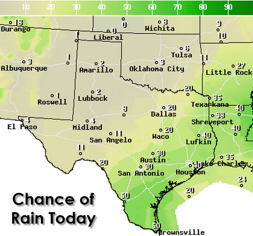
Scattered thunderstorms are expected today across East Texas, Southeast Texas, South-Central Texas, Deep South Texas, and the Rio Grande Valley. Isolated showers/storms will be possible across the Concho Valley and North Texas. The stronger storms will be capable of producing downburst (localized) wind gusts over 60 MPH. A very strong microburst hit just southwest of Oklahoma City on Monday resulting in a 96 MPH wind gust. Those sort of microbursts are less common – but it goes to show what happens when you get a powerful storm collapsing in a hurry. All thunderstorms produce lightning and are extremely dangerous to those outdoors. When a thunderstorm approaches move indoors or into a vehicle. When Thunder Roars Go Indoors!
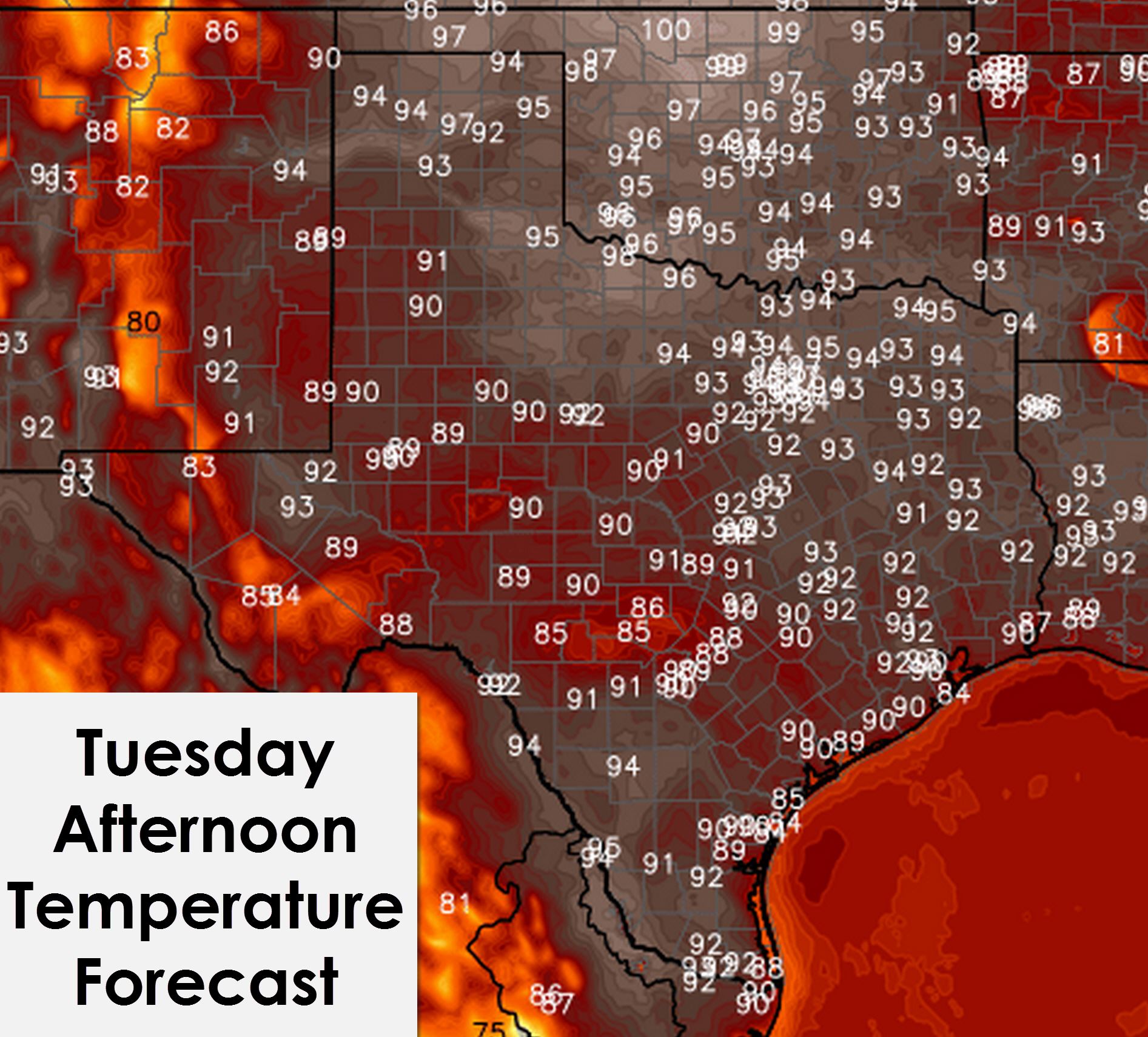
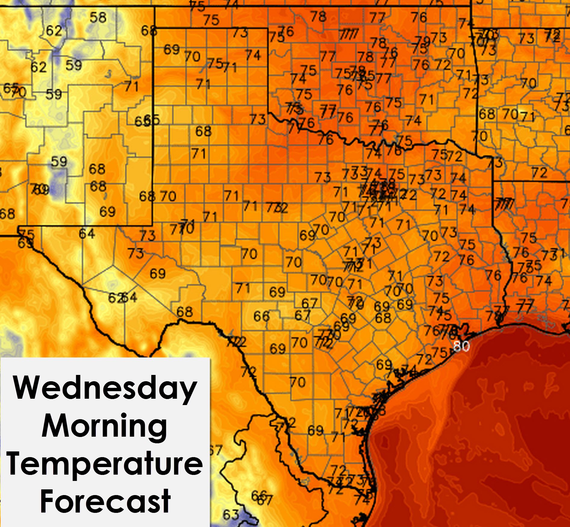
Temperatures will climb into the 90s by early afternoon across all of Texas. 80s are expected in the higher elevations in Southwest Texas. Those lucky enough to have storms near them this afternoon will likely cool off into the 80s as outflow winds bring an afternoon of less hot temperatures. Heat index values will be close to the triple digits with the high humidity values. Likewise low temperatures tonight will drop into the low to mid 70s with upper 60s in more rural parts of West Texas.


0 Comments