
Bill has been a pesky system to forecast. While tropical systems usually prove to be a pain to forecast this one ended up being a real troll. While the eastern side of a tropical system is usually the ‘dirty’ side with the heaviest rains Bill decided to bypass that logic yesterday. The end result was extremely heavy rains on the northwest/north side of the low which has produced major flooding along the Red River in Montague County and in Southern Oklahoma. At the time of this post Interstate 35 was closed in the Arbuckle Mountains due to a nasty rockslide. The overall forecast was a bust for some while in other aspects it verified quite nicely. We did see the heavy rains we expected across North Texas and parts of Central and Southeast Texas. Luckily we were able to keep the widespread flash flooding at bay. I do caution you not to dismiss the flooding threat yet though. We’ve still got potential new issues today and rivers/lakes will see more rises this weekend as flood waters move downstream.
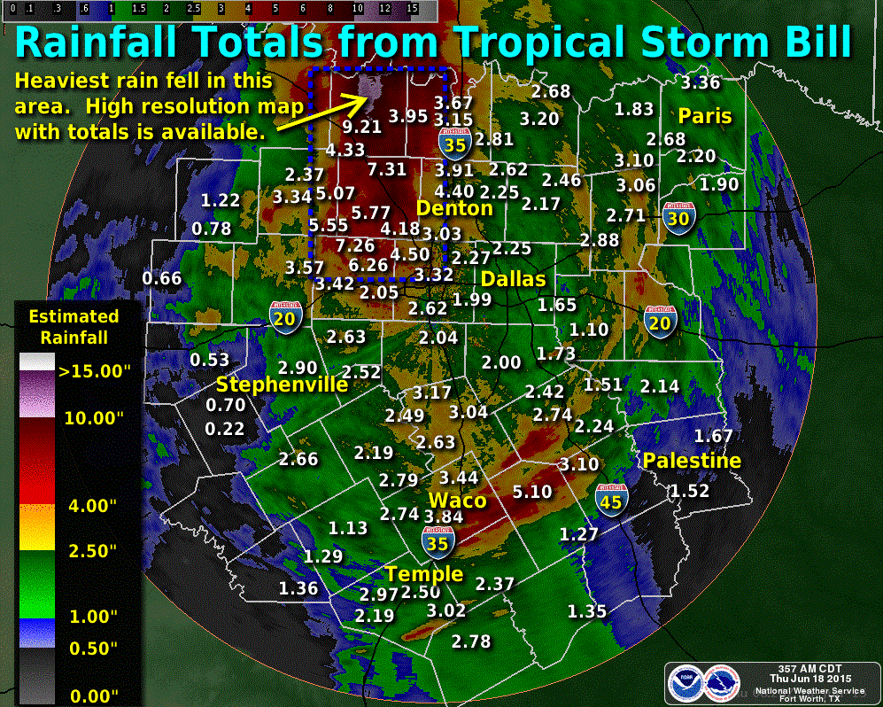
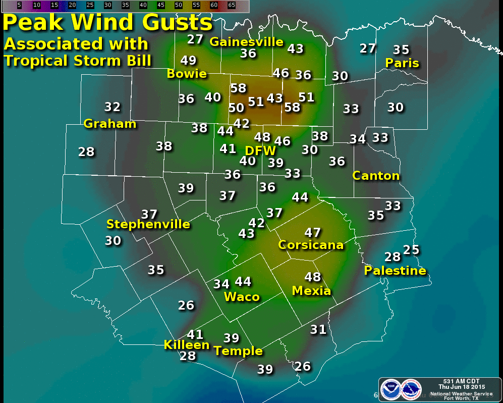
Here’s a few graphics from local National Weather Service offices with rainfall totals from Bill. We’ll share more graphics/information on rain totals later on when they’re released.
Tropical Depression Bill is now located about 65 miles southeast of Oklahoma City and is moving northeast away from Texas. As Bill continues to move away we’ll see the widespread heavy rain chances decrease across North Texas this morning. However we’re not done with the rain yet. Copious amounts of moisture remain in place and with sunshine expected this morning we’ll see new showers/storms pop up across parts of North, East, Central, South-Central, Deep South, and Southeast Texas late this morning into the afternoon hours. Scattered to numerous thunderstorms are probable with locally heavy rain. Some thunderstorms may produce rainfall rates of 2-3 inches per hour resulting in flash flooding. It will not take much rain to cause problems to redevelop in a hurry across North, Central, and Southeast Texas.

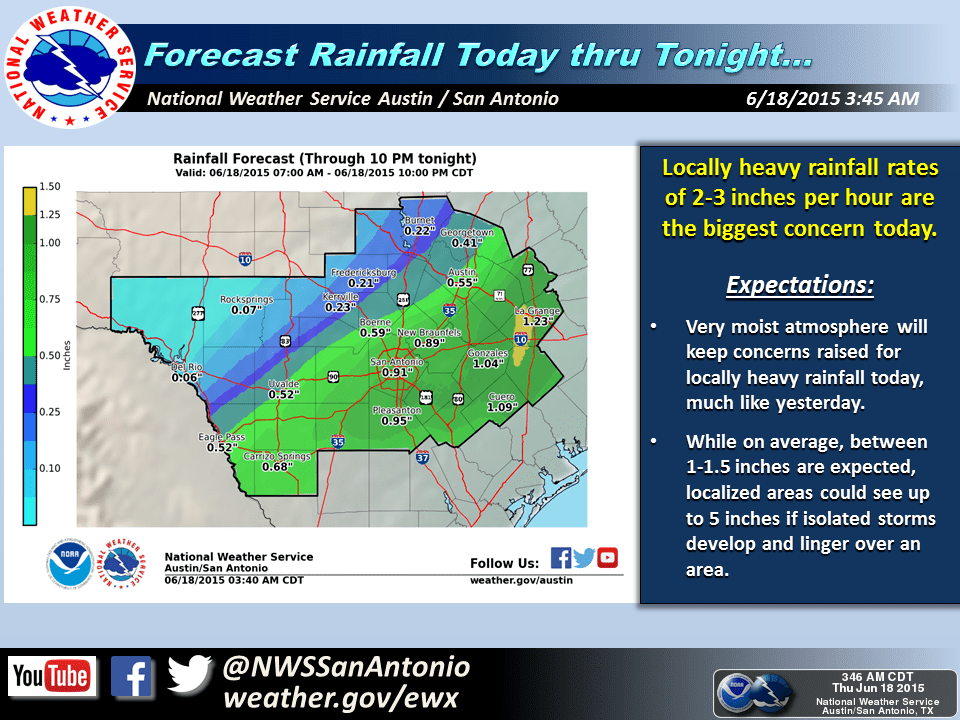
On a regional basis we’re expecting another quarter to half an inch of rain across Northeast, East, and Southeast Texas today. Not everyone will see rain and some folks will receive a lot more than half an inch of rain today. Very localized rain accumulations of 3-5 inches will be possible where very heavy storms set up. This is expected to be mainly east of Interstate 35 from the Red River south through San Antonio.

Otherwise it’s going to be a warm and humid day. Nothing surprising considering we just had a tropical storm roll through the state.


0 Comments