
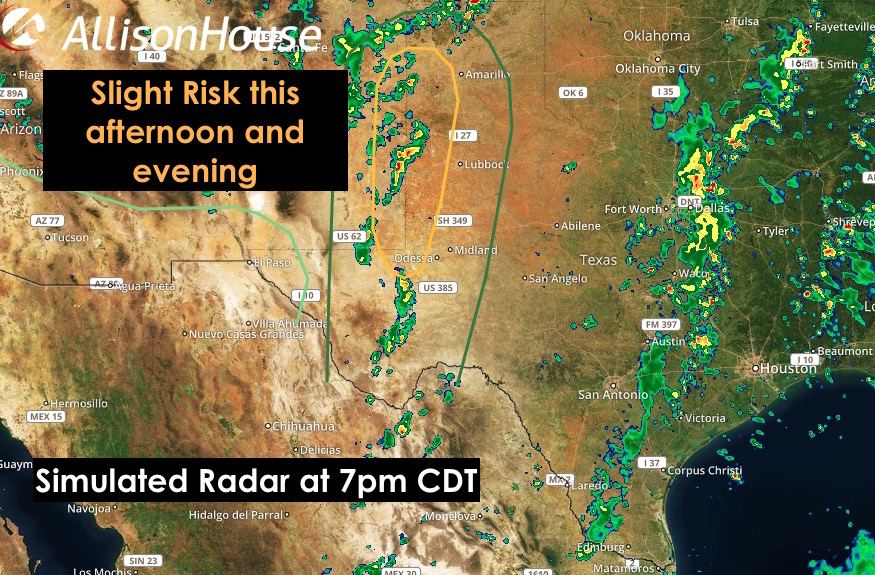
Good morning and happy Sunday! Western Texas will be under the gun again today for additional widespread strong to severe storm development similar to yesterday afternoon. Once again, storms are expected to fire up by early afternoon across eastern New Mexico and move into the western panhandle later in the afternoon. The capping inversion looks to be a bit less than what we had yesterday, so initial storm development should favor clusters rather than the more isolated supercell type storm modes. Eventually we’re expecting these clusters to congeal into another squall line by evening which will move east/southeast overnight across western/west central Texas then dissipate well after midnight. The Storm Prediction Center has a small portion of the western Texas panhandle region under a Slight Risk of severe weather today. This is mainly for mid to late afternoon development while the clusters of storms approaching from eastern New Mexico are still more isolated. Large hail, damaging winds and a brief tornado are the main threats. Flash flooding concerns will also be present, especially once the storms begin to congeal into a squall line. Additional areas of shower and storm development are expected across coastal and southeast Texas and into north central Texas. Again very similar to yesterday with pop-up showers and storms likely once we get into peak daytime heating. Downburst/microburst winds will be the main threats here, so folks out on area lakes this afternoon…those that have reopened after recent floods…will really need to keep an eye on the sky this afternoon and be prepared to seek shelter if one of these storms pops up in your area. Remember that downburst/microburst winds can impact you at quite a distance from the parent thunderstorm.
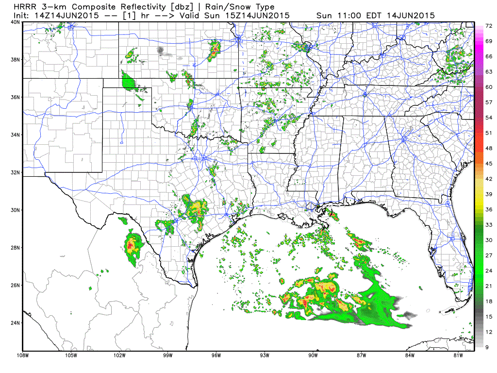
HRRR animated radar forecast between now and 8pm CDT
Watching the tropics! Our most recent invest sitting across the Yucatan is holding on to a 60% chance of tropical storm development within the next 48 hours. The forecast models are all coming into better agreement that tropical storm formation will happen, but the exact track and timing of landfall is still a bit uncertain. Right now, it appears that landfall sometime on Tuesday between Corpus and Houston is the most likely scenario. Again, this is NOT a certainty so be sure to check back with us for additional forecast updates. What is pretty certain at this point, is that this tropical system has the potential to bring flooding rain to areas which are still waterlogged from May’s rains. The precipitation outlook graphic below is not set in stone, but it’s worrisome and folks within the areas slated to receive the heaviest precip from this system should begin to review their flood safety plans now…especially if your home is in a flood-prone area. Also, be sure to bookmark our hurricane center link below and check back for the latest!
https://texasstormchasers.com/hurricanecenter/


0 Comments