
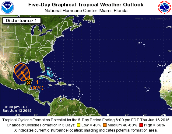
The National Hurricane Center designated the area of disturbed weather over the Yucatan Peninsula as Invest 91L earlier this afternoon. An invest is an area of investigation that is weaker/less organized than a tropical depression. The primary reason for the ‘invest’ term and designation is to allow tropical-specific weather models to start running. The brand new tropical weather outlook from the National Hurricane Center has increased the probability of development to 60% before the system makes landfall in Texas. I want to emphasis we are not expecting this to become a strong tropical storm or hurricane. At most this may become a weak tropical storm with only minor tidal surge and wind impacts. While I’m not concerned about a storm surge or wind damage this system will bring an incredible amount of moisture ashore with it. The eventual track of this system will determine where the heaviest rains fall – but there is certainly the potential for five to ten inches of rain in parts of East and Southeast Texas with this system. That’s a ‘higher-end/worst case’ scenario at this time.
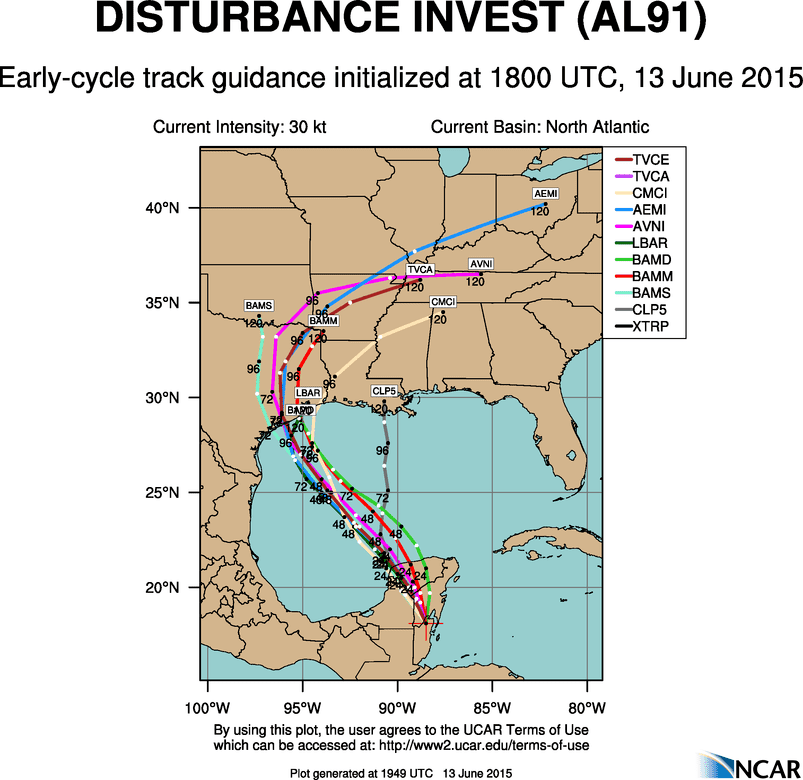
13/18Z Tropical Model Guidance – NOT A FORECAST – MODEL GUIDANCE ONLY
Here’s the first run of the tropical weather model’s for this system. We’ll have the evening runs out after 9 PM. Keep in mind this is not an official forecast and only model guidance. Still they’re pretty clustered adn confident on an Upper Texas coast landfall by early next week. They do diverge on timing with some being faster and others being slower. Regardless several factors will determine the storm’s eventual track not only while its in the Gulf of Mexico but once its in Texas as well. I am confident this will be a Texas landfall and a Texas storm. Typically we’ll see the heaviest rains along and east of the center’s track but that will also depend on how organized the system becomes. In all likelihood this will be a tropical depression or weak tropical storm with winds of 35-45 MPH. We will have to watch out for tornadoes east of the center along with the heavy rain and flood potential. I’ll have more information on it all in a blog post later this evening.


0 Comments