
A Tornado Watch will likely be issued by 3 PM for portions of West Texas and the Permian Basin. Satellite imagery indicates the cap across the region is weakening in conjunction with an approaching area of lift. With abundant moisture in place along with ample low level wind shear the stage is set for severe thunderstorms. Storms may fire up in extreme eastern New Mexico before moving into Texas. The strongest storms for the first few hours this afternoon may be capable of producing tennis-ball size hail and a couple of tornadoes. As storms form into a squall line around dinner time we should see the primary severe weather threat transition to damaging winds. The squall line will move east into the Big Country this evening. We’re also expecting some storms to fire up in the Panhandle later this afternoon (although we already are seeing some activity).
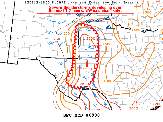
MESOSCALE DISCUSSION 0988
NWS STORM PREDICTION CENTER NORMAN OK
0144 PM CDT FRI JUN 12 2015
AREAS AFFECTED…PORTIONS OF FAR SERN NM…WRN TX
CONCERNING…SEVERE POTENTIAL…WATCH LIKELY
VALID 121844Z – 122045Z
PROBABILITY OF WATCH ISSUANCE…95 PERCENT
SUMMARY…THE SEVERE THREAT SHOULD INCREASE OVER THE NEXT 1-2 HOURS
ACROSS THE AREA. THE POTENTIAL EXISTS FOR VERY LARGE HAIL AND A FEW
DAMAGING WIND REPORTS…AS WELL AS A COUPLE OF TORNADOES. WW
ISSUANCE IS LIKELY.


0 Comments