
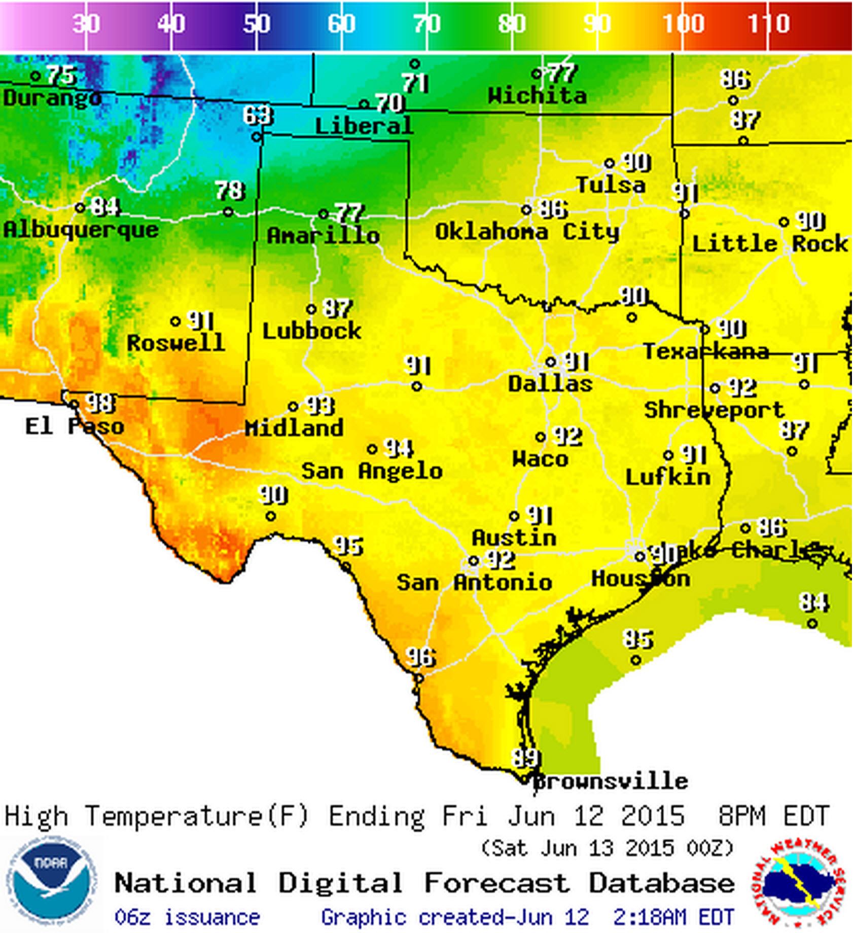
High temperature forecast for June 12
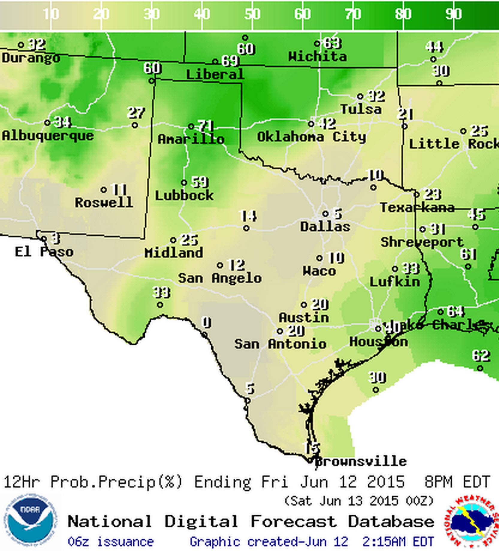
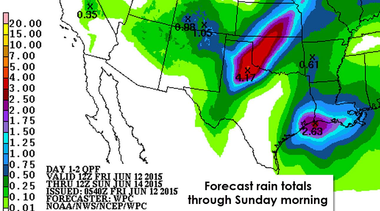
Chance of rain/storms today
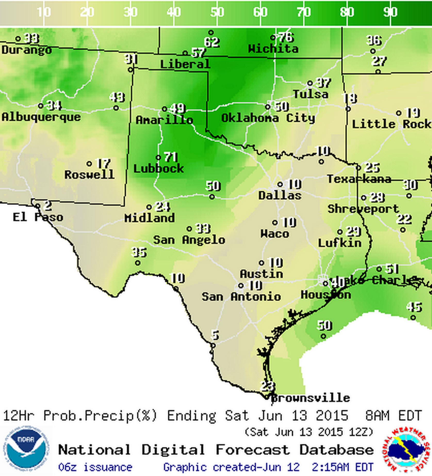
Chance of rain/storms tonight
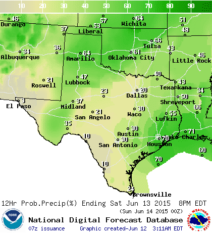
Chance of rain/storms on Saturday
Good morning and congratulations on making it through another work week. Welcome to the June 12th edition of the Texas Weather Roundup. The TWR is a quick way to get your weather forecast and information on any upcoming hazardous weather. For the first time this month we actually do have quite a bit to talk about in the weather department. Some of Texas will experience cooler temperatures plus storms today. Most others will continue with hot and humid conditions although it won’t be as warm as the middle of the work week. Same story goes for Saturday except rain chances will spread into East and Southeast Texas. Our main focus in today’s Texas Weather Roundup will be on the potential for organized thunderstorms in the Texas Panhandle and West Texas this afternoon and evening.
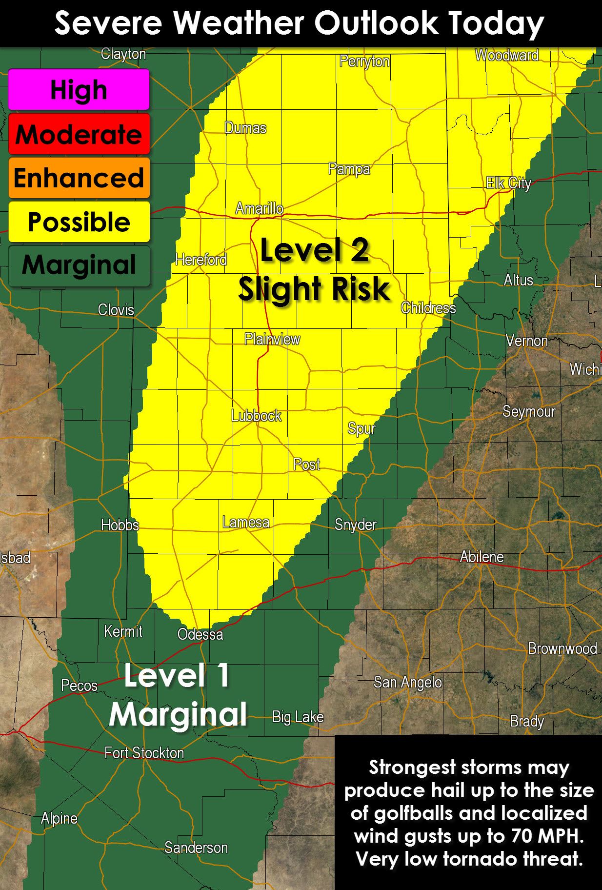
A slight risk of severe weather, a 2 on a 1 to 5 scale with 5 being the highest, has been issued for the Texas Panhandle, South Plains, and northern Permian Basin for this afternoon and evening. Today’s storms that fire up this afternoon will be driven by abundant moisture and heating resulting in moderate instablity. Wind shear values are on the low side of the spectrum but we should have enough to support a few supercells and thunderstorm clusters. The strongest supercells could produce hail up to the size of golfballs. What may be the most prevalent threat is the threat for damaging straight-line and downburst winds. We could see a few gusts of 60 to 70 MPH out of the stronger storms today. The tornado threat is nonzero meaning while I don’t expect tornadoes today – I can’t rule one out if we have a trollstorm. The severe weather threat will diminish by late evening as thunderstorms congeal into a large cluster with heavy rain becoming the primary concern.
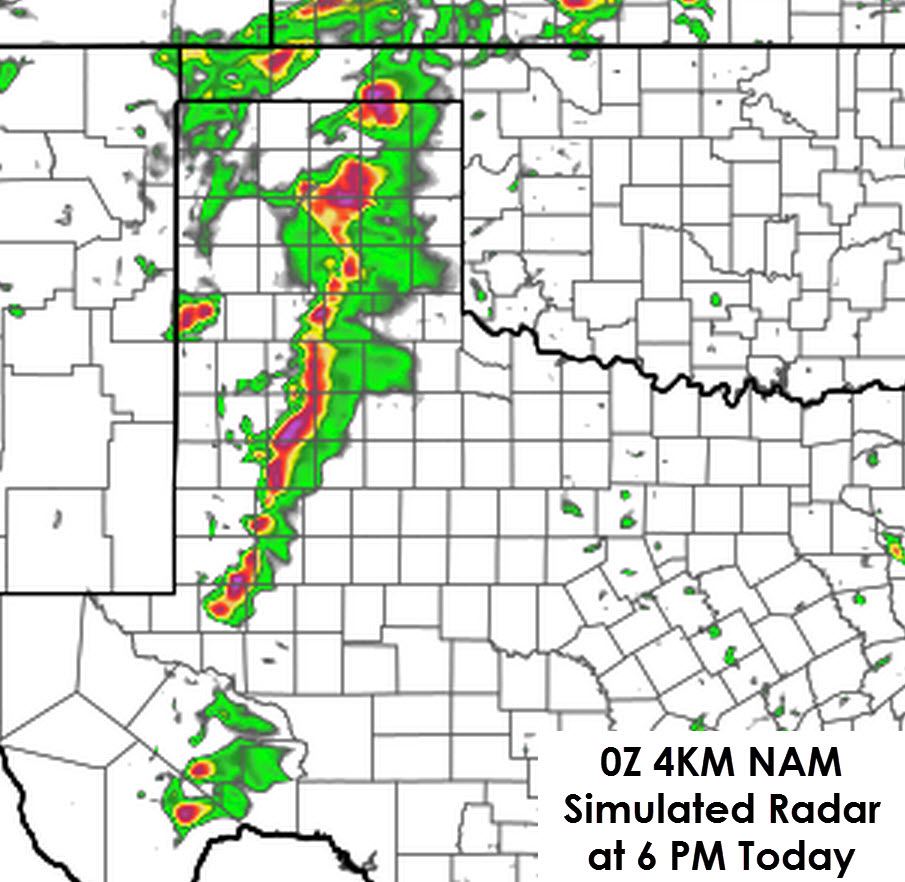
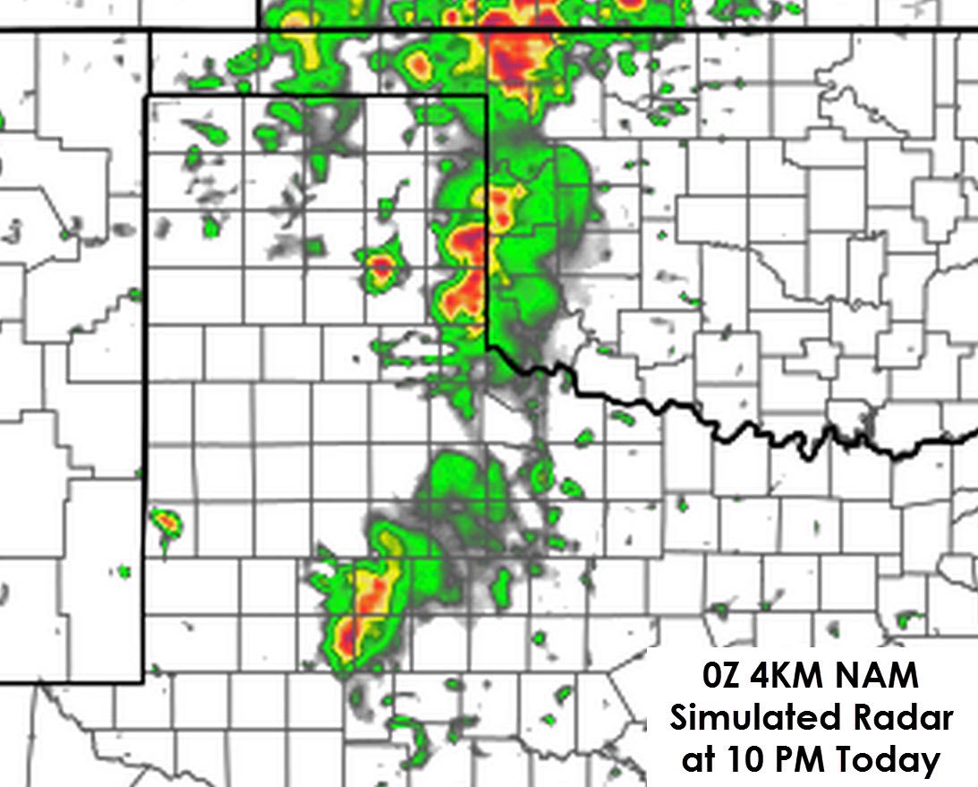
The first thunderstorms should form around 3 PM a county or two west of Interstate 27 from Lubbock north to the Oklahoma Panhandle. Thunderstorms may quickly develop after that and form into a line that will slowly move east. Individual storms in the line could produce wind gusts over 60 MPH and hail – but not all storms will be severe. Another threat, which will become the greatest concern by the evening hours, will be heavy rain potential. Thunderstorms will be moving slowly during the evening hours in the eastern Panhandle and Northwest Texas. Some locations may pick up a quick 2 to 4 inches which would result in flash flooding. I can’t tell you for sure exactly where the storms will set up this evening or who may get the heaviest rain at this time.
We will see another round of thunderstorms develop tomorrow afternoon across West-Central Texas – but they will be more isolated in nature. More widespread shower and thunderstorm development may occur across East and Southeast Texas in association with the seabreeze. Locally heavy rain and gusty winds will be possible with those storms. Remember when thunder roars go indoors!


0 Comments