
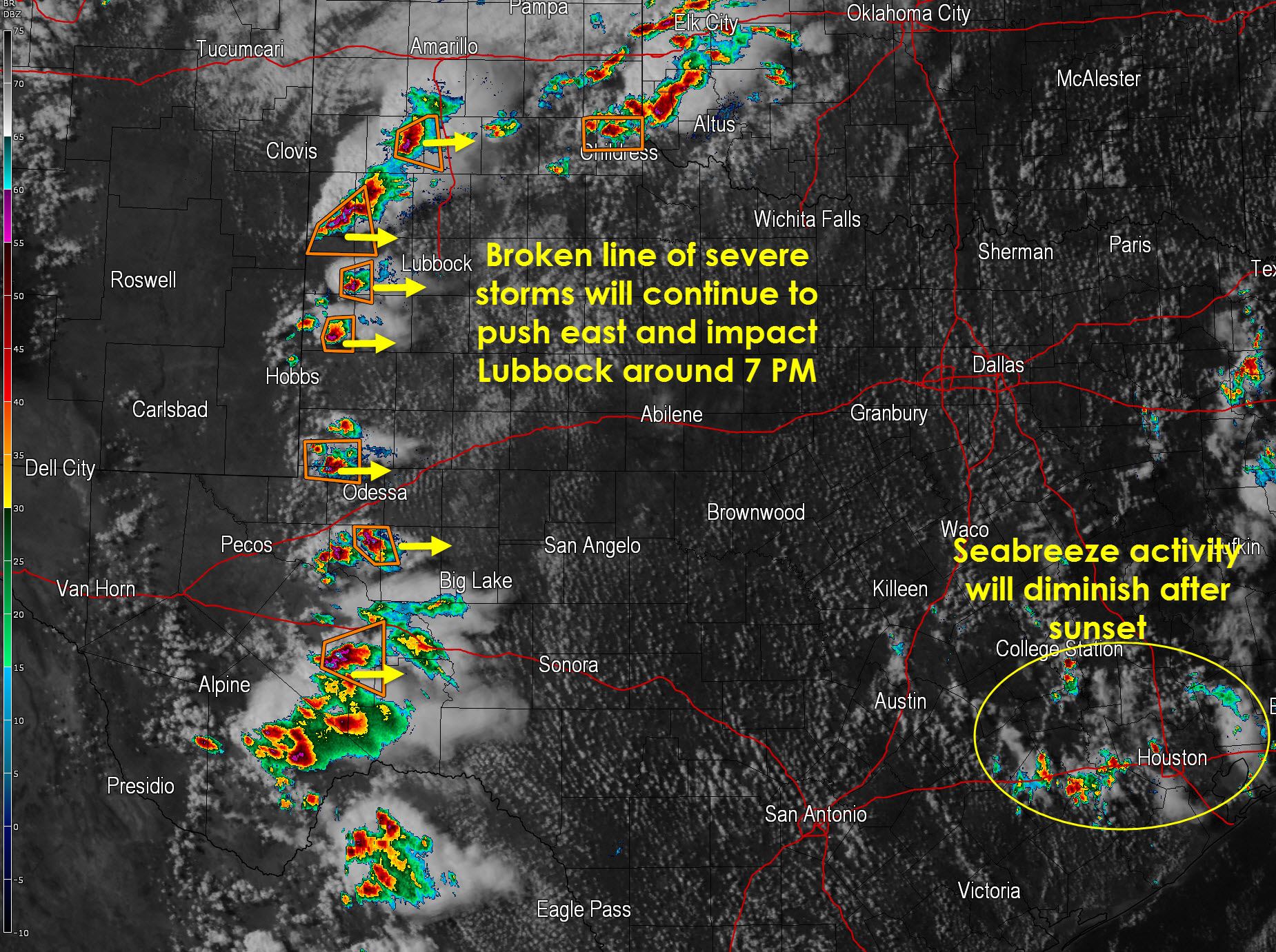
A broken line of severe thunderstorms extends from west of Tulia, TX south into the Permian Basin. Most of the thunderstorms are moving east at 10 to 20 MPH. The strongest storms are currently capable of producing hail up to the size of tennis balls and localized damaging wind gusts up to 70 MPH. We haven’t had any real tornado issues this afternoon with the exception of one brief landspout tornado about two hours ago. We’ll be watching for thunderstorms to congeal into a more solid line as they move east over the coming hours. As they do form into a line or cluster we’ll have to watch for damaging winds to become more of a threat along with heavy rains.
A second area of thunderstorms is impacting the eastern Texas Panhandle and western Oklahoma. A couple severe storms north of Childress to Memphis are producing hail and localized wind gusts up to 60 MPH. These storms may eventually become part of the larger cluster to the west as it moves east.
Finally a couple showers and thunderstorms are underway across Southeast and East Texas. These are your typical popup storms that occur during peak heating in the afternoon hours. Severe weather is not expected but lightning along with brief gusty winds and heavy rain will be possible. This activity should diminish after sunset.


0 Comments