
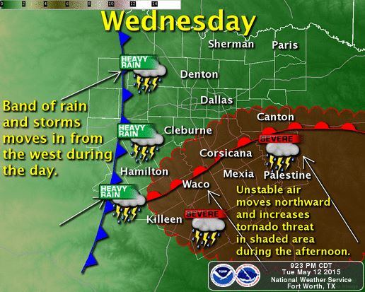
While far from set in stone there are a few ingredients tomorrow that are starting to present more of a concern for severe weather. A warm front will lift north on Wednesday allowing an unstable airmass to spread further north in parts of Central and East Texas. Meanwhile an upper level storm system along with strong low level wind shear will certainly support an organized storm mode. There is the concern that we may have a tornado threat develop with some storms tomorrow thanks to the increasing low level instablity in conjunction with the enhanced low level wind shear. Tomorrow’s storms wouldn’t be very tall (known as low-topped) with very little in the way of hail or lightning – but they could have the potential to spin up a tornado. The threat is far from certain but there is enough of a concern this evening to bring it up. I strongly suggest you check back in the morning for the updated forecast tomorrow. Regardless we’ll see an increase in rain and storms tomorrow along with a threat for flooding.


0 Comments