
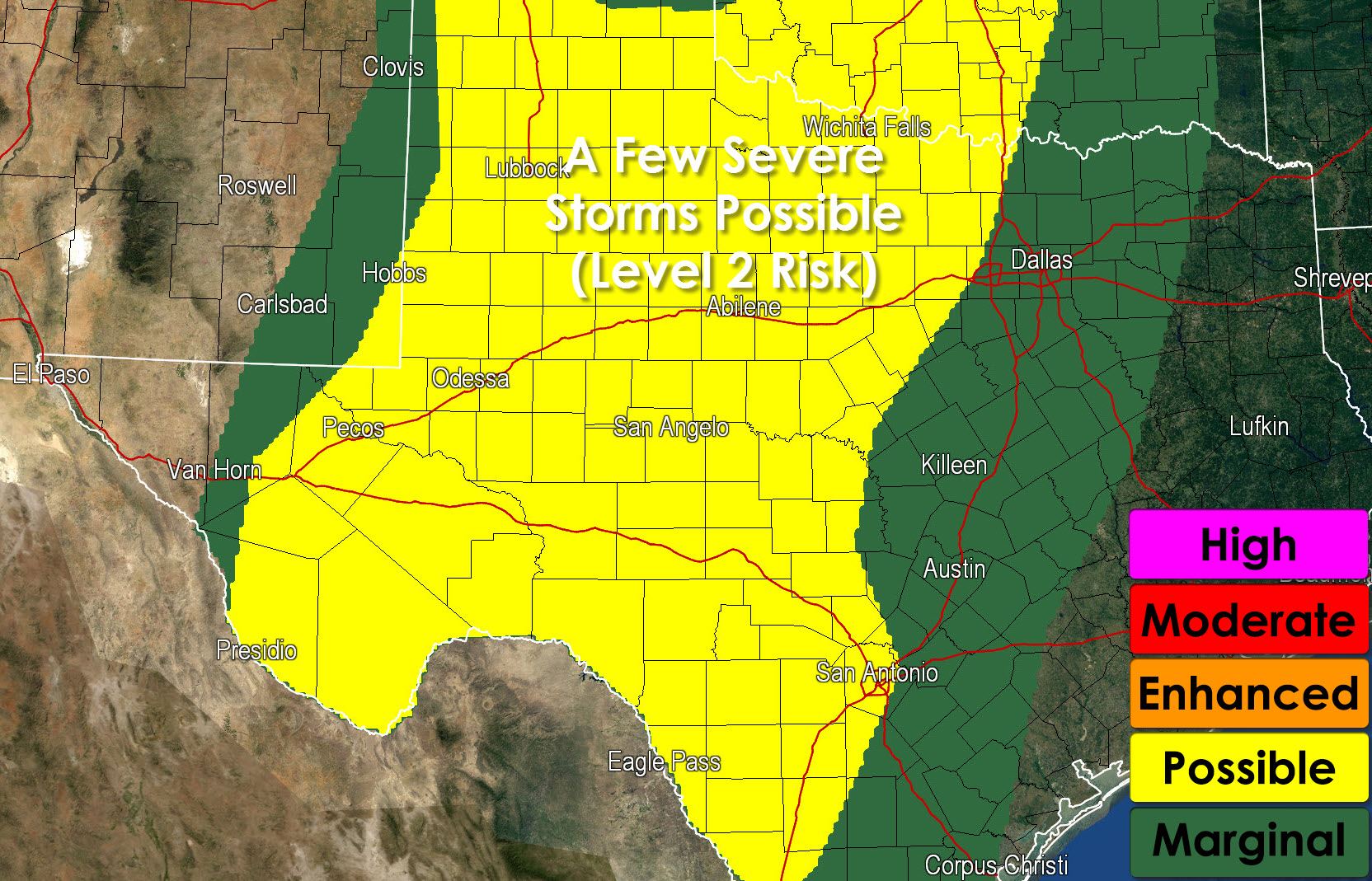
* Pockets of low level instablity combined with wind shear mean we cannot rule out a few brief tornadoes this afternoon. The overall threat is on the lower end of the spectrum – but present enough to make note of it.

Simulated radar at 7 PM tonight from weatherbell.com
* Thunderstorm coverage will increase later this afternoon. By early evening we should have a fairly large area of precipitation underway from Northwest Texas south into South-Central and Southwest Texas. Some storms will likely be producing very heavy rain and flash flooding is expected.
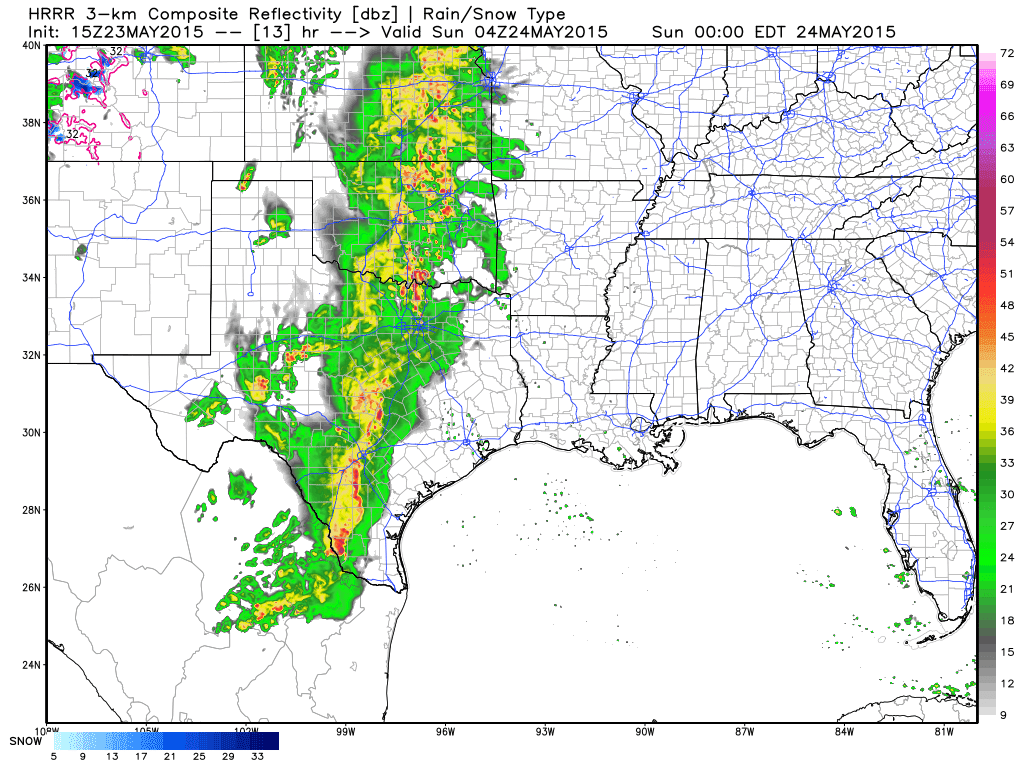
Simulated radar at 11 PM tonight from weatherbell.com
* By late evening rain will be falling across North Texas, Central Texas, South-Central Texas as a large area of precipitation continues to slowly progress east. Pockets of very heavy rain are expected with moderate/heavy rain over a larger area. Flash flooding is expected some locations tonight. The severe weather threat will diminish after sunset. Rain will continue much of the night with pockets of rain accumulations exceeding 4 inches expected. Not everyone will see the higher-end rain totals and flooding, but widespread rain is expected.


0 Comments