
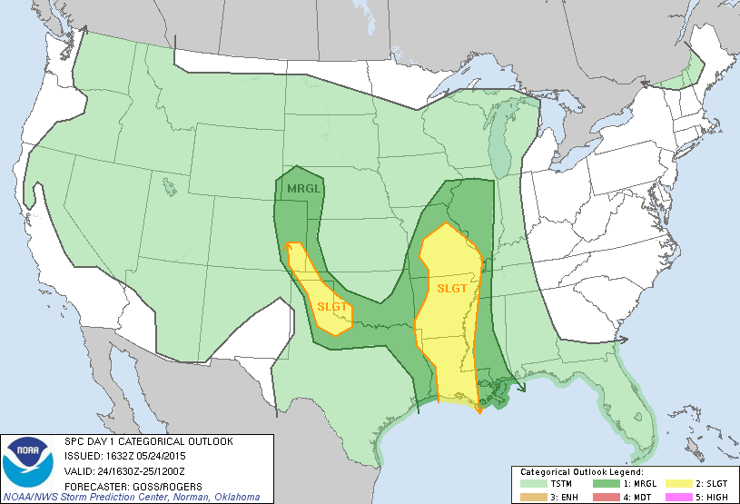
Once the current line of storms stretching across eastern Texas has completely moved out, things will remain relatively quiet across the state through the rest of today. A secondary line of rain showers has developed across north central Texas west of the DFW metro. This line will continue to move east/northeast during the day. Additional rain/storm development is possible across parts of north central Texas this afternoon, however the risk of severe weather development is low as the atmosphere will be fairly stabilized from early morning rain. The eastern panhandle/northwestern Texas areas have the highest probability of seeing a few isolated strong to severe storms by peak heating this afternoon along the dryline with large hail as the primary threat. Confidence in the threats across the panhandle and northwest Texas are not high, but it’s best to be weather aware across the area today just in case.

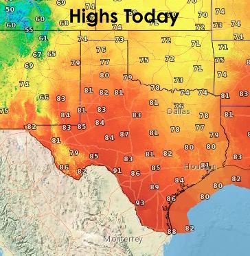
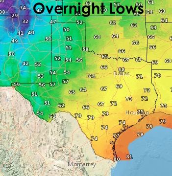
Here’s a look at the highs today and overnight lows. We’ll have tomorrow’s Memorial Day forecast out later this evening, so stay tuned!!!


0 Comments