
The Storm Prediction Center has indicated a severe weather watch is being considered for portions of Northwest and western North Texas. Severe thunderstorms are underway across the South Plains now extending east into West-Central Texas. These storms are expected to continue progressing east this afternoon and eventually may form into a squall line. The primary threat with the strongest storms for the next few hours will be hail up to the size of golfballs, a tornado or two, and flooding rains. As thunderstorms organize into a cluster/line this evening we’ll see the threat for damaging wind gusts increase along with a continued hail and flooding threat.
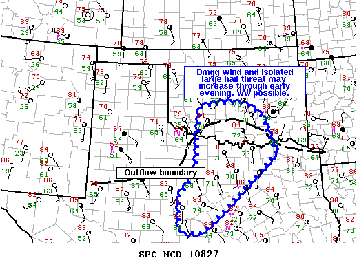
NWS STORM PREDICTION CENTER NORMAN OK
0256 PM CDT THU MAY 28 2015
AREAS AFFECTED…SRN OK…N AND NW TX
CONCERNING…SEVERE POTENTIAL…WATCH POSSIBLE
VALID 281956Z – 282130Z
PROBABILITY OF WATCH ISSUANCE…60 PERCENT
SUMMARY…THREAT FOR LARGE HAIL AND DMGG WIND GUSTS WILL INCREASE
THROUGH THE EARLY EVENING ACROSS SRN OK INTO NORTH TX. THE AREA IS
BEING CONSIDERED FOR A WW OVER THE NEXT HOUR.


0 Comments