
I really don’t like it when my forecast is a bad one – but that’s what happened yesterday. We saw a few severe storms fire up as expected in western North Texas during the afternoon hours. What I didn’t expect was the widespread strong/severe storm development that produced wind damage and flooding in the D/FW Metroplex, North Texas, and even parts of East Texas. Truthfully I haven’t even had a chance to look and see what caused that yet. All I can figure is we had an outflow boundary left over from Monday’s storms that helped break the cap and ignite more widespread storm development. This will be an interesting forecast to look back on once the weather calms down and I have time for studying.
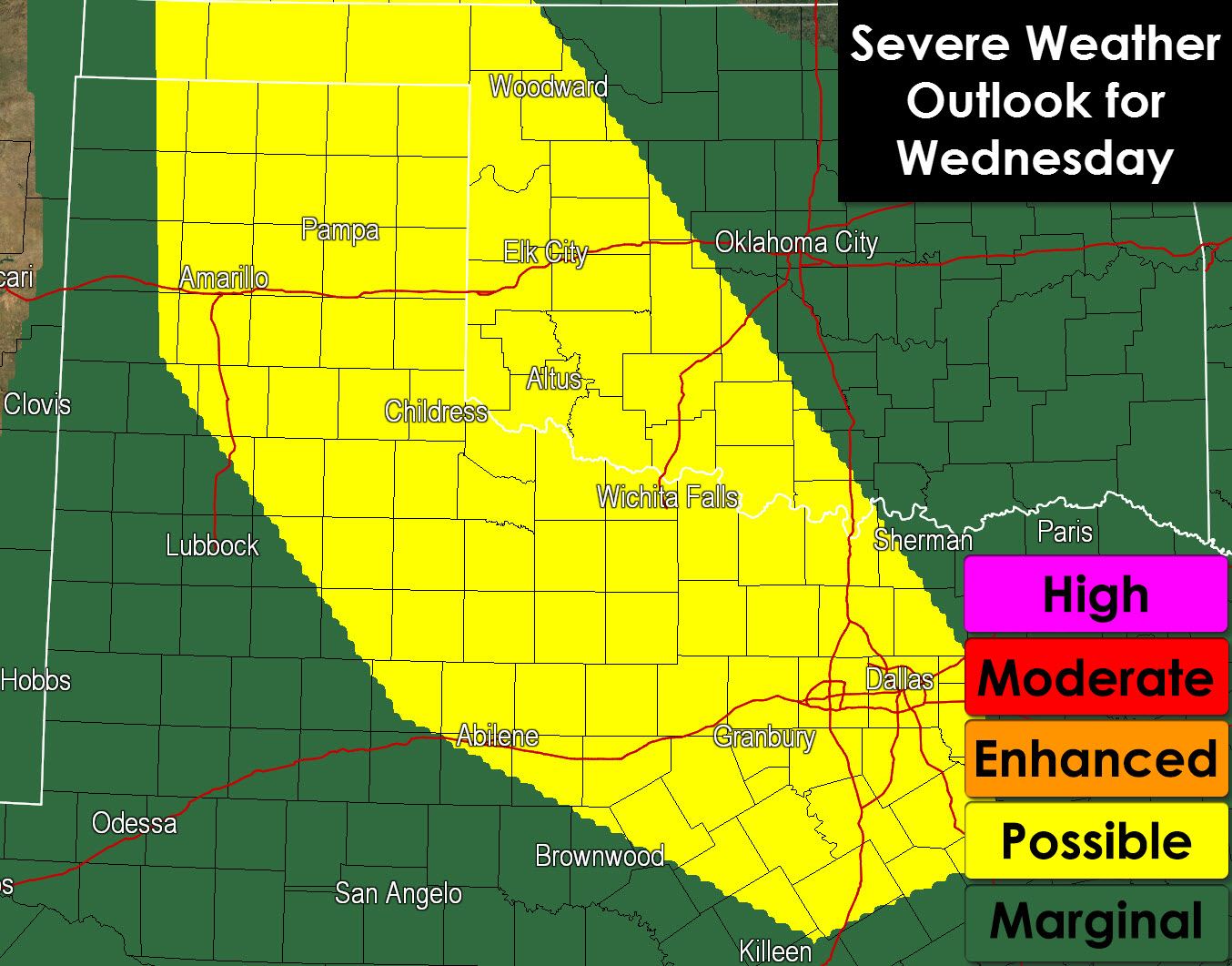
We’re expecting more isolated severe thunderstorms to develop this afternoon. Today’s target area will be the eastern Texas Panhandle, western Oklahoma, Northwest Texas, into NOrth Texas. Like on Tuesday wind shear values will be on the weaker side but the atmosphere will be strongly unstable. Once we see thunderstorms initiate they could go up in a hurry. The strongest storms could produce large hail up to the size of baseballs, 70 MPH wind gusts, and a few tornadoes. Slow storm motions will also result in the threat for localized flooding. I don’t expect widespread thunderstorm development today but like Tuesday proved we should always expect the unexpected. It’s possible we may see a cluster of storms fire up like Tuesday evening somewhere in the risk area. If that occurs it would possess a threat for damaging wind gusts and flooding. We’ll have to look at weather data later this morning to determine how everything is coming together. This is typical for late May in Texas. A few severe storms in the afternoon into early evening hours. We’re not talking a severe weather or tornado outbreak – just the typical isolated afternoon issues.


0 Comments