
Detailed graphics for rain chances through Monday
Today will actually be decently dry for most of Texas east of the Panhandle and West Texas. That all chances on Saturday as rain chances really ramp up and continue into Monday. Flash Flood Watches will likely be issued for a large portion of Texas. Many lakes are still in need of refilling and the good news is we’ve got rain on the way. The problem is there are parts of the Red River, Northwest Texas, and North Texas who are completely saturated. With the projected rain totals through Sunday and Monday we’re likely going to see a high-impact flood event. Flash flooding will be a significant concern with major river flooding a threat into next week. Those planning on camping or spending time outdoors this weekend should be aware of their surroundings and not approach flood waters.
Severe Weather Outlook
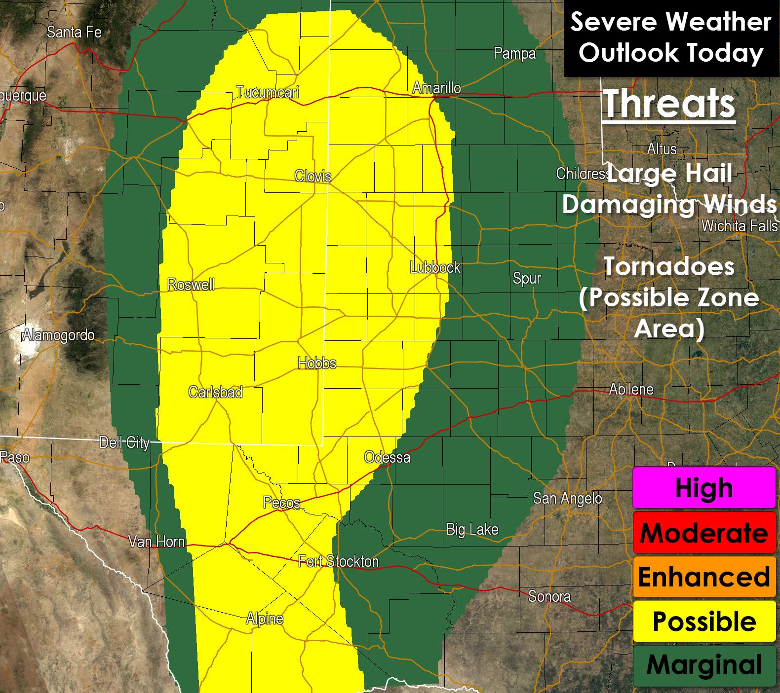
A level 2 possible severe weather risk is in effect late this afternoon through the overnight hours in the Permian Basin, South Plains, and western Texas Panhandle. Severe thunderstorms will develop in eastern New Mexico and move east into Texas later today. These storms will likely be capable of producing large hail, damaging winds, and pose a tornado threat. With strong low level winds advecting in moisture along with a weak cap the threat for severe weather could continue well into the nighttime hours.

On Saturday a Level 2 Risk includes the Texas Panhandle, South Plains, Permian Basin, Big Country, Concho Valley, Northwest Texas, and western North Texas. While the primary threat will be flooding we will have a threat for severe thunderstorms. The primary threat with the strongest storms will be a tornado threat and damaging wind gusts. Hail will also be possible with the stronger storms.


0 Comments