
A Severe Thunderstorm Watch will possibly be issued this evening for the Texas Panhandle and South Plains. An upper level storm system is making progress towards the region early this evening. As it approaches we should see thunderstorms begin to develop and increase in coverage tonight. With supportive windshear and an unstable atmosphere some of the storms will likely be severe with large hail and damaging straight-line winds. The severe weather threat could continue into the overnight hours until the storms move east into Oklahoma.
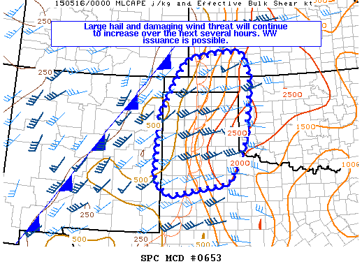
MESOSCALE DISCUSSION 0653
NWS STORM PREDICTION CENTER NORMAN OK
0805 PM CDT FRI MAY 15 2015
AREAS AFFECTED…FAR ERN NM AND SERN CO…SWRN KS…MUCH OF THE
TX/OK PANHANDLES…AND FAR WRN OK
CONCERNING…SEVERE POTENTIAL…WATCH POSSIBLE
VALID 160105Z – 160330Z
PROBABILITY OF WATCH ISSUANCE…40 PERCENT
SUMMARY…LARGE HAIL/DAMAGING WIND RISK SHOULD INCREASE OVER THE
NEXT SEVERAL HOURS. WW ISSUANCE IS POSSIBLE.


0 Comments