
Today’s threat for severe weather and thunderstorm initiation could begin by the late morning across across the southeastern Texas Panhandle and Northwest Texas. Without a strong cap in place it won’t take much to get thunderstorms to initially fire up by late morning. There remains some uncertainty on where exactly we’ll see storms first fire up – but the high resolution rapid refresh is indicating we should see storms fire up by about 10-11 AM in the eastern Texas Panhandle. I’m thinking we’ll likely see storms strengthening with a threat for hail and damaging wind gusts by late morning before storms move into Oklahoma. Storms may actually form into a broken line across Oklahoma south across the Red River into North Texas by early afternoon. The line of storms will move east with individual cells in the line moving northeast. At this time it looks like we’ll have the most intense storms just north of the Red River in Oklahoma – but we’ll likely have strong to severe storms in Northwest Texas this afternoon. The strongest storms will be capable of producing baseball size hail and localized damaging wind gusts over 70 MPH. The strongest storms may produce tornadoes especially in Central and Southern Oklahoma into Northwest Texas and the Red River Valley. Storms may form south into Texas as well with a threat of large hail and damaging winds by mid to late afternoon and continue into the evening hours.

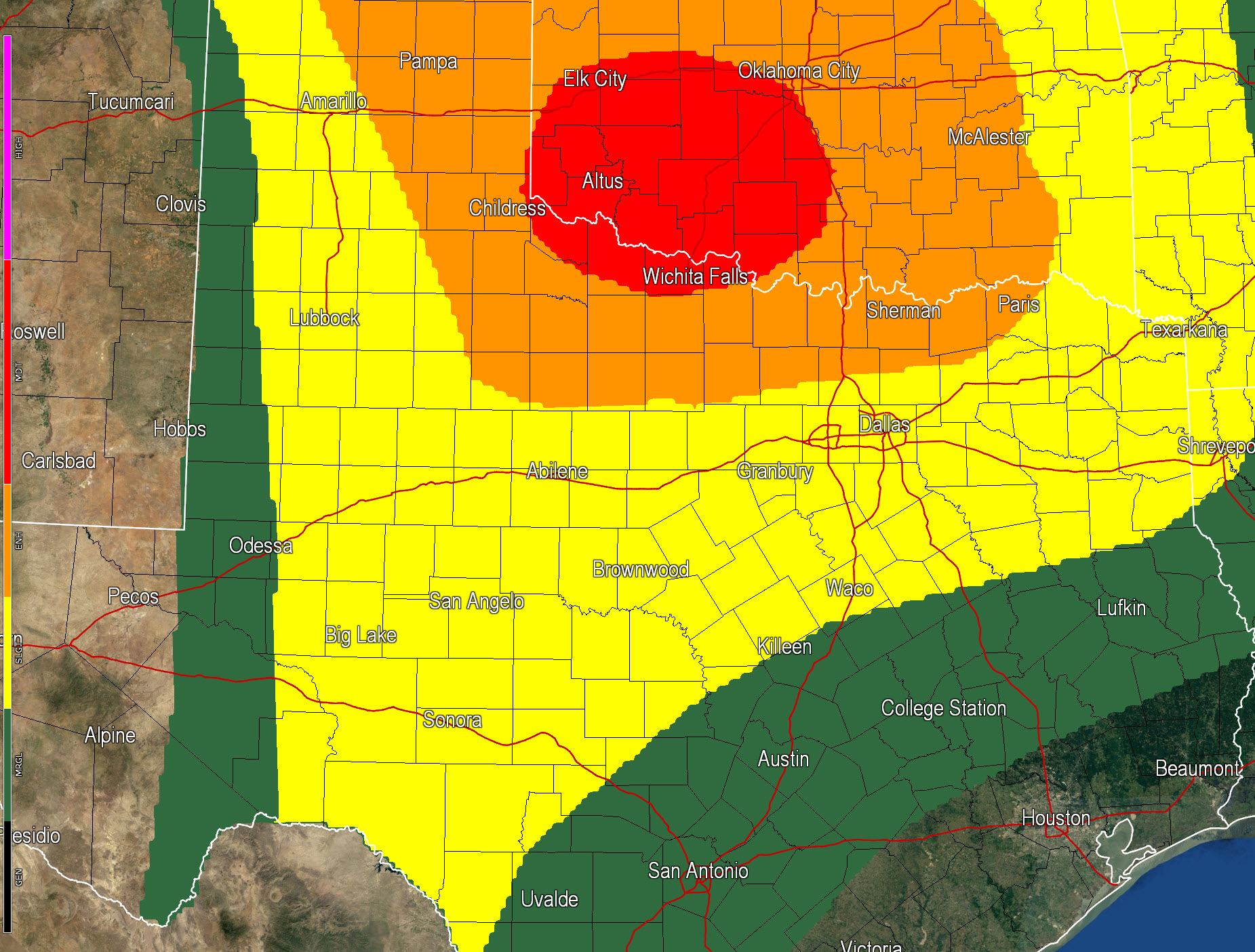
A moderate risk of severe weather is in effect for the eastern Texas Panhandle and the Red River Valley in Northwest Texas. An enhanced risk of severe weather includes the BIg Country, Concho Valley, and North Texas. A possible severe weather risk extends into the Concho Valley and Southwest Texas. A severe weather event is anticipated across the Southern Plains on Saturday across Kansas, Oklahoma, and Texas. Conditions could come together to support a significant tornado threat along with a hail and wind threat. Several factors still need to be determined including what impacts today’s event will have along with the threat of early storms tomorrow messing things up.
Another enhanced severe weather risk is expected in North, Central, Northeast, and East Texas on Sunday as the upper level storm system finally begins to move over the region. All modes of severe weather will be possible on Sunday but we’ll talk more about that at a later time. Lets focus on today and Saturday first.


0 Comments