

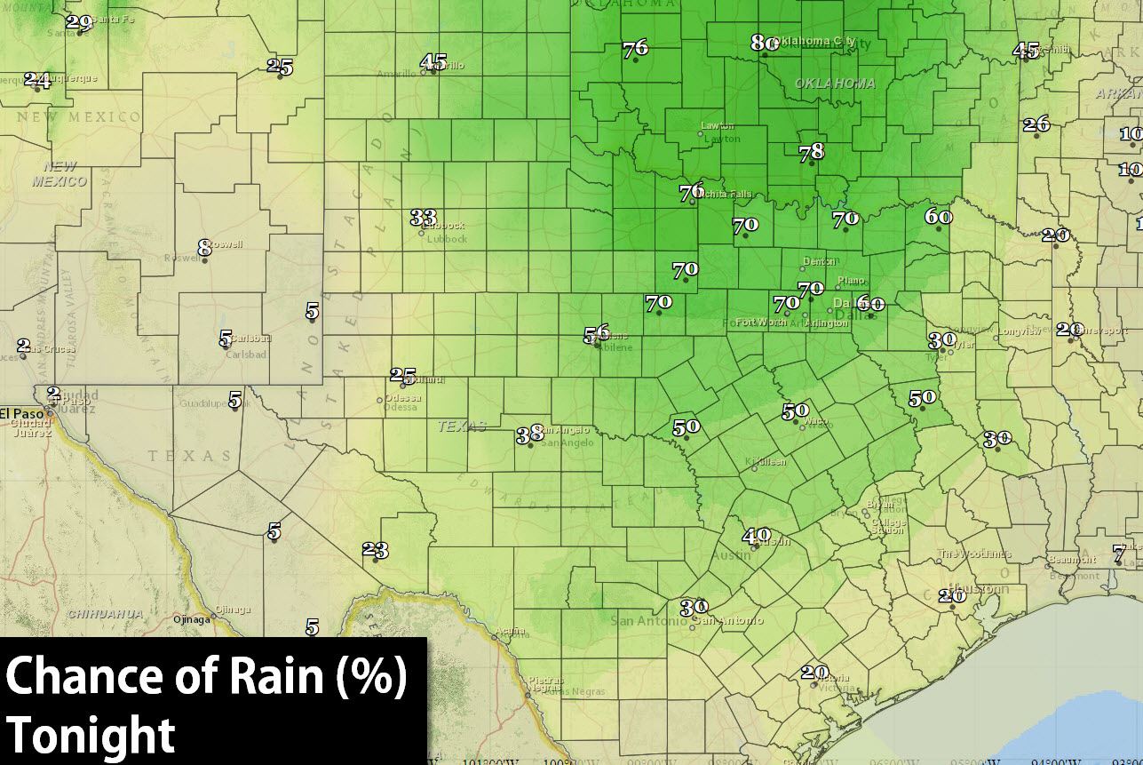
A large area of rain with embedded thunderstorms will gradually move east into Oklahoma later this morning into this afternoon. Thunderstorms may build south into North and Central Texas this afternoon as well with locally heavy rain. Behind the rain in the Texas Panhandle and West Texas it appears we may get a few hours of recovery this afternoon. Should that occur there will be another severe weather risk by late afternoon as another upper level disturbance moves in and helps fire storms up on the dryline. The highest rain chances today will be across the Panhandle, South Plains, into West-Central Texas. Rain chances increase tonight across Northwest and North Texas south into Central Texas.
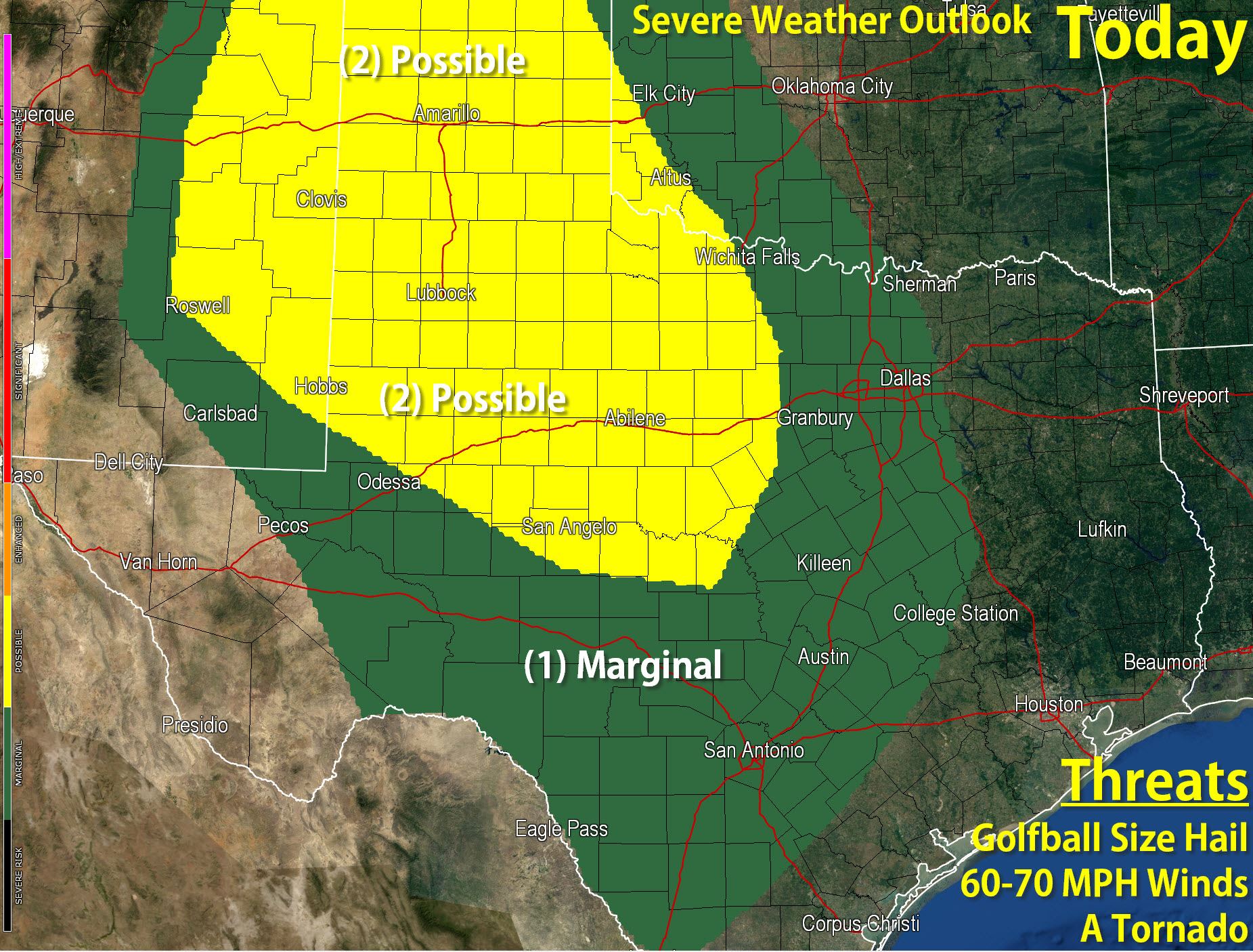
By this afternoon the threat for a few severe thunderstorms will increase across eastern New Mexico into the Texas Panhandle and South Plains in West Texas. We may see storms first fire up in eastern New Mexico move east into Texas this afternoon. These storms won’t have a ridiculous amount of wind shear or instability to work with but there should be enough to support the threat of organized thunderstorms. The most intense storms today should be capable of producing golfball size hail, localized wind gusts of 60 to 70 MPH, and a potential tornado. Storms may form into a cluster or line this evening and move east into the Big Country with a threat of hail and strong wind gusts. It goes without saying but the threat of flooding will be enhanced today especially in areas that received heavy rain over the past few days.
Remember you can keep up with the storms using our free interactive weather radar on our website at texasstormchasers.com/radar


0 Comments