

Rain is underway this morning and will continue through tonight. By lunchtime we should have rain falling from the Texas Panhandle southeast through the Big Country into Central Texas south into Deep South Texas. The primary threat with this activity will be flooding, especially in areas that have received significant rain over the past week. Flash Flood Watches are in effect for a large chunk of the state which means most of today’s rain will quickly runoff into local streams and eventually lakes and rivers. That’s good for the lakes that still need filling – but a big concern for other locations that are already flooding. We’ll keep an eye on how things evolve today flooding wise.
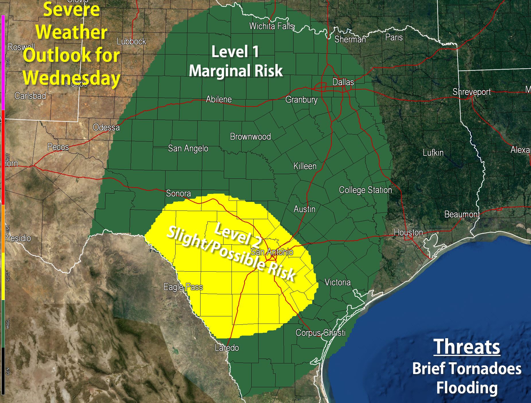
Widespread severe weather is not expected today but we do have the potential for a few issues today. The Storm Prediction Center has placed South-Central Texas in a Level 2 possible risk of severe weather today. A level 1 marginal risk includes the Concho Valley, Big Country, Northwest Texas, North Texas, Central Texas, and Deep South Texas. The primary threat with the strongest storms today will be a low-end tornado threat along with some hail. Low level winds will be strong today so we’ll be monitoring for signs of stronger storm development as they’d spin like a top. The most probable scenario is widespread rain and clouds keep instablity values low and thus the severe weather threat marginal. As Mother Nature shows us from time to time though – we need to expect the unexpected.


0 Comments