
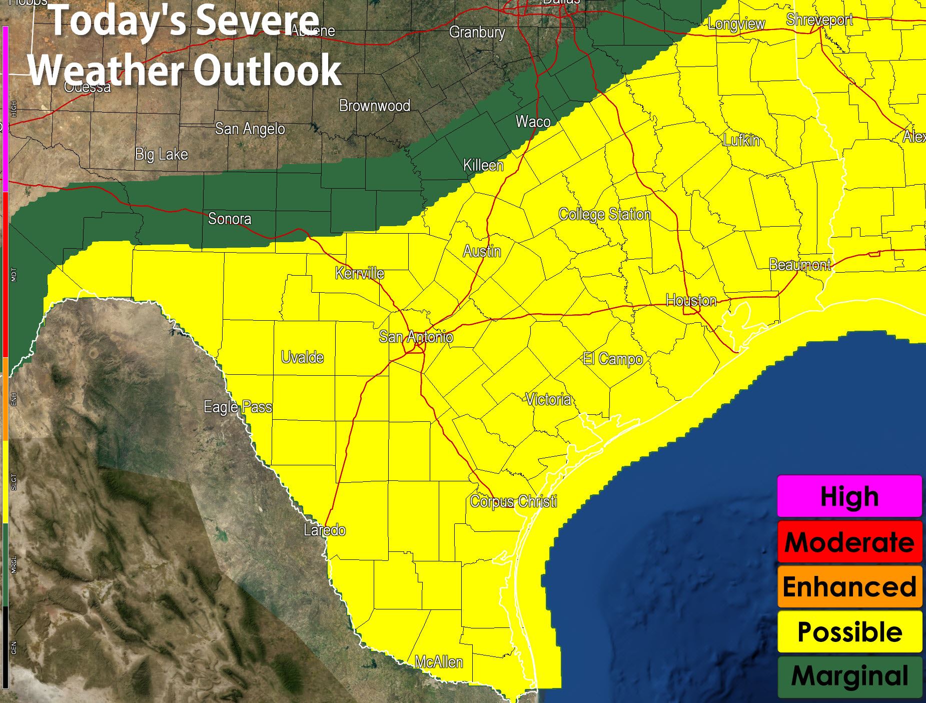
It’s been a very long night and with that in mind I’ll keep this blog nice and short. We will have a continued risk for some severe weather today – but the risk will be considerably lower. A slight risk/possible risk includes the southern half of Texas today south of a cool front. The severe weather never really stopped overnight and thus it almost seems like a continuation. Low level wind shear will be less impressive today so the tornado risk will be marginal. The strongest storms may produce large hail up to the size of golfballs and localized wind gusts over 60 MPH. I believe the primary issue today will be a continued flooding threat. We’ve had major flooding from Corsicana to Athens into parts of East Texas overnight where some locations saw nearly ten inches of rain in a few hours. That heavy rain threat will shift south to include more of Central and Southeast Texas today where several inches of rain will be possible. Like locations up north once we start seeing very heavy rains it won’t take too much to cause flash flooding. Copious amounts of moisture in the atmosphere will allow for efficient rain production. River flooding will be a problem in Northwest, North, and Northeast Texas but that threat will persist for most of this week and include more of Texas as peak flows move downstream.


0 Comments