
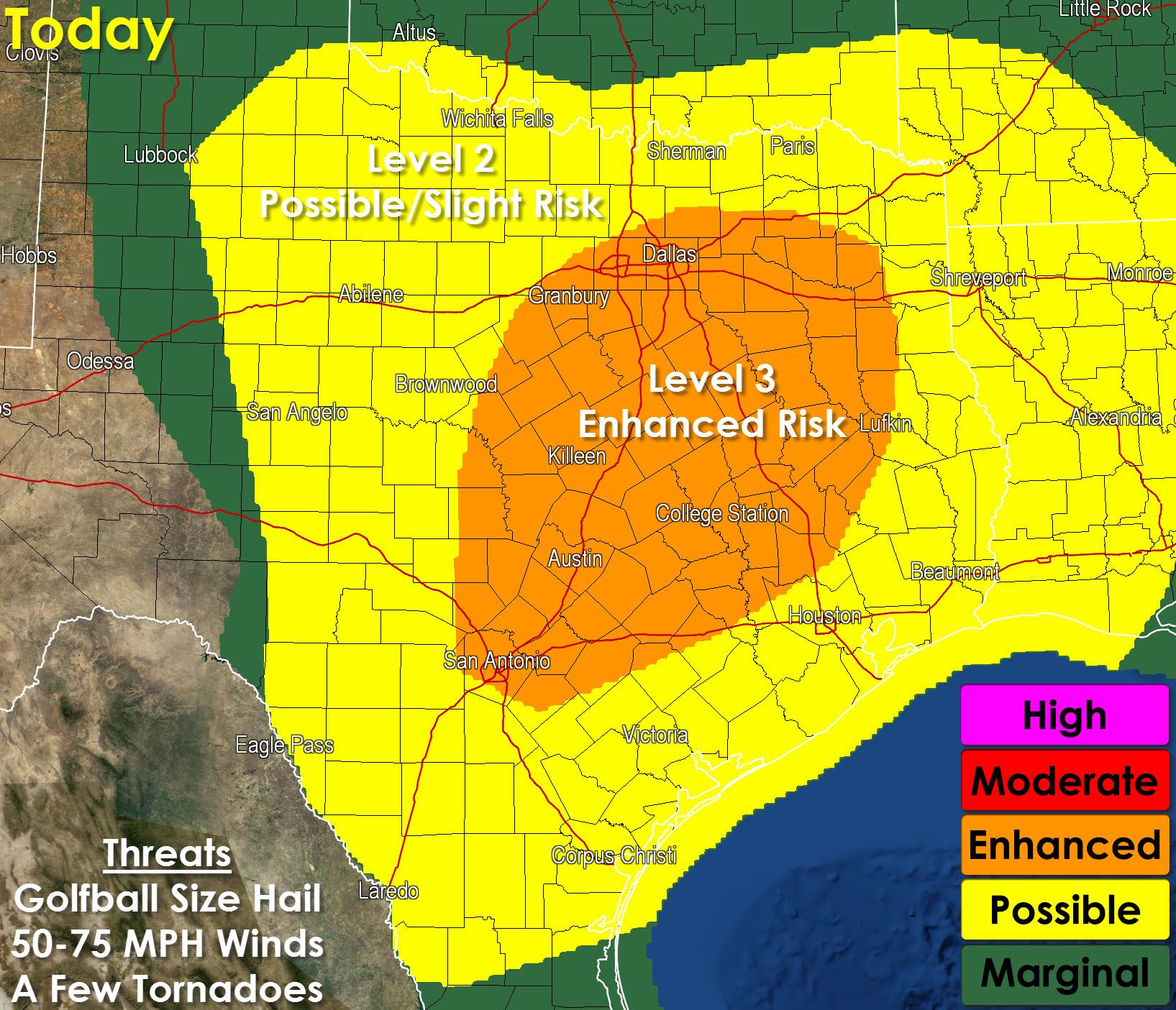
An Enhanced Risk (Level 3 out of 5) of Severe Weather has been issued for potions of North Texas, all of Central Texas, Brazos Valley, and the Sabine Valley. A level 2/possible risk includes West-Central Texas, the Concho Valley, Big Country, South Texas, Northeast Texas, East Texas, and Southeast Texas.
Our thinking has not changed from our blog post earlier this evening. We’ll see thunderstorms fire up in the Concho Valley later this morning and those will move east into the enhanced risk zone. If storms are in a squall line the threat for damaging straight-line wind gusts of 60-75 MPH will be elevated along with the chance for brief spinup tornadoes. Large hail will also be a threat today. Discrete thunderstorms or storms ahead of the squall line would pose a threat for tornadoes, very large hail, and damaging wind gusts. We may see a second round of isolated severe storms fire up late this afternoon across West-Central and Northwest Texas. Those additional storms are dependent on the ability for the atmosphere to recover/destabilize after storms this morning.


0 Comments