
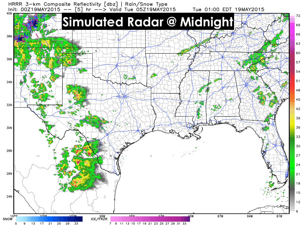
Increasing rainfall across parts of west Texas into the south plains and parts of the panhandle overnight will lead to additional chances for flooding area wide through early tomorrow. Fields and ditches across the area are already brimming and soils are saturated, so it won’t take but a little more rain overnight to cause some big issues. Flood Watches are in effect for the south plains up into northwest Texas through at least early tomorrow to address this threat. We also have a Severe Thunderstorm Watch in effect for multiple counties in west Texas through 10pm. If you like lightning and you live anywhere south of I-20 between Pecos and Monahans, you’re probably getting a good show courtesy of that feisty cell down in the Coyanosa area. For the remainder of the night, rain is expected to become more widespread across western Texas as an upper level system approaches late tonight. The severe threat is expected to calm just a bit, but periods of thunder along with gusty winds remains likely into early tomorrow morning as the complex of storms moves slowly off to the north/northeast.
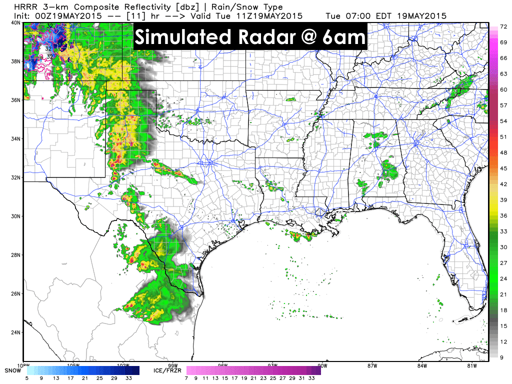
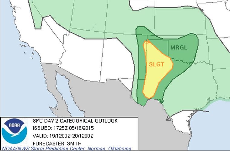
The severe threats tomorrow will be primarily across the western Panhandle down into the Permian Basin and Big Bend regions. However, it’s expected the much of the threat for severe weather will be mitigated by rain and storms across the panhandle and south plains early tomorrow. If the storms and/or residual clouds linger, the atmosphere will not have enough time in the afternoon to destabilize and we may not see much in the way of severe storm development across the northern half of the Slight Risk area in the graphic below. Instead, we’ll likely see development further south and potentially along outflow boundaries left over by the morning storms. It will be a wait and see, but just keep an eye on things tomorrow afternoon if you live in this region and have outdoor plans.
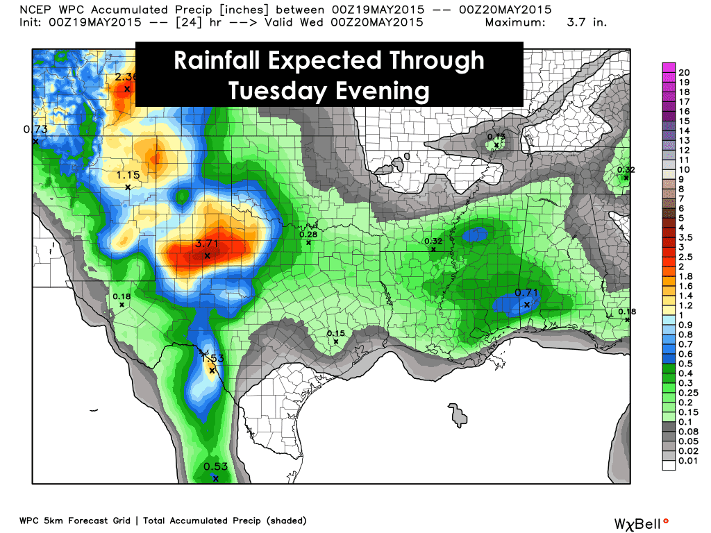
Here’s a look at the rainfall expected over the next 24 hours. These amounts are averaged over a large area, so some may not see quite that much, and some areas could see locally higher amounts. We just have to hold on through the end of the month. After that, as we conjure up the crystal ball of forecasting, it looks like we’ll finally start to dry out as our good friend, the High Pressure Ridge, begins to set up over the southern plains. Maybe it will stick around long enough to dry us out a bit.


0 Comments