
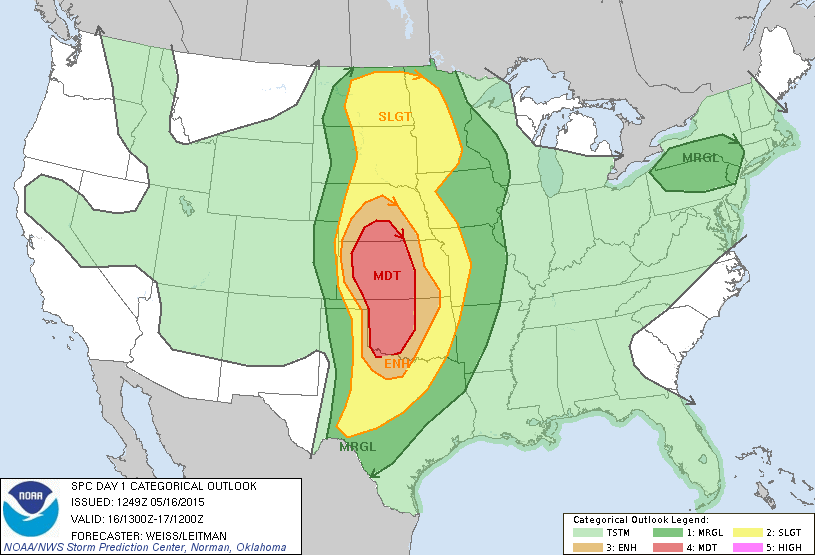
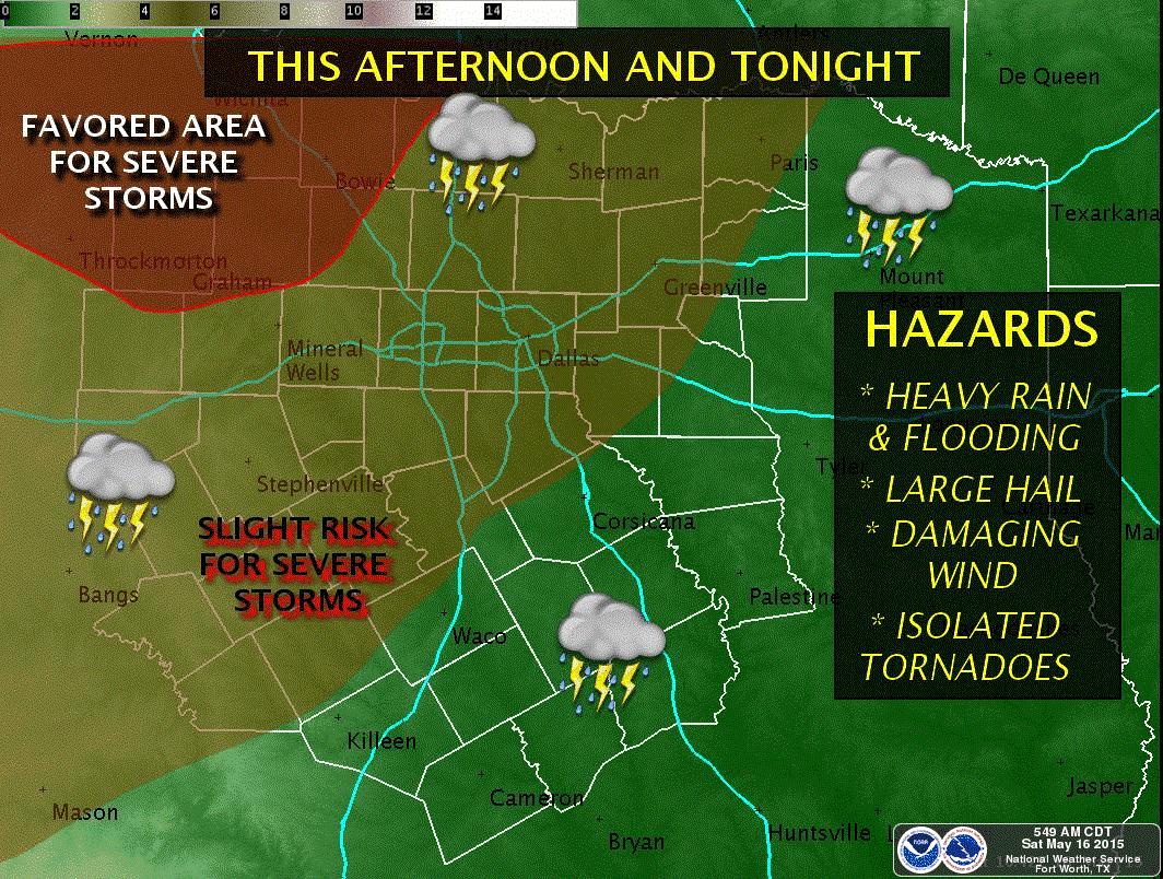
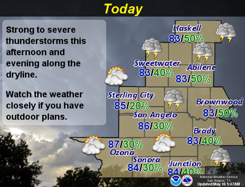
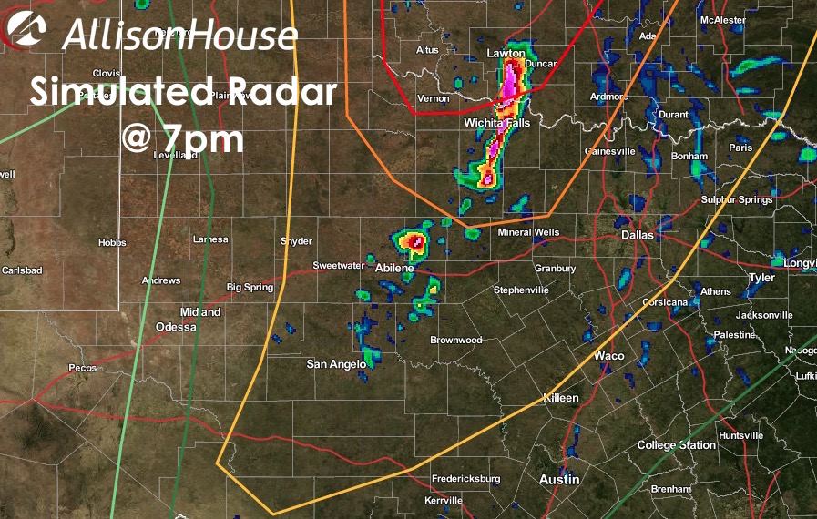
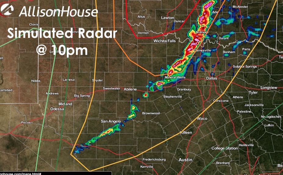
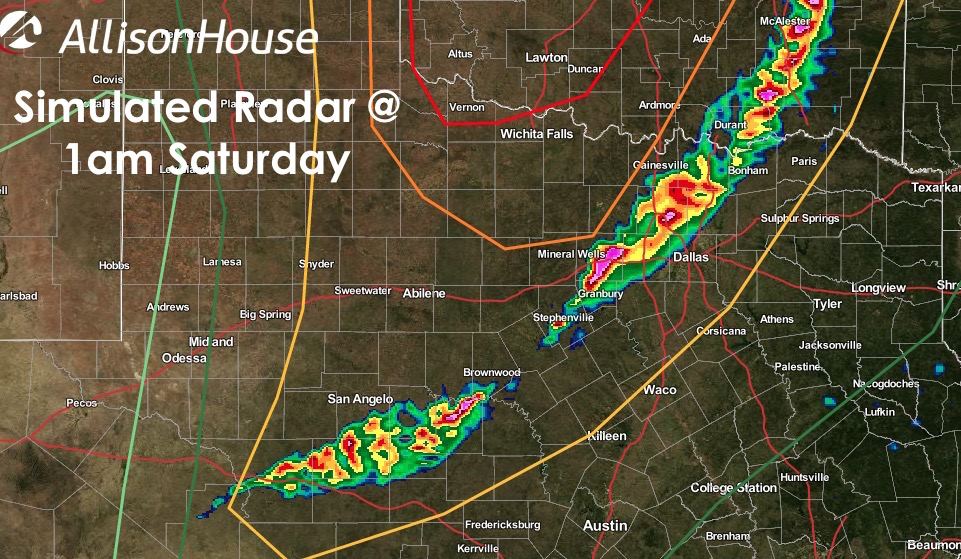
Let me start out by saying that the areas with the highest probabilities of seeing significant severe weather today will be north of the Red River up into OK and KS. That said…residents in north and west central Texas will still need to remain alert for the development of strong to severe storms late this afternoon and into the evening/overnight hours. We will still have risks…they just will likely not be AS risky as what OK and KS will be facing later. The region of our state most likely to see any significant severe weather will be for the counties up along the Red River in western north Texas…perhaps as far south as I-20. Storms are expected to develop late this afternoon across western north Texas, starting out as isolated, then merging into a squall line shortly after sunset. As we get into the early overnight hours, development further southwest along the line of storms is likely…all the way down into west central Texas/Permian Basin region. These squall line storms will carry a threat of high winds and hail overnight across north and west central Texas along with the chance for flash flooding due to individual storm cells moving northeast and training over the same areas as the line itself moves east. Below we have the most current severe weather outlook from the Storm Prediction Center, plus a set of forecast model graphics depicting how the radar “might” look like later this evening and into the overnight hours. Both David and I will be chasing this afternoon, but we’ll post updates from out in the field if any significant changes to the current forecast evolve.


0 Comments