
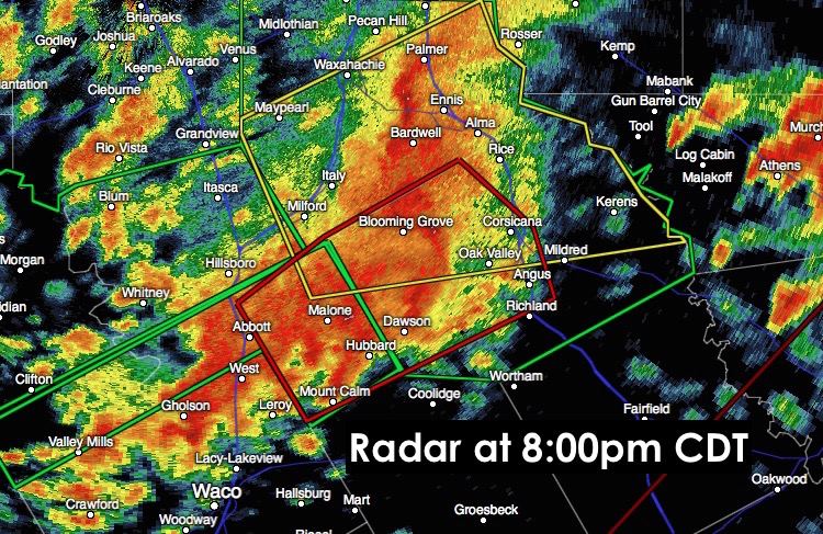
Tornado Warnings continue just southeast of the DFW metro area for Hill and Navarro counties until 8pm. At this time, the tornadic circulation is radar-indcated and there is no confirmed tornado on the ground via local emergency personnel or spotters, but it’s not out of the question for a rain-wrapped tornado to be present and in the area around Bardwell lake. North of the DFW metroplex, two small lines of storms have been back building across parts of Cooke, Montague and Wise counties, but no significant severe weather is noted with exception to additional heavy rain with flooding potential. The main threat continues to remain on areas just south of DFW as the tornadic storm complex between Hillsboro and and Corsicana continues to push east/northeast at 30mph. Residents ahead of this storm in Corsicana, Mustang, Oak Valley, Powell, Mildred and Eureka will need to prepare to take cover if a tornado is confirmed, or the current tornado warning is extended further east/northeast. As always, you can track the storms live via our free interactive radar at https://texasstormchasers.com/radar/ for the latest updates on storm progress.


0 Comments