
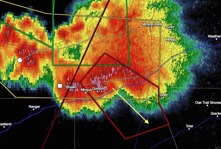
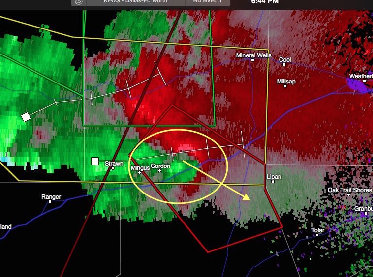
As mentioned earlier today, thunderstorm development today would be rather isolated, but would pack a punch. At this time, we have one cell southeast of Weatherford between Gordon and Lipan that has been consistently tornado-warned since about 4pm this afternoon. This cell is drifting east/southeast and should skirt just to the southwest of Weatherford within the next half hour to 45 minutes. This cell has a history of producing a confirmed tornado north of Gordon. A new circulation is developing between Gordon and Santo, just north of I-20, and it’s moving southeast at around 25mph. Residents in the path of this storm need to heed all warnings and seek shelter immediately. The tornado is likely rain-wrapped and will be impossible to see.


0 Comments