
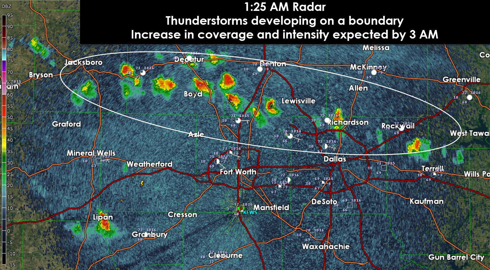
As expected thunderstorms are beginning to develop on a boundary located across North Texas. This boundary and thus storm development is occuring along a Jacksboro-Ponder-DFW Airport-Terrell line. Thunderstorm coverage and intensity will increase through 3 AM. We don’t think these storms will become severe but they’re certainly going to be capable of producing frequent cloud to ground lightning and small hail. Flash flooding is a major concern this morning since these storms will be ‘training’ or moving over the same areas. Considering we also just experienced a high-end flood event less than 24 hours ago any rain that falls this morning will immediately run off. That threat will increase after 3 AM.
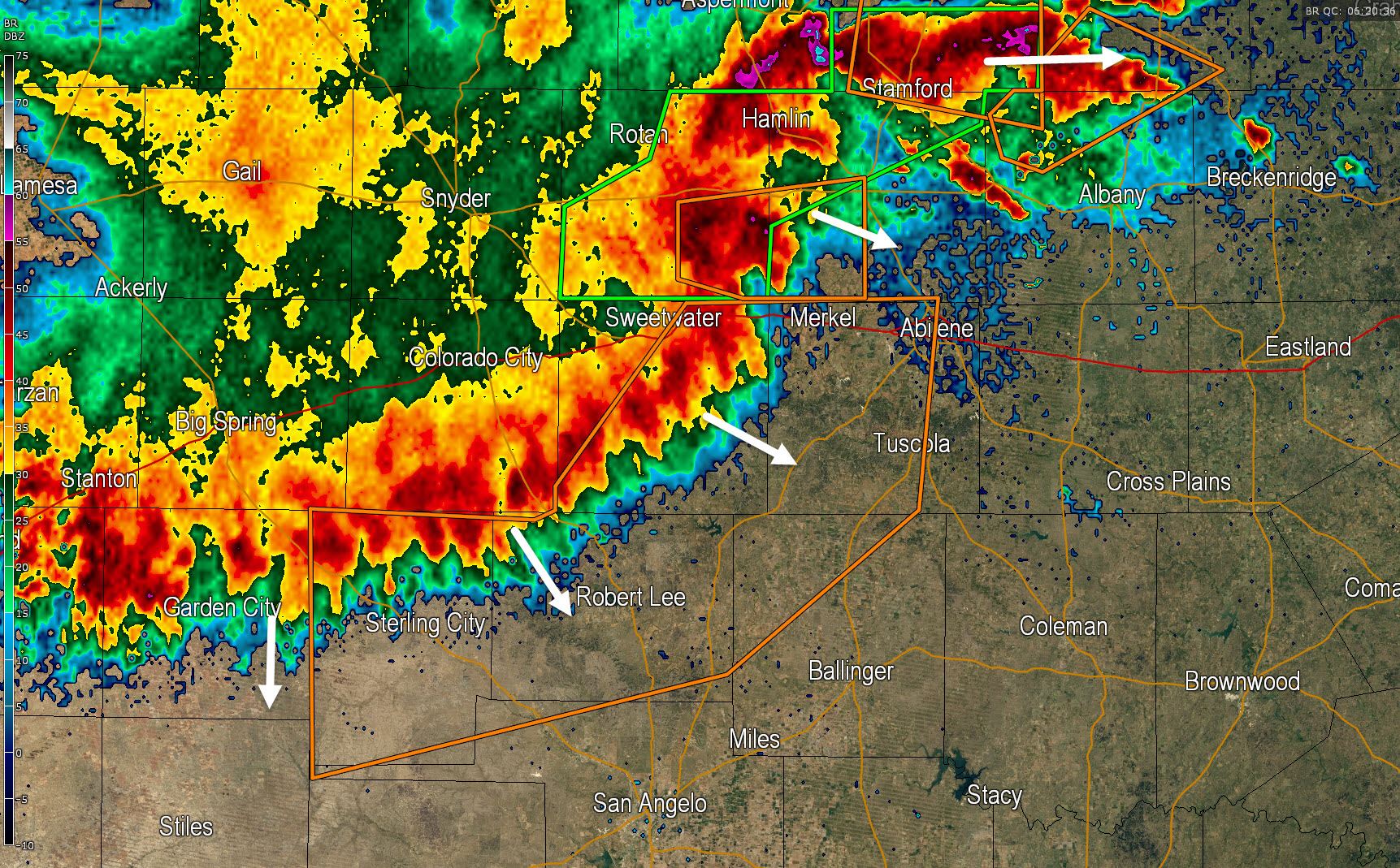
A cluster of severe thunderstorms extends from Sterling City to Blackwell, Abilene, and Throckmorton. This cluster of storms is moving east/southeast and will push into the Concho Valley, Big Country, Hill Country, and western North Texas through 3 AM. Wind gusts up to 60 MPH are possible along with extrmeely heavy rain. I believe hte damaging wind threat will continue to slowly diminish over the next 2 hours but heavy rain and potential flooding will remain a concern.


0 Comments