
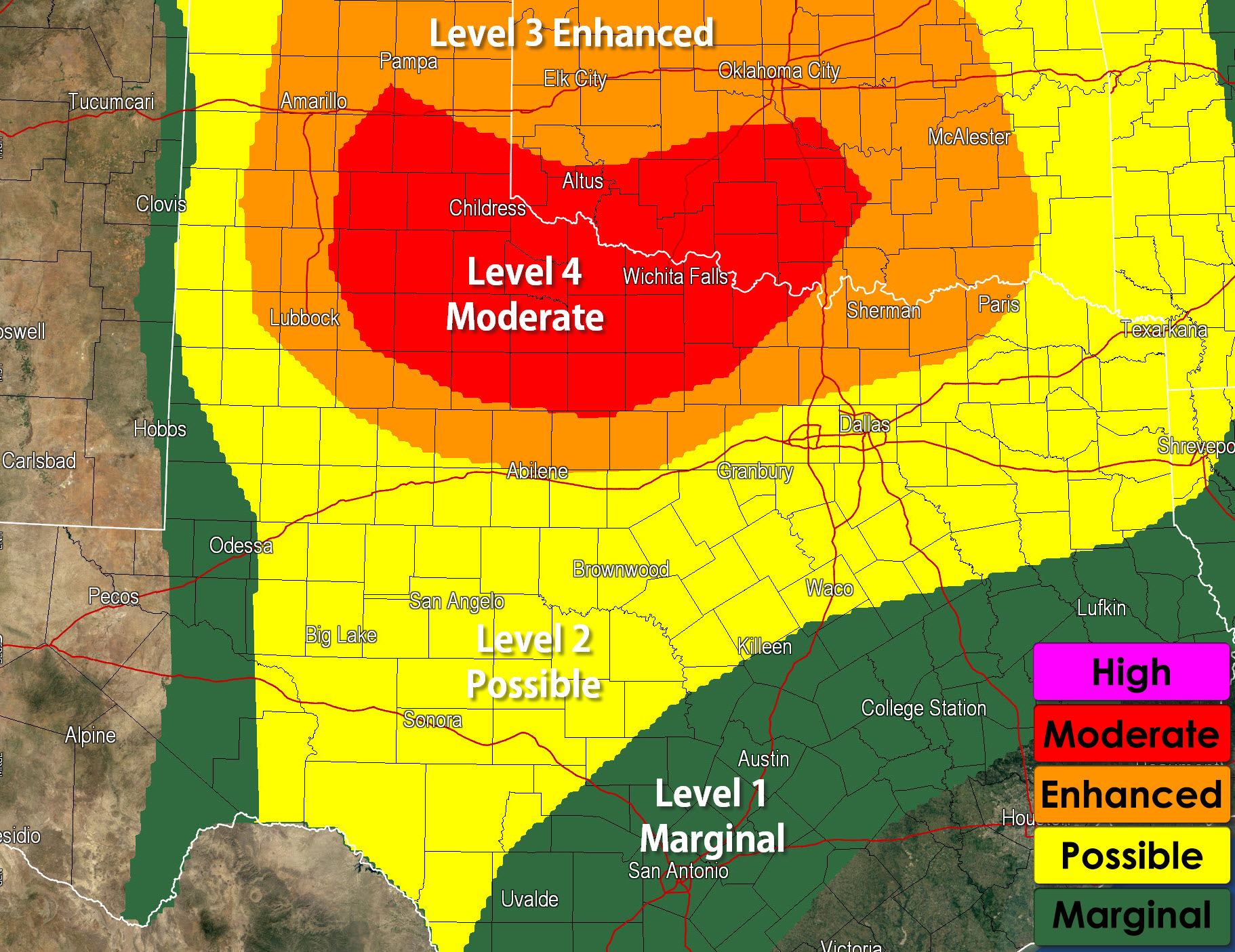
Here’s the updated severe weather outlook for today. It doesn’t matter as much now because we already have severe weather underway across West Texas, but its a good heads up for folks further east. The primary hazards today will be very large hail up to the size of baseballs or larger and 70+ MPH straight-line winds. A couple tornadoes are also possible with outflow boundaries locally enhancing low level shear with any storms that track along them. A level 4 moderate risk is now in effect for Northwest Texas, a level 3 enhanced for the Big Country and North Texas, a level 2 possible risk for the Concho Valley and Southwest Texas. What we’ll most likely see by early afternoon is a cluster of severe thunderstorms in Northwest Texas. They’ll move east/southeast with a large hail and damaging wind threat. Tornadoes will be possible with any discrete supercells that become established on outflow boundaries.


0 Comments