
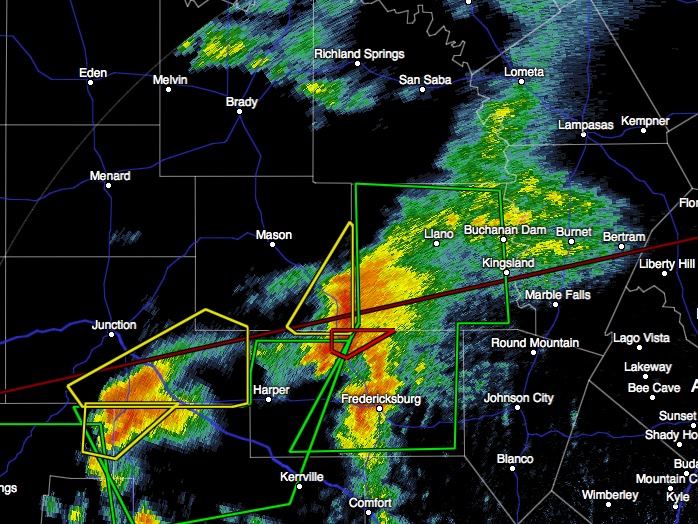
A cluster of severe warned cells will continue to track northeast across the region this morning. A few tornados are not out of the question with any of the more discrete storms. A “radar indicated” tornado warning was recently issued north of Fredericksburg in Gillespie County. So far, no definitive confirmation of a touch down with only reports of a “funnel cloud” and weak rotation coming in. These storms are moving northeast at around 20 to 30mph and will be approaching Johnson City, Round Mountain, Marble Falls, Kingsland and Llano within the next half our or so. Additional tornadic spin-ups are possible, high wind and large hail are likely, and flash flooding is a given, so stay on high alert!


0 Comments